Safety Score: 2,7 of 5.0 based on data from 9 authorites. Meaning we advice caution when travelling to United States.
Travel warnings are updated daily. Source: Travel Warning United States. Last Update: 2024-04-26 08:02:42
Discover Canarsie
Canarsie in Kings County (New York) with it's 87,366 citizens is a city in United States about 206 mi (or 331 km) north-east of Washington DC, the country's capital city.
Local time in Canarsie is now 01:03 PM (Friday). The local timezone is named America / New York with an UTC offset of -4 hours. We know of 8 airports in the vicinity of Canarsie, of which 3 are larger airports. The closest airport in United States is John F Kennedy International Airport in a distance of 6 mi (or 10 km), East. Besides the airports, there are other travel options available (check left side).
There are two Unesco world heritage sites nearby. The closest heritage site in United States is Statue of Liberty in a distance of 4 mi (or 7 km), North-West. Also, if you like golfing, there are a few options in driving distance. We discovered 10 points of interest in the vicinity of this place. Looking for a place to stay? we compiled a list of available hotels close to the map centre further down the page.
When in this area, you might want to pay a visit to some of the following locations: Brooklyn, Queens, Manhattan, Jersey City and The Bronx. To further explore this place, just scroll down and browse the available info.
Local weather forecast
Todays Local Weather Conditions & Forecast: 12°C / 53 °F
| Morning Temperature | 6°C / 43 °F |
| Evening Temperature | 11°C / 52 °F |
| Night Temperature | 9°C / 49 °F |
| Chance of rainfall | 0% |
| Air Humidity | 47% |
| Air Pressure | 1032 hPa |
| Wind Speed | Moderate breeze with 9 km/h (6 mph) from North |
| Cloud Conditions | Clear sky, covering 1% of sky |
| General Conditions | Sky is clear |
Friday, 26th of April 2024
11°C (52 °F)
10°C (49 °F)
Light rain, fresh breeze, overcast clouds.
Saturday, 27th of April 2024
13°C (56 °F)
16°C (60 °F)
Moderate rain, moderate breeze, overcast clouds.
Sunday, 28th of April 2024
20°C (69 °F)
14°C (57 °F)
Light rain, moderate breeze, broken clouds.
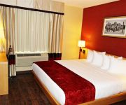
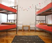
Hotels and Places to Stay
Delz Bed & Breakfast
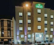
La Quinta Inn and Suites Brooklyn East
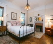
Lefferts Manor Bed & Breakfast
RNYNY - RED CARPET INN BROOKLYN
Gabbs Apartment
BEST WESTERN PLUS ARENA HOTEL
Hotel Bliss
Neptune Hotel
Hotel Lynx
Malcom X Apartment and Hostel
Videos from this area
These are videos related to the place based on their proximity to this place.
It's My Park: Natural Area Volunteers
Natural Areas Volunteers (NAVigators) is a new service program that recruits, trains, and supports volunteers for a variety of ecological projects across the city. NAVigators also help establish...
WOW,Brownsville and World Trade Center Site From L Train
New york subway above ground, I was on my way into Manhattan and I took this video of world trade center one progress froom Brooklyn L train. Starting at Livonia Ave Brooklyn, NY to Broadway...
IRT Livonia Ave Line: R142A 4 Trains at Saratoga Ave-Livonia Ave (Weekend)
Note: Due to Construction on the Lenox Ave Line in Manhattan no 3 Trains running in both direction from New Lots Ave to Harlem-148th St-Lenox Terminal. 4 Trains running local in both direction...
IRT Livonia Ave Line: R142 4 Train at Pennsylvania Ave-Livonia Ave (Weekend)
Note: Due to Construction on the Lenox Ave Line in Manhattan no 3 Trains running in both direction from New Lots Ave to Harlem-148th St-Lenox Terminal. 4 Trains running local in both direction...
IRT Livonia Ave Line: R142A 4 Train at Pennsylvania Ave-Livonia Ave (Weekend)
Note: Due to Construction on the Lenox Ave Line in Manhattan no 3 Trains running in both direction from New Lots Ave to Harlem-148th St-Lenox Terminal. 4 Trains running local in both direction...
GIGGY RIDDIM MIX BY INNER CITY MOVEMENTS (KING BIGGS)
GIGGY THROWBACK MIX 1.SINGING SWEET-WHEN I SEE YOU SMILE 2.SIMPLETON-COCO COLA SHAPE 3.REGGIE STEPPER-WIFE 4.PENNY IRIE-MATEY 5.POWER MAN-STONE 6.LOUIE ...
kayak trip from Martins Creek to Phillipsburg, N.J.
kayak trip,canoe,surf,ski,delaware,easton,pa,new jersey,Phillipsburg,ski,tennis,fishing,
Ginger's vacation adventue episode 2
In this episode Ginger and friends go to the beach. Ginger and Skitty pull a prank on Growlilthe. Everyone has tons of fun. Hope you like it. (I really did go on vacation)
It's My Park: Kayaking on Jamaica Bay
Explore Jamaica Bay with the Sebago Canoe Club on Paerdegat Basin Bergen Ave, E. 76 St, Paerdegat Avenue North Produced by Adrian Sas.
IRT Livonia Ave Line: R142 4 Train & R62 3 Train at Junius St-Livonia Ave
New Lots Ave bound R142 4 Train coming from Rockaway Ave station and entering at Junius St. Then New Lots Ave bound 4 Train leaves Junius St heading towards Pennsylvania Ave as it's next ...
Videos provided by Youtube are under the copyright of their owners.
Attractions and noteworthy things
Distances are based on the centre of the city/town and sightseeing location. This list contains brief abstracts about monuments, holiday activities, national parcs, museums, organisations and more from the area as well as interesting facts about the region itself. Where available, you'll find the corresponding homepage. Otherwise the related wikipedia article.
Canarsie, Brooklyn
Canarsie is a neighborhood in the southeastern portion of the borough of Brooklyn, in New York City, United States. The area is part of Brooklyn Community Board 18. Canarsie, which includes the entire 11236 ZIP code, is bordered on the east by Fresh Creek Basin, East 108th Street, and the BMT Canarsie Line to Linden Boulevard; on the north by Linden Boulevard; on the west by Remsen Avenue to Ralph Avenue and the Paerdegat Basin; and on the south by Jamaica Bay.
New Lots Avenue (BMT Canarsie Line)
New Lots Avenue is a station on the BMT Canarsie Line of the New York City Subway. Located at the intersection of New Lots and Van Sinderen Avenues in East New York, it is served by the L train at all times. This elevated station, opened on December 28, 1906, has two tracks and two offset side platforms. The platforms have windscreens and canopies at their centers and barbed-wire fences with dark gray steel frames at either ends.
East 105th Street (BMT Canarsie Line)
East 105th Street is grade-level station on the BMT Canarsie Line of the New York City Subway. Located at the intersection of East 105th Street and Turnbull Avenue in Canarsie, Brooklyn, it is served by the L train at all times. This grade-level station opened on December 28, 1906 as a replacement for a former station along a steam dummy line known as the Brooklyn and Rockaway Beach Railroad. It has three tracks and a narrow island platform.
Canarsie – Rockaway Parkway (BMT Canarsie Line)
Canarsie – Rockaway Parkway is the southern terminal station of the BMT Canarsie Line of the New York City Subway, and is one of the few grade-level stations in the system. Located at the intersection of Rockaway Parkway and Glenwood Road in the Canarsie neighborhood of Brooklyn, it is served by the L train at all times. This grade level station, opened on December 28, 1906, has two tracks and a single island platform. The two tracks end at offset bumper blocks at the south end of the station.
Rockaway Parkway
Rockaway Parkway is a major commercial street in the Canarsie neighborhood of Brooklyn, New York. Canarsie High School, as well as a firehouse and several homes and businesses are on Rockaway Parkway. The Rockaway Parkway station is the southern terminus of the BMT Canarsie Line. The B42 bus runs primarily along Rockaway Parkway, and riders can board free at the Rockaway Parkway subway station.
Linden Boulevard
Linden Boulevard is a boulevard in New York City. It starts off at Flatbush Avenue in Brooklyn and stretches through both Brooklyn and Queens. This boulevard, especially the area of Cambria Heights between Springfield Boulevard and the Nassau County line represents a smaller version of shopping centers located on Jamaica Avenue and Queens Boulevard. Linden Boulevard also continues into Nassau County to Valley Stream where it turns into Central Avenue.
Breukelen Houses
Breukelen Houses (pronounced brook-line), also known as Breukelen or Brookline Projects, is a large housing complex maintained in Canarsie, Brooklyn, by the New York City Housing Authority (NYCHA). Its main office is located at 618 East 108th Street, Brooklyn, NY 11236. It is bounded by Flatlands Avenue, East 103rd Street, Williams Avenue and Stanley Avenue.
Brooklyn Democracy Academy
The Brooklyn Democracy Academy is a transfer school for over-age/under-credited students in Brooklyn, New York. The school is a collaboration between the New York City Department of Education and the Jewish Child Care Association (JCCA), one of the oldest social-service agencies in New York City.
Canarsie High School
Canarsie High School is a public high school in the Brooklyn neighborhood of Canarsie in New York City.
High School for Medical Professions
The High School for Medical Professions is a public high school located in the Brooklyn neighborhood of Canarsie in New York City. It teaches grades 9 through 12, and enrolls students throughout the New York City school system. This high school opened in the buildings of the former Canarsie High School, which was closed due to poor performance and will graduate its last class in 2011.
Flatlands Avenue
Flatlands Avenue is a major street in the New York City borough of Brooklyn. It runs approximately five miles (8 km) east / west, from Avenue N and East 35th Street in Flatlands, Brooklyn in the west to Forbell Street, east of Fountain Avenue in East New York. The avenue runs a diagonal path and intersects with several other major streets in Brooklyn, including Flatbush Avenue, Utica Avenue, Ralph Avenue, Rockaway Parkway, and Pennsylvania Avenue.
Pennsylvania Avenue (Brooklyn)
Pennsylvania Avenue is a major street in Brooklyn, New York. It generally runs north to south, from the Jackie Robinson Parkway in Broadway Triangle to the Belt Parkway in Starrett City. The IRT New Lots Line has a station at the intersection of Pennsylvania Avenue and Livonia Avenue. The IND Fulton Street Line has a stop at the intersection of Pennsylvania and Liberty Avenues, and the station is called Liberty Avenue.


