Safety Score: 3,0 of 5.0 based on data from 9 authorites. Meaning we advice caution when travelling to United Kingdom.
Travel warnings are updated daily. Source: Travel Warning United Kingdom. Last Update: 2024-04-28 08:22:10
Discover Morvil
Morvil in Pembrokeshire (Wales) is a place in United Kingdom about 205 mi (or 329 km) west of London, the country's capital city.
Current time in Morvil is now 03:02 AM (Monday). The local timezone is named Europe / London with an UTC offset of one hour. We know of 12 airports near Morvil, of which 5 are larger airports. The closest airport in United Kingdom is Haverfordwest Airport in a distance of 9 mi (or 14 km), South-West. Besides the airports, there are other travel options available (check left side).
There is one Unesco world heritage site nearby. It's Castles and Town Walls of King Edward in Gwynedd in a distance of 95 mi (or 154 km), North-East. Also, if you like playing golf, there is an option about 11 mi (or 18 km). away. If you need a hotel, we compiled a list of available hotels close to the map centre further down the page.
While being here, you might want to pay a visit to some of the following locations: Ambleston, Newport, Nevern, Spittal and Wiston. To further explore this place, just scroll down and browse the available info.
Local weather forecast
Todays Local Weather Conditions & Forecast: 10°C / 50 °F
| Morning Temperature | 9°C / 48 °F |
| Evening Temperature | 10°C / 50 °F |
| Night Temperature | 9°C / 49 °F |
| Chance of rainfall | 8% |
| Air Humidity | 96% |
| Air Pressure | 1005 hPa |
| Wind Speed | Strong breeze with 21 km/h (13 mph) from North |
| Cloud Conditions | Overcast clouds, covering 100% of sky |
| General Conditions | Moderate rain |
Tuesday, 30th of April 2024
8°C (46 °F)
8°C (46 °F)
Moderate rain, strong breeze, overcast clouds.
Wednesday, 1st of May 2024
11°C (52 °F)
8°C (46 °F)
Light rain, moderate breeze, overcast clouds.
Thursday, 2nd of May 2024
9°C (47 °F)
8°C (47 °F)
Light rain, gentle breeze, overcast clouds.
Hotels and Places to Stay
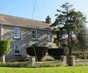
Llysyfran Farm B&B
Videos from this area
These are videos related to the place based on their proximity to this place.
Bluestone Holiday
Franglaise Family holiday in Bluestone National Park, Pembrokeshire, Wales in June 2014. For all blog posts about our stay at Bluestone National Park, go to www.FranglaiseMummy.com and tap...
30m x15m marquee for Anabelle & Carl's wedding
Dingle Marquee Hire of Narberth were delighted to be approached to provide the marquee for Anabelle & Carl's wedding reception taking place in August 2013. The special nature of the event,...
59 days
If you want a well edited video, do not watch, i cant stand editing. This is a very basic edited go pro video that tells a story. Thats it. Filmed on the Go ...
Domz Holz
A few days in Pembrokshire, hanging with friends, building the ranch and catching some waves! Happy times...
Sea Kayaking the Pembrokeshire coast.
Watch us kayak from Pwllgwaelod to Lower Town Fishguard.. On a beautiful winters day... Here you will find caves, waves and fun days... Oh and a little silliness too! :-) Want to kayak...
2014-15 bodysurf Broad Haven, Pembrokeshire
New years eve bodysurf, surfing into 2015. Handplaning with Sakura Workshops wooden bodysurf handplane at Broad Haven beach, Pembrokeshire, Wales.
Newport self catering holiday cottage | Ger y Traeth
http://www.bestofwales.co.uk/self-catering-holiday-cottages-pembrokeshire-west-wales-newport-cottages-75055 Ger y Traeth Holiday Cottage in Newport, Pembrokeshire can sleep up to 6 guests...
Videos provided by Youtube are under the copyright of their owners.
Attractions and noteworthy things
Distances are based on the centre of the city/town and sightseeing location. This list contains brief abstracts about monuments, holiday activities, national parcs, museums, organisations and more from the area as well as interesting facts about the region itself. Where available, you'll find the corresponding homepage. Otherwise the related wikipedia article.
Banc Du
Banc Du is a prominent, fairly flat-topped southwards-projecting promontory of Foel Eryr, at about 334m OD at the west end of the Preseli Hills in north Pembrokeshire, Wales. First spotted in July 1990 during an aerial photographic survey of the region, this hilltop enclosure consists of two non-concentric and incomplete earthworks that define a roughly oval area around the hilltop, amidst a series of cultivation features and abandoned trackways.
Castlebythe
Castlebythe is a village and parish in Pembrokeshire, Wales. It is situated on the southern slopes of the Preseli Hills, 10 km south-east of Fishguard. The northern part of the parish is in the Pembrokeshire Coast National Park. Together with the parishes of Henry's Moat, Little Newcastle, Morvil and Puncheston, it constitutes the community of Puncheston.
Puncheston
Puncheston is a village in Pembrokeshire, South West Wales. There is a nearby mountain known as Castly Bythe, or in english Cow Castle mountain.


