Safety Score: 3,0 of 5.0 based on data from 9 authorites. Meaning we advice caution when travelling to United Kingdom.
Travel warnings are updated daily. Source: Travel Warning United Kingdom. Last Update: 2024-04-28 08:22:10
Discover Grindon
Grindon in Northumberland (England) is a place in United Kingdom about 258 mi (or 416 km) north of London, the country's capital city.
Current time in Grindon is now 06:49 AM (Monday). The local timezone is named Europe / London with an UTC offset of one hour. We know of 8 airports near Grindon, of which 3 are larger airports. The closest airport in United Kingdom is Carlisle Airport in a distance of 22 mi (or 35 km), West. Besides the airports, there are other travel options available (check left side).
There are several Unesco world heritage sites nearby. The closest heritage site is Frontiers of the Roman Empire in Germany at a distance of 35 mi (or 56 km). The closest in United Kingdom is New Lanark in a distance of 45 mi (or 56 km), East. Also, if you like playing golf, there are a few options in driving distance. If you need a hotel, we compiled a list of available hotels close to the map centre further down the page.
While being here, you might want to pay a visit to some of the following locations: Bardon Mill, Birtley, Wall, Warden and Acomb. To further explore this place, just scroll down and browse the available info.
Local weather forecast
Todays Local Weather Conditions & Forecast: 11°C / 52 °F
| Morning Temperature | 6°C / 43 °F |
| Evening Temperature | 9°C / 49 °F |
| Night Temperature | 9°C / 48 °F |
| Chance of rainfall | 2% |
| Air Humidity | 69% |
| Air Pressure | 1008 hPa |
| Wind Speed | Moderate breeze with 12 km/h (8 mph) from North |
| Cloud Conditions | Overcast clouds, covering 99% of sky |
| General Conditions | Light rain |
Tuesday, 30th of April 2024
15°C (58 °F)
10°C (50 °F)
Light rain, fresh breeze, overcast clouds.
Wednesday, 1st of May 2024
16°C (61 °F)
10°C (51 °F)
Light rain, moderate breeze, broken clouds.
Thursday, 2nd of May 2024
13°C (55 °F)
9°C (48 °F)
Overcast clouds, moderate breeze.
Hotels and Places to Stay
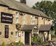
Battlesteads Hotel
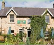
Simonburn Tearooms
Videos from this area
These are videos related to the place based on their proximity to this place.
Ploughing Competition at Park End, Simonburn.
Park End Farms hosted a ploughing contest organised by Charlie Halliday on behalf of the Northern Area Vintage Ploughing Association. Visit http://www.aquietlifeinthecountry.blogspot.com for...
NRF24L01 Short Range Radio Modules- Using With Arduino
A video about sending arbitrary information (a text message, integers, floats, whatever you want) from one Arduino to another reliably over short distances using the cheap NRF24L01 modules....
RCC - Stuck in a Hole... - River Allen
Me having a bit of a swim on the River Allen ;) P.S. - I lost the set of paddles that I foolishly dropped when I swam, if anyone is paddling the Allen or the South Tyne and happens to see...
Videos provided by Youtube are under the copyright of their owners.
Attractions and noteworthy things
Distances are based on the centre of the city/town and sightseeing location. This list contains brief abstracts about monuments, holiday activities, national parcs, museums, organisations and more from the area as well as interesting facts about the region itself. Where available, you'll find the corresponding homepage. Otherwise the related wikipedia article.
Stanegate
The Stanegate, or "stone road", was an important Roman road built in what is now northern England. It linked two forts that guarded important river crossings; Corstopitum in the east, situated on Dere Street, and Luguvalium in the west. The Stanegate ran through the natural gap formed by the valleys of the Tyne and Irthing.
A69 road
The A69 is a major road in northern England, running east-west across the Pennines, through the counties of Tyne and Wear, Northumberland and Cumbria. Originally the road started in Blaydon, but since the creation of the A1 Western Bypass around Newcastle upon Tyne, it now starts at Denton Burn a suburb of Newcastle upon Tyne. The road runs up the Tyne valley, bypassing the village of Corbridge and the market town Hexham.
Hadrian's Wall
Hadrian's Wall (Latin: Vallum Aelium, "Aelian Wall" – the Latin name is inferred from text on the Staffordshire Moorlands Patera) was a defensive fortification in Roman Britain. Begun in AD 122, during the rule of emperor Hadrian, it was the first of two fortifications built across Great Britain, the second being the Antonine Wall, lesser known of the two because its physical remains are less evident today. The wall was the most heavily fortified border in the Empire.
Halleypike Lough
Halleypike Lough is an inland lake on Haughton common at the southern edge of Northumberland National Park, northeast of Bardon Mill, and 1 mile north of the B6318 Military Road road in Northumberland, northern England. The lake is of Victorian origin and is fished.
Milecastle 32
Milecastle 32 (Carraw) was a milecastle of the Roman Hadrian's Wall. Its remains exist as earthworks and with no exposed masonry. The layout of the milecastle walls is defined (still quite evident) by robber trenches (to a maximum depth of 0.3 metres . The north wall is beneath a modern wall.
Milecastle 33
Milecastle 33 (Shield on the Wall) was a milecastle of the Roman Hadrian's Wall, one of a series of small fortlets built at intervals of approximately one Roman mile along the length of the UNESCO World Heritage Site in northern England. Its remains exist as clearly visible earthworks, with the exception of part of the north gate and wall, and a fragment of the south gate, which are exposed. Exposed parts survive to a maximum height of 1.2 metres (north wall).


