Safety Score: 3,0 of 5.0 based on data from 9 authorites. Meaning we advice caution when travelling to United Kingdom.
Travel warnings are updated daily. Source: Travel Warning United Kingdom. Last Update: 2024-05-11 07:34:58
Discover Westerdale
Westerdale in North Yorkshire (England) is a city in United Kingdom about 205 mi (or 330 km) north of London, the country's capital city.
Local time in Westerdale is now 12:23 AM (Sunday). The local timezone is named Europe / London with an UTC offset of one hour. We know of 8 airports in the vicinity of Westerdale, of which 3 are larger airports. The closest airport in United Kingdom is Durham Tees Valley Airport in a distance of 19 mi (or 31 km), West. Besides the airports, there are other travel options available (check left side).
There are several Unesco world heritage sites nearby. The closest heritage site in United Kingdom is Studley Royal Park including the Ruins of Fountains Abbey in a distance of 31 mi (or 50 km), South-East. Also, if you like golfing, there is an option about 15 mi (or 23 km). away. We discovered 1 points of interest in the vicinity of this place. Looking for a place to stay? we compiled a list of available hotels close to the map centre further down the page.
When in this area, you might want to pay a visit to some of the following locations: Guisborough, South Bank, Nunthorpe, Great Habton and Middlesbrough. To further explore this place, just scroll down and browse the available info.
Local weather forecast
Todays Local Weather Conditions & Forecast: 21°C / 69 °F
| Morning Temperature | 13°C / 55 °F |
| Evening Temperature | 16°C / 61 °F |
| Night Temperature | 11°C / 51 °F |
| Chance of rainfall | 0% |
| Air Humidity | 64% |
| Air Pressure | 1021 hPa |
| Wind Speed | Moderate breeze with 9 km/h (6 mph) from North-West |
| Cloud Conditions | Overcast clouds, covering 93% of sky |
| General Conditions | Overcast clouds |
Sunday, 12th of May 2024
17°C (63 °F)
13°C (55 °F)
Light rain, moderate breeze, overcast clouds.
Monday, 13th of May 2024
19°C (66 °F)
13°C (55 °F)
Moderate rain, gentle breeze, overcast clouds.
Tuesday, 14th of May 2024
13°C (55 °F)
11°C (52 °F)
Moderate rain, moderate breeze, overcast clouds.
Hotels and Places to Stay
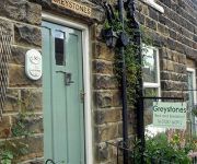
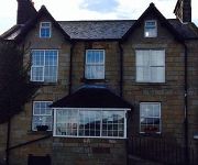
Greystones Bed & Breakfast
Church House Farm
The Eskdale Inn
Videos from this area
These are videos related to the place based on their proximity to this place.
Birk Brow & Commondale - 24 April 2011
A 17.5km round trip from Birk Brow car park, down to Margrove Park, through Charltons, into Guisborough Woods and then over Guisborough Moor to Commondale and then back to Birk Brow along the ...
Green Laning North York Moors - Rosedale Abbey
One section of 100+mile loop all on green lanes open to all traffic from Farndale to Scarborough and back.
Gillies Jones Glassmakers
Glassmakers Gillies Jones making a Beautiful Bowl in steel blue in Rosedale Abbey, North Yorkshire. Add a brilliant splash of colour to your home with our signature beautiful bowl. Place it...
tom rudd wheelieing gt agresser xc3
tom rudd wheelieing gt agresser xc3 at Rosedale Abbey camp site.
tom rudd poping botal of water on gt agressor xc3
tom rudd poping botal of water on gt agressor xc3 2009,at Rosedale Abbey camp site.
Haibike Xduro storms up Rosedale Chimney Bank
Rosedale Chimney Bank is supposedly the steepest uphill public road in the UK, but is easily conquered by a 64 year old pensioner riding a 2015 Haibike Xduro in 5 mins 15 seconds - what a blast!...
No More Tea
My Missus - Full of Tea. A once in a lifetime Miracle that has never been witnessed again.
Videos provided by Youtube are under the copyright of their owners.
Attractions and noteworthy things
Distances are based on the centre of the city/town and sightseeing location. This list contains brief abstracts about monuments, holiday activities, national parcs, museums, organisations and more from the area as well as interesting facts about the region itself. Where available, you'll find the corresponding homepage. Otherwise the related wikipedia article.
River Esk, North Yorkshire
The River Esk is a river in North Yorkshire, England that empties into the North Sea at Whitby after a course of around 28 miles through the valley of Eskdale, named after the river itself.
Esk Valley Walk
The Esk Valley Walk is a long distance footpath in North Yorkshire, England. The route first follows a loop on the North York Moors to the south of Castleton, reaching the source of the River Esk, and then follows its journey to the North Sea. Waymarking uses the symbol of a leaping salmon, with yellow arrows denoting footpaths and blue arrows bridleways. From Castleton the route leads to Danby Dale, Rosedale Head and Blakey Ridge.


