Safety Score: 3,0 of 5.0 based on data from 9 authorites. Meaning we advice caution when travelling to United Kingdom.
Travel warnings are updated daily. Source: Travel Warning United Kingdom. Last Update: 2024-04-26 08:02:42
Discover Woburn
Woburn in Central Bedfordshire (England) with it's 933 citizens is a city in United Kingdom about 39 mi (or 63 km) north-west of London, the country's capital city.
Local time in Woburn is now 07:48 PM (Friday). The local timezone is named Europe / London with an UTC offset of one hour. We know of 11 airports in the vicinity of Woburn, of which 5 are larger airports. The closest airport in United Kingdom is London Luton Airport in a distance of 13 mi (or 21 km), South-East. Besides the airports, there are other travel options available (check left side).
There are several Unesco world heritage sites nearby. The closest heritage site in United Kingdom is Blenheim Palace in a distance of 10 mi (or 16 km), South. Also, if you like golfing, there are a few options in driving distance. We discovered 1 points of interest in the vicinity of this place. Looking for a place to stay? we compiled a list of available hotels close to the map centre further down the page.
When in this area, you might want to pay a visit to some of the following locations: Aspley Guise, Husborne Crawley, Potsgrove, Woburn Sands and Battlesden. To further explore this place, just scroll down and browse the available info.
Local weather forecast
Todays Local Weather Conditions & Forecast: 11°C / 52 °F
| Morning Temperature | 1°C / 34 °F |
| Evening Temperature | 10°C / 49 °F |
| Night Temperature | 3°C / 38 °F |
| Chance of rainfall | 0% |
| Air Humidity | 54% |
| Air Pressure | 1004 hPa |
| Wind Speed | Gentle Breeze with 6 km/h (4 mph) from West |
| Cloud Conditions | Scattered clouds, covering 48% of sky |
| General Conditions | Scattered clouds |
Saturday, 27th of April 2024
6°C (43 °F)
8°C (47 °F)
Light rain, moderate breeze, overcast clouds.
Sunday, 28th of April 2024
7°C (45 °F)
6°C (43 °F)
Moderate rain, moderate breeze, overcast clouds.
Monday, 29th of April 2024
12°C (54 °F)
6°C (44 °F)
Sky is clear, moderate breeze, clear sky.
Hotels and Places to Stay
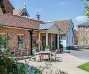
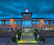
The Woburn Hotel previously Inn at Woburn
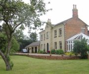
Woodleys Farm House
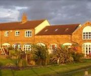
The Old Stables
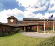
Hilton Milton Keynes
The Bell Hotel Woburn
Kents Hill Park Training & Conference centre
JCT.14 Holiday Inn MILTON KEYNES EAST M1
TRAVELODGE BEDFORD MARSTON MORETAINE
Videos from this area
These are videos related to the place based on their proximity to this place.
Woburn Sands - Brown stain of shame
A very wet and windy ride around some of the newly discovered trails at Woburn Sands. A combination of static views showing some of the trails at Woburn Sands. A new helmet is on order after...
Woburn Sands - Lens down! (Helmet & Seatpost POV)
A very wet and slippery ride at Woburn Sands in between showers after 2 weeks away with work. I knock the wide angle lens off of my bullet cam at 1:21 - which is now lost to this world......
Woburn Sands - A Haddon for Dust (Chest POV)
Recorded with the ISAW A3 Extreme, 1080p @ 60fps. A VERY hot 2 days riding at Woburn Sands. A good friend Haddon stayed for the weekend and was keen to sample some of the riding available...
Woburn Sands - DIY Cable Cam Test
EDIT: I messed up and rather than using 120 and 60 fps I accidentally selected the wrong frame rate... at least it means the footage can only get better!) THIS IS JUST A PROOF OF CONCEPT!...
60010 R.M.C.train passing woburn sands station
60010 BLETCHLEY R.M.C. to PEAK FOREST CEMEX SDGS at Woburn Sands on 8 April 2014.
Woburn Sands Jump on DH bike
A trip to Woburn Sands: Jumped further than I've managed before = 4 bike lengths or just over 20 feet: immense for me, puny for others...
MTB Night Ride, Aspley Woods, Woburn Sands - March 2015
Since my first ever night ride, Nov 2014, I've done a night ride every week since then all through the winter, this is the school report edit of progress made!
Boma Wheelchair - Out on the trail (1)
Bomas and bikes out on the forest trails. Aspley Heath, Woburn Sands, UK August 08.
Videos provided by Youtube are under the copyright of their owners.
Attractions and noteworthy things
Distances are based on the centre of the city/town and sightseeing location. This list contains brief abstracts about monuments, holiday activities, national parcs, museums, organisations and more from the area as well as interesting facts about the region itself. Where available, you'll find the corresponding homepage. Otherwise the related wikipedia article.
Marston Vale Line
The Marston Vale Line (Network Rail route MD 140) is the community rail line between Bletchley and Bedford in England, formerly part of the "Varsity Line" between Oxford and Cambridge.
A4012 road
The A4012 is a road in the United Kingdom. It starts in the village of Husborne Crawley to the south east of Milton Keynes and heads southwest to the village of Woburn. Here it meets the A5130 and changes direction, heading southeast past Milton Bryan before crossing the A5 at right angles in the village of Hockliffe. After this it continues west on into the town of Leighton Buzzard.
Woburn Safari Park
Woburn Safari Park is a safari park located in Woburn, Bedfordshire, England. Visitors to the park can drive through the large animal exhibits, which contain species such as White Rhino, Elephants, Tigers and Black Bears. It is part of the estates of the Duke of Bedford that also includes Woburn Abbey and its 3,000-acre deer park. Woburn Safari Park is a member of the British and Irish Association of Zoos and Aquariums (BIAZA) and the European Association of Zoos and Aquaria (EAZA).
A507 road
The A507 is an A-class road in England, linking the M1 motorway near Milton Keynes to the A10 at Buntingford. Beginning at junction 13 of the M1, the road heads east past Ridgmont to Ampthill. Here it passes between Ampthill and its close neighbour Flitwick, essentially separating the two. After this it passes Flitton before encountering the A6 at a roundabout. Passing Shefford the road briefly multiplexes with the A600 before crossing the A6001 and bypassing Stotfold.
Froxfield, Bedfordshire
Froxfield is a small hamlet in Bedfordshire, England. {{#invoke:Coordinates|coord}}{{#coordinates:51|59|24|N|0|34|48|W| |primary |name= }}
St Mary's Church, Potsgrove
St Mary's Church, Potsgrove, is a redundant Anglican church in the village of Potsgrove, Bedfordshire. England. It has been designated by English Heritage as a Grade II* listed building, and is under the care of the Churches Conservation Trust. The church stands at the end of a country lane, north of the A5 road, some 5 miles northeast of Leighton Buzzard.
Church of St Peter, Milton Bryan
Church of St Peter is a Grade I listed church in Milton Bryan, Bedfordshire, England. It became a listed building on 23 January 1961.
Church of St Peter & All Saints, Battlesden
Church of St Peter & All Saints is a Grade I listed church in Battlesden, Bedfordshire, England. It became a listed building on 23 January 1961.


