Safety Score: 3,0 of 5.0 based on data from 9 authorites. Meaning we advice caution when travelling to United Kingdom.
Travel warnings are updated daily. Source: Travel Warning United Kingdom. Last Update: 2024-05-02 08:23:34
Touring Barkisland
Barkisland in Calderdale (England) with it's 1,004 residents is a town located in United Kingdom about 168 mi (or 270 km) north-west of London, the country's capital place.
Time in Barkisland is now 09:26 AM (Thursday). The local timezone is named Europe / London with an UTC offset of one hour. We know of 8 airports nearby Barkisland, of which 5 are larger airports. The closest airport in United Kingdom is Leeds Bradford Airport in a distance of 17 mi (or 27 km), North-East. Besides the airports, there are other travel options available (check left side).
There are several Unesco world heritage sites nearby. The closest heritage site in United Kingdom is Liverpool – Maritime Mercantile City in a distance of 42 mi (or 67 km), South-East. Also, if you like the game of golf, there are several options within driving distance. Need some hints on where to stay? We compiled a list of available hotels close to the map centre further down the page.
Being here already, you might want to pay a visit to some of the following locations: Halifax, Meltham, Clayton, Huddersfield and Oxenhope. To further explore this place, just scroll down and browse the available info.
Local weather forecast
Todays Local Weather Conditions & Forecast: 14°C / 58 °F
| Morning Temperature | 9°C / 49 °F |
| Evening Temperature | 10°C / 50 °F |
| Night Temperature | 8°C / 47 °F |
| Chance of rainfall | 0% |
| Air Humidity | 79% |
| Air Pressure | 1005 hPa |
| Wind Speed | Fresh Breeze with 13 km/h (8 mph) from South-West |
| Cloud Conditions | Overcast clouds, covering 100% of sky |
| General Conditions | Overcast clouds |
Friday, 3rd of May 2024
12°C (53 °F)
9°C (49 °F)
Moderate rain, gentle breeze, overcast clouds.
Saturday, 4th of May 2024
9°C (48 °F)
9°C (47 °F)
Light rain, gentle breeze, overcast clouds.
Sunday, 5th of May 2024
16°C (62 °F)
12°C (54 °F)
Sky is clear, gentle breeze, clear sky.
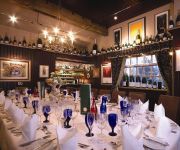
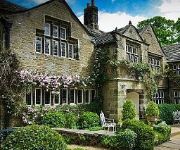
Hotels and Places to Stay
The Three Acres Inn & Restaurant
The New Hobbit Hotel
Holdsworth House
Shibden Mill Inn
Thorpe House
Tower House Hotel
Best Western Pennine Manor Hotel
The White Swan Halifax by Compass Hospitality
The Wool Merchant Hotel
Durker Roods
Videos from this area
These are videos related to the place based on their proximity to this place.
Sowerby Bridge 12/03/08
Neil & H take a drive through Sowerby Bridge, Halifax, West Yorkshire, England. To see if anything has changed,since leaving the U.K. back in 1989.
SPICE NIGHTS - WEEK 4
The North Indian province of Punjab is a fertile region full of wonderful, rich ingredients. Its people love big flavours and their dishes are packed with onions, ginger, garlic, tomatoes and...
M62 Farmhouse
We filmed this on a holiday in the UK in 2000. The story is that apparently when the motorway was built the farmer wouldn't sell the land so the developers just split the motorway carriageways...
Incinerating A CD with 12kV
A CD on 12kv 16kw transformer being burned up completely. Inspired by Photonicinduction with his videos of things blowing up. You should visit his channel if you like that sort of stuff!
Unboxing: Potential perfect pouches for the iPhone 3g
I decided i needed a new pouch for my iPhone 3G - but ended up ordering one or two extra!! I have used the Foofpod lots - i love it - but have not used the others yet so i will let you know...
Review: zCover Silicone Skin for Macbook and wireless keyboard (Apple)
This is a review (over time) of the zCover Silicone skin for the keyboards of the Macbook, Macbook Air and wireless keyboard. The cover fit very well on the Apple Wireless Keyboard and was...
All rounders 2009 crowd cam part 2.SKYBLAZERS FIREWORKS
Part 2 of the a show we fired on the 4th of November 2009 at the Greetland all rounders rugby ground. My mate filming was watching the show and just pointing the camera so some things got...
Honda CB250 K4 (1972) Candy Gold England CB350
Honda CB250K4 restoration Candy Gold, views in Lancashire England 1972.
Videos provided by Youtube are under the copyright of their owners.
Attractions and noteworthy things
Distances are based on the centre of the city/town and sightseeing location. This list contains brief abstracts about monuments, holiday activities, national parcs, museums, organisations and more from the area as well as interesting facts about the region itself. Where available, you'll find the corresponding homepage. Otherwise the related wikipedia article.
Calder and Hebble Navigation
The Calder and Hebble Navigation is a Broad (i.e. with 14-foot-wide locks and bridgeholes) inland waterway in West Yorkshire, England, which has remained navigable since it was opened.
Scammonden
Scammonden was a village close to Huddersfield, in the Dean Head Valley, England, before it was flooded in the 1960s to create the Scammonden Reservoir. The M62 motorway crosses the dam wall and then passes through a cutting to the west over which Scammonden Bridge carries a B-road. The Chapel of St Barthelomew still exists, as does the old vicarage, now a boat club.
Calder Valley (UK Parliament constituency)
Calder Valley is a constituency represented in the House of Commons of the UK Parliament since 2010 by Craig Whittaker of the Conservative Party.
River Ryburn
The River Ryburn is river in West Yorkshire, England. It flows through the villages of Rishworth, Ripponden and Triangle before flowing into the River Calder at Sowerby Bridge.
List of United Kingdom locations: Tri-Tz
Soyland
Soyland is a village in Calderdale, West Yorkshire, England.
Black Brook, West Yorkshire
The Black Brook is a small river in Calderdale, West Yorkshire, England. The Black Brook rises near the border of Calderdale and Kirklees next to Scammonden Dam. It flows downwards through Stainland Dean, and then between Greetland and Stainland. Most of the river, at this point, forms a parish border between the parishes of Greetland and Stainland. The Holywell Brook flows into the Black Brook before flowing into West Vale and going on to join the River Calder.
Triangle, West Yorkshire
Triangle is a village in Calderdale on the main A58 road over the Pennines, near Halifax and between Sowerby Bridge and Ripponden in the Ryburn valley. It dates mainly from the 19th century period of industrialisation but was here for some time prior. The name of the village derives from the patch of ground formed when the old road parted with the newer (A58) toll road to Rochdale. Previous to this time the village was named Pond.


