Safety Score: 3,0 of 5.0 based on data from 9 authorites. Meaning we advice caution when travelling to Germany.
Travel warnings are updated daily. Source: Travel Warning Germany. Last Update: 2024-05-02 08:23:34
Discover Pechern
Pechern in Saxony is a town in Germany about 95 mi (or 152 km) south-east of Berlin, the country's capital city.
Current time in Pechern is now 02:51 PM (Thursday). The local timezone is named Europe / Berlin with an UTC offset of 2 hours. We know of 8 airports near Pechern, of which 4 are larger airports. The closest airport in Germany is Cottbus-Drewitz Airport in a distance of 31 mi (or 50 km), North-West. Besides the airports, there are other travel options available (check left side).
There are several Unesco world heritage sites nearby. The closest heritage site in Germany is Muskauer Park / Park Mużakowski in a distance of 9 mi (or 14 km), North-West. Looking for a place to stay? we compiled a list of available hotels close to the map centre further down the page.
When in this area, you might want to pay a visit to some of the following locations: Przewoz, Rietschen, Hahnichen, Leknica and Weisskeissel. To further explore this place, just scroll down and browse the available info.
Local weather forecast
Todays Local Weather Conditions & Forecast: 23°C / 74 °F
| Morning Temperature | 15°C / 59 °F |
| Evening Temperature | 21°C / 70 °F |
| Night Temperature | 16°C / 61 °F |
| Chance of rainfall | 0% |
| Air Humidity | 42% |
| Air Pressure | 1005 hPa |
| Wind Speed | Moderate breeze with 12 km/h (7 mph) from North-West |
| Cloud Conditions | Broken clouds, covering 50% of sky |
| General Conditions | Scattered clouds |
Friday, 3rd of May 2024
13°C (55 °F)
11°C (52 °F)
Overcast clouds, gentle breeze.
Saturday, 4th of May 2024
20°C (68 °F)
14°C (57 °F)
Light rain, light breeze, overcast clouds.
Sunday, 5th of May 2024
16°C (61 °F)
8°C (47 °F)
Light rain, gentle breeze, overcast clouds.
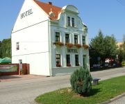
Hotels and Places to Stay
Hostel Bike Park
Videos from this area
These are videos related to the place based on their proximity to this place.
Czym zachwyca Łęknica ? Film promocyjny (PL)
więcej informacji na: http://www.leknica.pl https://www.facebook.com/LeknicaCzyliMuzakow https://www.facebook.com/bazarleknica Twórcy: Realizacja: Żuczek - Film Studio Muzyka: Marek Wiskowski,.
Łęknica
http://horacy67.blogspot.com/2013/05/dolny-slask-i-okolice-2.html Przejazd przez Łęknicę w województwie lubuskim, w powiecie żarskim. 5.05.2013 Muzyka własna.
Oddział PZHGP - 0370 - Żary - sekcja Łęknica - koszowanie - 18.05.2013r.
Oddział PZHGP - 0370 - Żary - sekcja Łęknica - koszowanie - 18.05.2013r.
XX Bałtyk-Karkonosze 2012 - Łęknica - przejazd peletonu
Fragment trasy wyścigu Bałtyk-Karkonosze, Łęknica ul. 1-Maja długi zjazd zakończony ostrym zakrętem.
Przewoźniki
http://horacy67.blogspot.com/2013/05/dolny-slask-i-okolice-2.html Przejazd przez Przewoźniki w województwie lubuskim, w powiecie żarskim, w gminie Trzebiel. 5.05.2013 Muzyka własna.
Ruiny w Łęknicy
Ruiny znajdujące się nieopodal budowanej obwodnicy. Nie znam ich przeznaczenia, ale obecny stan wskazuje, że nie postoją długo.
Holzwolle-Hobelmaschine von 1900
Vorführung einer alten Maschine zur Herstellung von Holzwolle (z.B. als Verpackungsmaterial für die Glasindustrie oder für Sauerkrautplatten) im Museum Sagar. http://www.museum-sagar.de...
Ich war so im Knatter
ÖFFNE MICH FÜR MEHR◅ ▻ BODO bei YouTube abonnieren: http://bit.ly/1ijPlLo ▻ MEIN PARTNERCHANNEL: http://bit.ly/OeDWQh ▻ FACEBOOK: https://www.facebook.com/xlBodolicious ▻...
Videos provided by Youtube are under the copyright of their owners.
Attractions and noteworthy things
Distances are based on the centre of the city/town and sightseeing location. This list contains brief abstracts about monuments, holiday activities, national parcs, museums, organisations and more from the area as well as interesting facts about the region itself. Where available, you'll find the corresponding homepage. Otherwise the related wikipedia article.
Dąbrowa Łużycka
Dąbrowa Łużycka is a village in the administrative district of Gmina Przewóz, within Żary County, Lubusz Voivodeship, in western Poland, close to the German border. It lies approximately 22 kilometres south-west of Żary and 64 km south-west of Zielona Góra. Before 1945 the area was part of Germany.
Potok, Lubusz Voivodeship
Potok is a village in the administrative district of Gmina Przewóz, within Żary County, Lubusz Voivodeship, in western Poland, close to the German border. It lies approximately 5 kilometres west of Przewóz, 25 km south-west of Żary, and 67 km south-west of Zielona Góra. Before 1945 the area was part of Germany.
Włochów, Lubusz Voivodeship
Włochów is a village in the administrative district of Gmina Przewóz, within Żary County, Lubusz Voivodeship, in western Poland, close to the German border. It lies approximately 6 kilometres north-west of Przewóz, 21 km south-west of Żary, and 63 km south-west of Zielona Góra. Before 1945 the area was part of Germany.
Straszów, Lubusz Voivodeship
Straszów is a village in the administrative district of Gmina Przewóz, within Żary County, Lubusz Voivodeship, in western Poland, close to the German border. It lies approximately 25 kilometres south-west of Żary and 67 km south-west of Zielona Góra. Before 1945 the area was part of Germany.


