Safety Score: 3,0 of 5.0 based on data from 9 authorites. Meaning we advice caution when travelling to Germany.
Travel warnings are updated daily. Source: Travel Warning Germany. Last Update: 2024-05-11 07:34:58
Discover Stößwitz
Stößwitz in Saxony-Anhalt is a city in Germany about 106 mi (or 171 km) south-west of Berlin, the country's capital city.
Local time in Stößwitz is now 11:34 PM (Saturday). The local timezone is named Europe / Berlin with an UTC offset of 2 hours. We know of 12 airports in the vicinity of Stößwitz, of which 5 are larger airports. The closest airport in Germany is Leipzig Halle Airport in a distance of 16 mi (or 26 km), North-East. Besides the airports, there are other travel options available (check left side).
There are several Unesco world heritage sites nearby. The closest heritage site in Germany is Bauhaus and its Sites in Weimar and Dessau in a distance of 37 mi (or 60 km), South-West. We discovered 1 points of interest in the vicinity of this place. Looking for a place to stay? we compiled a list of available hotels close to the map centre further down the page.
When in this area, you might want to pay a visit to some of the following locations: Elstertrebnitz, Merseburg, Kretzschau, Droyssig and Schkopau. To further explore this place, just scroll down and browse the available info.
Local weather forecast
Todays Local Weather Conditions & Forecast: 21°C / 70 °F
| Morning Temperature | 12°C / 54 °F |
| Evening Temperature | 19°C / 66 °F |
| Night Temperature | 11°C / 52 °F |
| Chance of rainfall | 1% |
| Air Humidity | 51% |
| Air Pressure | 1022 hPa |
| Wind Speed | Gentle Breeze with 7 km/h (4 mph) from South-West |
| Cloud Conditions | Broken clouds, covering 58% of sky |
| General Conditions | Light rain |
Sunday, 12th of May 2024
18°C (64 °F)
11°C (53 °F)
Broken clouds, moderate breeze.
Monday, 13th of May 2024
20°C (68 °F)
12°C (54 °F)
Sky is clear, moderate breeze, clear sky.
Tuesday, 14th of May 2024
20°C (68 °F)
12°C (54 °F)
Sky is clear, moderate breeze, clear sky.
Hotels and Places to Stay
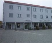
Landhotel Bad Dürrenberg
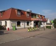
Am Platz
Alte Apotheke
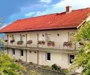
Fleischhauer Landhaus
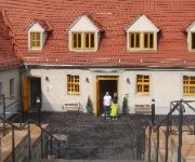
Hostel Altes Salzamt
Videos from this area
These are videos related to the place based on their proximity to this place.
Feuerwehr Uebung SITA
Übung der Freiwilligen Feuerwehr Zorbau bei der SITA Abfallverwertungsanlage. Simulation eines Bunkerbrandes. Geübt wurde bis zum kompletten Aufbau - Erstversorgung mit Großanklöschfahrzeug ...
Bahnbetrieb bei der Mibrag - Winterbetrieb T. 3
Ein Film von Klaus Kanthak und Frank Schulze So schön der Winter auch ist, so birgt er auch Gefahren besonders im Tagebau und im Bahnbetrieb. Bedingt durch die niedrigen Temperaturen und...
MIBRAG-Lok 1094 mit leeren Kohlezug in Hohenmölsen
MIBRAG-Lok 1094 und eine weitere EL2 mit einem leeren Kohlependel bei der ehemaligen Bundeswehrkaserne in Hohenmölsen.
Tagebau Hohenmölsen 18.10.2014
Uns hat es diesmal in Tagbau bei Hohnemölsen verschlagen wo freies fahren war was von der quadfactory-beitler organisiert wurde Musik: Luigi_talluto_-_turn_it_up-luigi_talluto http://atv-fun.de/...
20140423 110917
LIEBHERR Mobilbagger A 914 Baujahr 2005 12.400 Bh Fa. Bauer Baumaschinenhandel GmbH 06686 Zorbau.
Fliegerbombe in Bad Dürrenberg auf dem Sportplatz.. vor der Sprengung aus der Luft gefilmt
Denkt daran den Film in HD QUALITÄT zu schauen. Falls er euch gefällt: Kommentieren, Daumen HOCH, teilen und ABONNIEREN! Danke! Die in Bad Dürrenberg entdeckte britische Fliegerbombe ...
Videos provided by Youtube are under the copyright of their owners.
Attractions and noteworthy things
Distances are based on the centre of the city/town and sightseeing location. This list contains brief abstracts about monuments, holiday activities, national parcs, museums, organisations and more from the area as well as interesting facts about the region itself. Where available, you'll find the corresponding homepage. Otherwise the related wikipedia article.
Battle of Lützen (1632)
The Battle of Lützen (1632) was one of the most decisive battles of the Thirty Years' War. It was a Protestant victory, but cost the life of one of the most important leaders of the Protestant alliance, Gustavus Adolphus of Sweden, which caused the Protestant campaign to lose direction.
Lützen-Wiesengrund
Lützen-Wiesengrund was a Verwaltungsgemeinschaft ("collective municipality") in the district Burgenlandkreis, in Saxony-Anhalt, Germany. It was situated east of Weißenfels. The seat of the Verwaltungsgemeinschaft was in Lützen. It was disbanded in January 2011.


