Safety Score: 3,0 of 5.0 based on data from 9 authorites. Meaning we advice caution when travelling to Germany.
Travel warnings are updated daily. Source: Travel Warning Germany. Last Update: 2024-05-02 08:23:34
Explore Dankensen
Dankensen in Saxony-Anhalt is located in Germany about 106 mi (or 170 km) west of Berlin, the country's capital.
Local time in Dankensen is now 10:55 AM (Thursday). The local timezone is named Europe / Berlin with an UTC offset of 2 hours. We know of 11 airports in the wider vicinity of Dankensen, of which 5 are larger airports. The closest airport in Germany is Braunschweig Wolfsburg Airport in a distance of 32 mi (or 52 km), South-West. Besides the airports, there are other travel options available (check left side).
There are several Unesco world heritage sites nearby. The closest heritage site in Germany is St Mary's Cathedral and St Michael's Church at Hildesheim in a distance of 57 mi (or 92 km), South-West. If you need a place to sleep, we compiled a list of available hotels close to the map centre further down the page.
Depending on your travel schedule, you might want to pay a visit to some of the following locations: Juebar, Daehre, Wallstawe, Rohrberg and Schnega. To further explore this place, just scroll down and browse the available info.
Local weather forecast
Todays Local Weather Conditions & Forecast: 21°C / 70 °F
| Morning Temperature | 13°C / 56 °F |
| Evening Temperature | 19°C / 67 °F |
| Night Temperature | 15°C / 59 °F |
| Chance of rainfall | 0% |
| Air Humidity | 60% |
| Air Pressure | 1003 hPa |
| Wind Speed | Moderate breeze with 12 km/h (7 mph) from North-West |
| Cloud Conditions | Few clouds, covering 20% of sky |
| General Conditions | Few clouds |
Friday, 3rd of May 2024
12°C (53 °F)
10°C (50 °F)
Light rain, gentle breeze, overcast clouds.
Saturday, 4th of May 2024
16°C (61 °F)
11°C (52 °F)
Light rain, light breeze, overcast clouds.
Sunday, 5th of May 2024
15°C (59 °F)
9°C (49 °F)
Light rain, light breeze, overcast clouds.
Hotels and Places to Stay
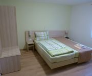
Pension Zur Eiche
Videos from this area
These are videos related to the place based on their proximity to this place.
Nutria in der Ohre bei Brome
Ein Nutria schwimmt in der Ohre bei Brome (Schreibfehler im Titel). In der ersten aktion verschäucht es eine Katze die kurz vorher am Wasser war. Dann schwimmt es in seine Höhle am Ufer....
20110313 Ride to Nettgau
Winter 2010/2011. Kamerafahrt von Mellin nach Nettgau (Altmark). K1127 von Mellin bis zum Siebenarm (Abzweig Wendischbrome) Straßenzustand katastrophal (alt). Vom Siebenarm bis Nettgau ...
2013 Winterwanderung mit Grünkohlessen in Nettgau
Jübar - OT Nettgau. Winterwanderung in den Bauernwald des Wismarer Forstes mit anschließendem Grünkohlessen auf dem Dorfgemeinschaftssaal, Altmarkkreis Salzwedel, Altmark, Sachsen-Anhalt,.
Nettgau - Angrillen mit Radio-SAW 2008
Jübar OT Nettgau Im März 2008 gewann Nettgau, auf Initiative von Anne K., das erste Angrillen des Jahres von Radio SAW. Das SAW-Team veranstaltete das Event von 16:00 bis 18:00 Uhr vor der...
Nettgau - Freiwillige Feuerwehr - Jubi80-Feier
Jübar OT Nettgau Freiwillige Feuerwehr Nettgau. 80-jähriges Jubiläum 2012. Am 9. September 2012 feierten die Kameradinnen und Kameraden der Freiwilligen Feuerwehr gemeinsam mit ...
2012 Freiwillige Feuerwehr Nettgau. Die Chronik, der Film
1932 - 2012 Bis zur Gründung der Freiwilligen Feuerwehr Nettgau gab es, wie damals üblich, eine Pflichtfeuerwehr. Bestimmte Jahrgänge, z.B. der Musterungsjahrgang fürs Militär, wurde zum...
20121204 Gemeinde Jübar OT Nettgau, Straßenbau Ahornweg
Jübar - OT Nettgau, Straßenbau Ahornweg. Der Untergrund ist vorbereitet. Nun werden die Betonformsteine mit dem Greifarm verlegt.
AML POV 001 20111209 Nettgau Bunker Feld
AltmarkLining - Laufen lassen! Nur zusehen. Entspannen, Gedanken schweifen lassen. Endschleunigen! Die Seele baumeln lassen. Nichts passiert ... so werden kleine Änderungen, Bewegungen etc.
Nettgau - Ost-Bunker Glunz
Jübar OT Nettgau Blick aus dem Beobachtungsbunker der NVA-Grenztruppen im Osten Nettgaus Richtung Glunz AG (Spanplattenwerk). Laufen lassen! Nur Zusehen. Entspannen, Gedanken ...
Videos provided by Youtube are under the copyright of their owners.
Attractions and noteworthy things
Distances are based on the centre of the city/town and sightseeing location. This list contains brief abstracts about monuments, holiday activities, national parcs, museums, organisations and more from the area as well as interesting facts about the region itself. Where available, you'll find the corresponding homepage. Otherwise the related wikipedia article.
Beetzendorf-Diesdorf
Beetzendorf-Diesdorf is a Verbandsgemeinde ("collective municipality") in the Altmarkkreis Salzwedel (district), in Saxony-Anhalt, Germany. Until 1 January 2010, it was a Verwaltungsgemeinschaft. It is situated southwest of Salzwedel. The seat of the Verbandsgemeinde is in Beetzendorf. The Verbandsgemeinde Beetzendorf-Diesdorf consists of the following municipalities: Apenburg-Winterfeld Beetzendorf Dähre Diesdorf Jübar Kuhfelde Rohrberg


