Safety Score: 3,0 of 5.0 based on data from 9 authorites. Meaning we advice caution when travelling to Germany.
Travel warnings are updated daily. Source: Travel Warning Germany. Last Update: 2024-05-11 07:34:58
Explore Kastel
The district Kastel of Kastel-Staadt in Rhineland-Palatinate is located in Germany about 360 mi south-west of Berlin, the country's capital.
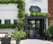
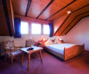
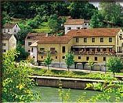
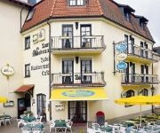
If you need a place to sleep, we compiled a list of available hotels close to the map centre further down the page.
Depending on your travel schedule, you might want to pay a visit to some of the following locations: Serrig, Taben-Rodt, Freudenburg, Trassem and Irsch. To further explore this place, just scroll down and browse the available info.
Local weather forecast
Todays Local Weather Conditions & Forecast: 23°C / 73 °F
| Morning Temperature | 10°C / 51 °F |
| Evening Temperature | 21°C / 70 °F |
| Night Temperature | 13°C / 56 °F |
| Chance of rainfall | 0% |
| Air Humidity | 47% |
| Air Pressure | 1019 hPa |
| Wind Speed | Gentle Breeze with 7 km/h (4 mph) from West |
| Cloud Conditions | Scattered clouds, covering 30% of sky |
| General Conditions | Scattered clouds |
Sunday, 12th of May 2024
22°C (71 °F)
15°C (59 °F)
Light rain, gentle breeze, overcast clouds.
Monday, 13th of May 2024
18°C (64 °F)
13°C (56 °F)
Light rain, gentle breeze, overcast clouds.
Tuesday, 14th of May 2024
18°C (65 °F)
12°C (54 °F)
Moderate rain, gentle breeze, overcast clouds.
Hotels and Places to Stay
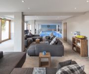
Saarschleife Landhotel
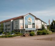
Saarpark
St. Erasmus
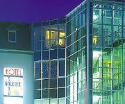
Saar Galerie
Weinhotel Ayler Kupp Nichtraucherhotel
Landhaus Cloef
Haus Schons Biohotel***S
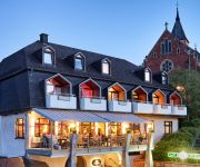
Zum Schwan
Mettlacher Hof
Mannebacher Landhotel
Videos from this area
These are videos related to the place based on their proximity to this place.
Saarburg Germany Tourism - Saarburg Tourismus Deutschland - Mosel - Moselle / Saar Valley
Europe Video Production travel videos: Saarburg Germany Tourism video - Saarburg Tourismus - Mosel - Moselle / Saar Valley - German Saarburg - Deutschland.
Feldbahn Serrig Ns2h mit Sitzloren
Ns2H: Bj.1958, 6,5 to, ca. 30 PS, VEB LKM Babelsberg mit Sitzloren aus der ehem. staatl. Weinbaudomäne Serrig http://www.feldbahnfreunde-serrig.de.
Bounce - Dry County (Saarburg, 4.08.2012) [HD 1080p]
Die deutsche Bon Jovi Tribute Band Bounce live auf der Saarburger SummerNight am 04.08.2012.
Weinfest Saarburg 2013 Rede der neuen Saar-Obermosel-Weinkönigin Frederieke Welter
Zur 9. Saar-Obermosel-Weinkönigin wurde Frederieke Welter in Saarburg gekrönt. Die künftigen Weinprinzessinnen sind Sitta Piedmont aus Konz-Filzen und Barbara Steffes.
Hochwald-Kliniken Weiskirchen Saarland Germany Saarburg T16k
Saarburg bei Regen besucht. link über Saarburg: http://de.wikipedia.org/wiki/Saarburg links: http://www.hochwaldkliniken.de/ http://www.weiskirchen.de/
Videos provided by Youtube are under the copyright of their owners.
Attractions and noteworthy things
Distances are based on the centre of the city/town and sightseeing location. This list contains brief abstracts about monuments, holiday activities, national parcs, museums, organisations and more from the area as well as interesting facts about the region itself. Where available, you'll find the corresponding homepage. Otherwise the related wikipedia article.
Trier-Saarburg
Trier-Saarburg is a district in the west of Rhineland-Palatinate, Germany. Neighboring districts are (from the north and clockwise) Bitburg-Prüm, Bernkastel-Wittlich, Birkenfeld, Sankt Wendel (Saarland), and Merzig-Wadern (Saarland). To the west it borders Luxembourg. The district-free city Trier is completely surrounded by the district.
Saar (river)
The Saar is a river in northeastern France and western Germany, and a right tributary of the Moselle. It rises in the Vosges mountains on the border of Alsace and Lorraine and flows northwards into the Moselle near Trier. It has two headstreams (the Sarre Rouge and Sarre Blanche, which join in Lorquin), that both start near Mont Donon, the highest peak of the northern Vosges. After 246 km the Saar flows into the Moselle at Konz between Trier and the Luxembourg border.
Wasserbillig
Wasserbillig is a town in the commune of Mertert, in eastern Luxembourg. As of 2005, Wasserbillig has 2,186 inhabitants, which makes it the largest town in Mertert. It lies at the confluence of the rivers Moselle and Sauer, which form the border with Germany at the town. Wasserbillig is the lowest settlement in Luxembourg, at 132 m above sea level. Wasserbillig is home to a large aquarium with tanks of up to 40,000 litres exhibiting fish from around the world in natural surroundings.
Sauer
The Sauer or Sûre is a river in Belgium, Luxembourg and Germany. A left tributary of the river Moselle, its total length is 173 km. Rising near Vaux-sur-Sûre in the Ardennes in southeastern Belgium, the Sauer flows eastwards and crosses the border with Luxembourg near Martelange. It forms the border between Belgium and Luxembourg for 13 km north of Martelange.
Grevenmacher
Grevenmacher is a commune with city status in eastern Luxembourg, near the border with Germany. It is the capital of the canton and the district of Grevenmacher. The city is situated on the left bank of the Moselle River, in a wine growing region. As of 2005, the town of Grevenmacher, which lies in the east of the commune, has a population of 3,734. The town is the site of one of the six regional headquarters of the Grand Ducal Police.
Mertert
Mertert is a commune and town in eastern Luxembourg, on the border with Germany. It is part of the canton of Grevenmacher, which is part of the district of Grevenmacher. The commune consists of the towns of Mertert and Wasserbillig. Mertert has a river port on the Moselle, the largest in Luxembourg. The commune's administrative centre is Wasserbillig. As of 2005, the town of Mertert, which lies in the south of the commune, has a population of 1,101.
Wormeldange
Wormeldange is a commune and small town in eastern Luxembourg. It is part of the canton of Grevenmacher, which is part of the district of Grevenmacher. As of 2005, the town of Wormeldange, which lies in the south of the commune, has a population of 742. Other towns within the commune include Ahn, Ehnen, Machtum, and Wormeldange-Haut.
Op Flohr Stadion
Op Flohr Stadion is a multi-use stadium in Grevenmacher, Luxembourg. It is currently used mostly for football matches and is the home stadium of CS Grevenmacher. The stadium holds 4,062 people.
Little Switzerland (Luxembourg)
Little Switzerland (Luxembourgish: Kleng Lëtzebuerger Schwäiz, French: Petite Suisse Luxembourgeoise, German: Kleine Luxemburger Schweiz) is a nickname for a region in the east of Luxembourg, bestowed upon the region on account of its reputed geographic similarities to Switzerland. It is roughly contiguous with the canton of Echternach. It is also known as the Mullerthal after the town of Mullerthal.
Syre
The Syre or Syr is a river flowing through Luxembourg, joining the Moselle in Mertert. It flows through Schuttrange, Roodt-sur-Syre, Betzdorf and Manternach.
Munschecker
Munschecker is a village in the commune of Manternach, in eastern Luxembourg. As of 2005, the village has a population of 146.
Wormeldange-Haut
Wormeldange-Haut is a small town in the commune of Wormeldange, in south-eastern Luxembourg. As of 2005, the town has a population of 509.
Machtum
Machtum is a small town in the commune of Wormeldange, in south-eastern Luxembourg. As of 2005, the town has a population of 286. In the Moselle valley wine region, Machtum – along with Wormeldange, Ahn, and Ehnen – hosts the Riesling Open wine festival in September.
Roscheider Hof Open Air Museum
The Roscheider Hof Open Air Museum is the open-air museum and Folklore Museum of the Greater SaarLorLux Region. The museum is situated in Konz, Germany, on the Saar and Mosel rivers, 8 km west of Trier and 30 km east of Luxembourg. It is a museum for rural cultural history in northwest Rhineland-Palatinate and the German-Luxembourg-Lorraine border region. Unlike many other open air museums, the Roscheider Hof is not a public or community institution.
Battle of Konzer Brücke
The Battle of Konzer Brücke was fought as part of the Franco-Dutch War on 11 August 1675 and resulted in an Imperial victory.
Mertert railway station
Mertert railway station is a railway station serving Mertert, in eastern Luxembourg. It is operated by Chemins de Fer Luxembourgeois, the state-owned railway company. The station is situated on Line 30, which connects Luxembourg City to the east of the country and Trier.
Wasserbillig railway station
Wasserbillig railway station is a railway station serving Wasserbillig, in the commune of Mertert, in eastern Luxembourg. It is operated by Chemins de Fer Luxembourgeois, the state-owned railway company. The station is situated on Line 30, which connects Luxembourg City to the east of the country and Trier.
Konz (Verbandsgemeinde)
Konz is a Verbandsgemeinde ("collective municipality") in the district Trier-Saarburg, in Rhineland-Palatinate, Germany. The seat of the Verbandsgemeinde is in Konz. The Verbandsgemeinde Konz consists of the following Ortsgemeinden ("local municipalities"): Kanzem Konz Nittel Oberbillig Onsdorf Pellingen Tawern Temmels Wasserliesch Wawern Wellen
Saarburg (Verbandsgemeinde)
Saarburg is a Verbandsgemeinde ("collective municipality") in the district Trier-Saarburg, in Rhineland-Palatinate, Germany. The seat of the Verbandsgemeinde is in Saarburg. The Verbandsgemeinde Saarburg consists of the following Ortsgemeinden ("local municipalities"): Ayl Fisch Freudenburg Irsch Kastel-Staadt Kirf Mannebach Merzkirchen Ockfen Palzem Saarburg Schoden Serrig Taben-Rodt Trassem
Weingut von Othegraven
Weingut von Othegraven is a wine-growing estate in the Mosel wine region with a wine-growing history of the site from the 2nd–4th century and a documented tradition of more than 600 years. It is located on the lower banks of the Saar River a tributary of the Moselle River, opposite to the village of Kanzem.
Roman Villa Borg
The Roman Villa Borg is a reconstructed Roman villa rustica located near the villages of Borg and Oberleuken in the municipality of Perl in Saarland, Germany. Discovered at the end of the 19th century, the site was excavated in the late 1980s. Reconstruction work, which began in the mid 1990s, was virtually completed in late 2008 although further excavation work is still continuing. The site is a popular tourist attraction with some 50,000 visitors per year.
Butterfly Garden, Grevenmacher
The Butterfly Garden or Jardin des Papillons is located in Grevenmacher in south-western Luxembourg. Owned by the Caves Bernard-Massard wine company, the indoor site presents hundreds of exotic butterflies in natural surroundings made up of an impressive diversity of plants. The Butterfly Garden is open every day from 9.30 am to 5 pm from April to mid-October.
Wasserbillig Aquarium
The Wasserbillig Aquarium is located in Wasserbillig, a small town in the south west of Luxembourg on the German border. It consists of 15 tanks ranging in size from 300 to 40,000 litres (to US gal), with fish from all five continents in their natural surroundings. Among the more exotic varieties are angelfish, neon tetra, the colourful Japanese koi and percidae from South America. But there are also species from closer to home, including eel, bream, gudgeon, asp, tench and zander.
Feinmechanisches Museum Fellenbergmühle
Feinmechanisches Museum Fellenbergmühle is a museum in Saarland, Germany.
Merzig (Saar) station
The Merzig (Saar) station is a railway station on the Saar line between Trier and Saarbrücken in the town of Merzig in the German state of Saarland. Next to the station there is a bus station and a taxi stand. The station is classified by Deutsche Bahn as a category 4 station.





!['Bounce - Dry County (Saarburg, 4.08.2012) [HD 1080p]' preview picture of video 'Bounce - Dry County (Saarburg, 4.08.2012) [HD 1080p]'](https://img.youtube.com/vi/tAkRhn1XbGc/mqdefault.jpg)

