Safety Score: 3,0 of 5.0 based on data from 9 authorites. Meaning we advice caution when travelling to Germany.
Travel warnings are updated daily. Source: Travel Warning Germany. Last Update: 2024-04-18 08:12:24
Discover Wiltingen
Wiltingen in Rhineland-Palatinate with it's 1,349 citizens is a place in Germany about 356 mi (or 573 km) south-west of Berlin, the country's capital city.
Current time in Wiltingen is now 07:33 AM (Friday). The local timezone is named Europe / Berlin with an UTC offset of 2 hours. We know of 11 airports near Wiltingen, of which 4 are larger airports. The closest is airport we know is Luxembourg-Findel International Airport in Luxembourg in a distance of 17 mi (or 28 km). The closest airport in Germany is Bitburg Airport in a distance of 20 mi (or 28 km), West. Besides the airports, there are other travel options available (check left side).
There are several Unesco world heritage sites nearby. The closest heritage site in Germany is Roman Monuments, Cathedral of St Peter and Church of Our Lady in Trier in a distance of 7 mi (or 11 km), North. If you need a hotel, we compiled a list of available hotels close to the map centre further down the page.
While being here, you might want to pay a visit to some of the following locations: Kanzem, Schoden, Ockfen, Wawern and Ayl. To further explore this place, just scroll down and browse the available info.
Local weather forecast
Todays Local Weather Conditions & Forecast: 6°C / 42 °F
| Morning Temperature | 5°C / 40 °F |
| Evening Temperature | 6°C / 42 °F |
| Night Temperature | 4°C / 39 °F |
| Chance of rainfall | 3% |
| Air Humidity | 97% |
| Air Pressure | 1012 hPa |
| Wind Speed | Fresh Breeze with 13 km/h (8 mph) from North-East |
| Cloud Conditions | Overcast clouds, covering 100% of sky |
| General Conditions | Light rain |
Saturday, 20th of April 2024
6°C (44 °F)
3°C (38 °F)
Light rain, moderate breeze, overcast clouds.
Sunday, 21st of April 2024
9°C (48 °F)
3°C (38 °F)
Light rain, gentle breeze, overcast clouds.
Monday, 22nd of April 2024
7°C (44 °F)
3°C (37 °F)
Light rain, gentle breeze, broken clouds.
Hotels and Places to Stay
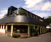
BECKER’S Hotel und Restaurant
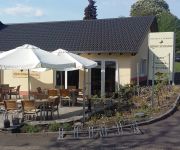
Blesius Garten
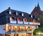
Vienna House Easy Trier
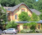
Villa Hügel
Eurener Hof
Weingut König Johann Gästezimmer
St. Erasmus
Mannebacher Landhotel
Keisers Hotel Garni
Albachmühle Waldhotel Landgasthof
Videos from this area
These are videos related to the place based on their proximity to this place.
Neue kompakte Radlader von Volvo, der L30G & L35G stellen sich vor
Die überarbeiteten Radlader L30G und L35G von Volvo Construction Equipment sind einerseits kompakt, was sie ideal für Arbeiten unter beengten Bedingungen macht, doch zugleich besitzen sie...
Volvo-Produktionsstandort Konz
In dem Konzer Produktionsstandort von Volvo Construction Equipment werden kompakte Radlader, Raupenbagger und Mobilbagger gefertigt. Weitere Informationen finden Sie unter: www.volvoce.de.
Schwerer Unfall in Konz
Konz, 30.08.2014: Bei einem Unfall sind am Samstagmorgen auf der B 51 bei Konz eine Autofahrerin und ein Autofahrer schwer verletzt worden.
Atomunfall: Notfallübung in Konz
Konz, 5. April 2014: Atomkatastrophe in Cattenom - für die Rettungskräfte im nahegelegenen Kreis Trier-Saarburg eine Herausforderung. Unser Reporter war bei der Notfallübung in Konz dabei.
TTF Konz gegen Daun Dockweiler Gerolstein - Teil 1
Saison 2013/2014 - 2. Rheinlandliga Vorrunde TTF Konz gegen Daun-Dockweiler-Gerolstein 9 : 7.
Videos provided by Youtube are under the copyright of their owners.
Attractions and noteworthy things
Distances are based on the centre of the city/town and sightseeing location. This list contains brief abstracts about monuments, holiday activities, national parcs, museums, organisations and more from the area as well as interesting facts about the region itself. Where available, you'll find the corresponding homepage. Otherwise the related wikipedia article.
Saar (river)
The Saar is a river in northeastern France and western Germany, and a right tributary of the Moselle. It rises in the Vosges mountains on the border of Alsace and Lorraine and flows northwards into the Moselle near Trier. It has two headstreams (the Sarre Rouge and Sarre Blanche, which join in Lorquin), that both start near Mont Donon, the highest peak of the northern Vosges. After 246 km the Saar flows into the Moselle at Konz between Trier and the Luxembourg border.
Battle of Konzer Brücke
The Battle of Konzer Brücke was fought as part of the Franco-Dutch War on 11 August 1675 and resulted in an Imperial victory.
Weingut von Othegraven
Weingut von Othegraven is a wine-growing estate in the Mosel wine region with a wine-growing history of the site from the 2nd–4th century and a documented tradition of more than 600 years. It is located on the lower banks of the Saar River a tributary of the Moselle River, opposite to the village of Kanzem.


