Safety Score: 3,0 of 5.0 based on data from 9 authorites. Meaning we advice caution when travelling to Germany.
Travel warnings are updated daily. Source: Travel Warning Germany. Last Update: 2024-05-04 08:22:41
Discover Kachtenhauserheide
The district Kachtenhauserheide of Kachtenhausen in Regierungsbezirk Detmold (North Rhine-Westphalia) is a subburb in Germany about 201 mi west of Berlin, the country's capital city.
If you need a hotel, we compiled a list of available hotels close to the map centre further down the page.
While being here, you might want to pay a visit to some of the following locations: Leopoldshohe, Augustdorf, Detmold, Herford and Hovelhof. To further explore this place, just scroll down and browse the available info.
Local weather forecast
Todays Local Weather Conditions & Forecast: 15°C / 58 °F
| Morning Temperature | 8°C / 47 °F |
| Evening Temperature | 14°C / 58 °F |
| Night Temperature | 11°C / 52 °F |
| Chance of rainfall | 3% |
| Air Humidity | 61% |
| Air Pressure | 1015 hPa |
| Wind Speed | Gentle Breeze with 7 km/h (5 mph) from North-West |
| Cloud Conditions | Overcast clouds, covering 99% of sky |
| General Conditions | Moderate rain |
Sunday, 5th of May 2024
14°C (57 °F)
9°C (48 °F)
Moderate rain, moderate breeze, scattered clouds.
Monday, 6th of May 2024
16°C (60 °F)
11°C (51 °F)
Light rain, gentle breeze, overcast clouds.
Tuesday, 7th of May 2024
15°C (60 °F)
8°C (47 °F)
Light rain, gentle breeze, overcast clouds.
Hotels and Places to Stay
Mügge am Iberg
Zum Löwen
Forellenhof
Senne Hotel Stukenbrock
Gasthof Zur Post
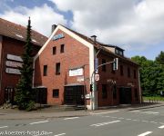
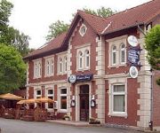
Kösters
Heinrich-Hansen Haus ver.di-IMKBildungsstätte
Altes Gasthaus Nagel
Liemer Krug
Videos from this area
These are videos related to the place based on their proximity to this place.
BINGO Film 2014 - Eltromat & Hans-Ehrenberg-Schule
Schülerinnen und Schüler besuchen im Rahmen des BINGO-Aktionstags 2014 die Firma Eltromat in Leopoldshöhe. BINGO - die Berufsoffensive für INGenieur/innen in OstWestfalenLippe- ist ...
Von der Kumsttonne zur Hünenkapelle Oerlinghausen - www.lipperland.de
Ein sehr schöner Rundwanderweg mit interessanten Stationen von Oerlinghausen über den Philosophenweg die Himmelsleiter hoch zur Kumsttonne. Von dort aus geht es über den Hermannsweg ...
Jugendfeuerwehr Lage Kernstadt - BF Tag 2014
24 Stunden Dienst der Jugendfeuerwehr Lage Kernstadt vom 10-11.05.2014.
Pfeife rauchen: SNAHTI Chimney und Tipps zur Aufbewahrung
Hans Wormit fertigt in seiner kleinen lippischen Werkstatt wundervolle Einzelexemplare. Meine Chimney hat zwar nur 3 Kupferpunkte, was für Wormit die untere Klassifikation darstellt, sie sieht...
Siegerwagen Dorffest Helpup 2012 HD
Der Siegerwagen vom Dorffest in Helpup 2012 Thema: Highway to Hell ..pup Festwagengemeinschaft Osterheide, Auf der Neustadt, Im Stillen Winkel.
Siegerwagen Dorffest Helpup 2012 - Teil 2
Der Siegerwagen beim Dorffest in Helpup 2012 Auf dem Rückweg geht es immer noch ab!
san andreas (sa-mp) Copleben auf SkyCity-Reallife
Copleben auf SkyCity-Reallife Server IP :85.214.87.48:7777 Forum: http://www.Sky-Reallife.de.lv Wir würden uns sehr freuen wenn du mal bei uns reinschauen würdest.
Wasserpark Währentrup in Oerlinghausen - www.lipperland.de
Impressionen vom wunderschön angelegten Wasserpark am Iberg in Oerlinghausen-Währentrup. Mehr Informationen: http://www.lipperland.de/iberg_oerlinghausen/wasserpark_waehrentrup.html Auf.
Videos provided by Youtube are under the copyright of their owners.
Attractions and noteworthy things
Distances are based on the centre of the city/town and sightseeing location. This list contains brief abstracts about monuments, holiday activities, national parcs, museums, organisations and more from the area as well as interesting facts about the region itself. Where available, you'll find the corresponding homepage. Otherwise the related wikipedia article.
Teutoburg Forest
The Teutoburg Forest is a range of low, forested mountains in the German states of Lower Saxony and North Rhine-Westphalia which is believed to be the scene of a decisive battle in AD 9. Until the 19th century the official name of the mountain ridge was Osning.
Detmold (region)
Detmold is one of the five Regierungsbezirks of North Rhine-Westphalia, Germany, located in the north-east of the state. It is congruent with the administratively not existent area of Ostwestfalen-Lippe (OWL). The Regierungsbezirk was created in 1947 when the former state of Lippe was incorporated into North Rhine-Westphalia by merging the former Regierungsbezirk Minden with the territory of Lippe-Detmold.
Hermannsdenkmal
The Hermannsdenkmal (German for Hermann monument) is a monument located in Ostwestfalen-Lippe in Germany in the Southern part of the Teutoburg Forest, which is southwest of Detmold in the district of Lippe. It stands on the densely forested and 386 m tall Teutberg in the ring fortification located there, which is called Grotenburg.
Sender Bielstein
The Sender Bielstein (Transmitter Bielstein) is an FM- and TV-broadcasting facility on the 393 metre high Bielstein mountain in the Forest of Teutoburg, North Rhine-Westphalia, Germany. Bielstein transmitter, which is property of WDR and used for transmitting its programmes was established in 1951. It used until 1954 a 60 metre tall mast. This mast was replaced in 1954 by a 102 metre tall antenna tower.
Oerlinghausen Airfield
Oerlinghausen Airfield, known as Oerlinghausen Segelflugplatz, German for Oerlinghausen gliding airflield, is a small airfield situated in the town of Oerlinghausen close to Bielefeld in the North Rhine-Westphalia German region. With around 25,000 glider take-offs each year it is one of the largest gliding centres, comparable with Lasham Gliding Society. It is also used by motor planes, microlights and hot air balloons. The airfield is home to 13 gliding clubs and to a gliding school.
Hanning Elektro-Werke
Hanning Elektro-Werke GmbH und Co. KG, (limited partnership with a limited liability company as general partner) a German family-owned company, was founded in 1947 by Robert Hanning. Currently the company employs approximately 1,000 employees, only counting the various European locations. The head office is situated in Oerlinghausen, in the state of North Rhine-Westphalia. Further production sites are located in Eggesin, in Vilnius, Shenzhen und Vadodara.
Friedrich-Ludwig-Jahn-Stadion
Friedrich-Ludwig-Jahn-Stadion is a multi-use stadium in Herford, Germany . It is used as the stadium of HSV Borussia Friedenstal matches. The capacity of the stadium is 18,400 spectators.
Detmold Open-air Museum
The Detmold Open-air Museum, or Westphalian Open Air Museum, is open seasonally, between April 1 and October 31. The museum is at Detmold, North Rhine-Westphalia, Germany. Over 100 historic, rural buildings were transported and reconstructed from across the state, including schools, farmhouses, thatched cottages, and windmills. Over 200 acres of bucolic fields and ponds are available for horse-drawn carriage rides, walking tours, and picnicking.
Bega (Werre)
Bega (Werre) is a river of North Rhine-Westphalia, Germany.
Bentgraben
Bentgraben is a river of North Rhine-Westphalia, Germany.
Bexter
Bexter is a river of North Rhine-Westphalia, Germany.
Gruttbach
Gruttbach is a river of North Rhine-Westphalia, Germany.
Haferbach
Haferbach is a river of North Rhine-Westphalia, Germany.
Heidenbach
Heidenbach is a river of North Rhine-Westphalia, Germany.
Hörster Bach
Hörster Bach is a river of North Rhine-Westphalia, Germany.
Ilse (Bega)
Ilse (Bega) is a river of North Rhine-Westphalia, Germany.
Krebsbach (Haferbach)
Krebsbach (Haferbach) is a river of North Rhine-Westphalia, Germany.
Menkebach
Menkebach is a river of North Rhine-Westphalia, Germany.
Rethlager Bach
Rethlager Bach is a river of North Rhine-Westphalia, Germany.
Rothenbach (Werre)
Rothenbach (Werre) is a river of North Rhine-Westphalia, Germany.
Salze (Bega)
Salze (Bega) is a river of North Rhine-Westphalia, Germany.
Siekbach (Werre)
Siekbach (Werre) is a river of North Rhine-Westphalia, Germany.
Sprungbach
Sprungbach is a river of North Rhine-Westphalia, Germany.
Wiembecke
Wiembecke is a river of North Rhine-Westphalia, Germany.
21st Armoured Brigade (Bundeswehr)
The 21st (Lipperland) Armoured Brigade is a brigade in the German Army and part of the Bundeswehr. The brigade staff and most of its units are housed in Generalfeldmarschall Rommel Barracks in Augustdorf, North Rhine-Westphalia. Several companies are based in Glückauf Barracks in Unna-Königsborn. The roughly 4,100 strong brigade is one of the Army's reaction forces and, like Panzerlehrbrigade 9, is subordinate to the 1st Armoured Division whose headquarters is in Hanover.






!['Ein bisschen Sachs Sx1 fahren [HD]' preview picture of video 'Ein bisschen Sachs Sx1 fahren [HD]'](https://img.youtube.com/vi/GqvBokcDhkU/mqdefault.jpg)


