Safety Score: 3,0 of 5.0 based on data from 9 authorites. Meaning we advice caution when travelling to Germany.
Travel warnings are updated daily. Source: Travel Warning Germany. Last Update: 2024-04-27 08:23:39
Discover Weißehütte
Weißehütte in Regierungsbezirk Kassel (Hesse) is a town in Germany about 175 mi (or 282 km) south-west of Berlin, the country's capital city.
Current time in Weißehütte is now 10:19 AM (Saturday). The local timezone is named Europe / Berlin with an UTC offset of 2 hours. We know of 12 airports near Weißehütte, of which 5 are larger airports. The closest airport in Germany is Kassel-Calden Airport in a distance of 14 mi (or 23 km), South-West. Besides the airports, there are other travel options available (check left side).
There are several Unesco world heritage sites nearby. The closest heritage site in Germany is Carolingian Westwork and Civitas Corvey in a distance of 17 mi (or 27 km), North-West. We discovered 2 points of interest in the vicinity of this place. Looking for a place to stay? we compiled a list of available hotels close to the map centre further down the page.
When in this area, you might want to pay a visit to some of the following locations: Buhren, Adelebsen, Scheden, Fuldatal and Derental. To further explore this place, just scroll down and browse the available info.
Local weather forecast
Todays Local Weather Conditions & Forecast: 17°C / 62 °F
| Morning Temperature | 4°C / 40 °F |
| Evening Temperature | 16°C / 62 °F |
| Night Temperature | 11°C / 51 °F |
| Chance of rainfall | 0% |
| Air Humidity | 51% |
| Air Pressure | 1009 hPa |
| Wind Speed | Gentle Breeze with 7 km/h (4 mph) from North |
| Cloud Conditions | Overcast clouds, covering 94% of sky |
| General Conditions | Overcast clouds |
Sunday, 28th of April 2024
19°C (67 °F)
10°C (49 °F)
Light rain, gentle breeze, overcast clouds.
Monday, 29th of April 2024
15°C (59 °F)
11°C (52 °F)
Light rain, light breeze, overcast clouds.
Tuesday, 30th of April 2024
22°C (72 °F)
15°C (59 °F)
Light rain, gentle breeze, broken clouds.
Hotels and Places to Stay
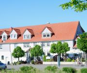
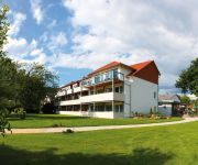
Gasthaus Zum Lindenwirt
Kronenhof
Hotel Peter
Videos from this area
These are videos related to the place based on their proximity to this place.
Feuerwehr Oedelsheim Cold Water Challenge 2014
Hiermit nominieren wir die Feuerwehren: ▻ Gieselwerder ▻ Lippoldsberg Innerhalb der nächsten 48h erwarten wir ein Video von euch, ansonsten sind wir demnächst zum Grillen bei Euch! ...
Campen am Fluss Oedelsheim - Flug über unseren Campingplatz mit einer Videodrohne (Kurzversion)
Lernen Sie unseren Campingplatz aus einer ganz anderen Perspektive kennen! Vielen Dank an die Firma GF-Film aus Dortmund für die einzigartigen Aufnahmen!
Besuch der Freilichtaustellung Mühlenplatz in Gieselwerder
In Gieselwerder befindet sich die Freilichtaustellung Mühlenplatz. Es handelt sich dabei um einen Miniaturenpark mit Bauwerken in den Maßstäben 1:25 und 1:40. Einträchtig steht die Karlsburg...
Campen am Fluss - Der kleine Vorgeschmack auf unseren Campingplatz!
Ob Sie mit einem Zelt, einem Caravan oder einem Wohnmobil anreisen, unsere großzügigen und parzellierten Stellplätze mit herrlichem Panoramablick auf das Wesertal und seiner reizvollen ...
HSG Twistetal siegt in Wesertal mit einem Tor Unterschied
Der Jubel nach dem Spiel. Steffen Fingerhut drischt den Ball in den letzten drei Sekunden zur Führung zwischen die Pfosten der Gäste und die Freude ist groß.
Himmelfahrt 2005; eigener Bollerwagen
der eigene Bollerwagen für Himmelfahrt !! Ostern 2005 war es soweit!
Bei Bursfelde und Löwenhagen: Faule Bäume zu Energieholz
Bursfelde, 18. November 2013: An der Straße zwischen Bursfelde und Löwenhagen im Landkreis Göttingen ließen die Niedersächsischen Landesforsten Bäume fällen. Die einen waren faul und...
Videos provided by Youtube are under the copyright of their owners.
Attractions and noteworthy things
Distances are based on the centre of the city/town and sightseeing location. This list contains brief abstracts about monuments, holiday activities, national parcs, museums, organisations and more from the area as well as interesting facts about the region itself. Where available, you'll find the corresponding homepage. Otherwise the related wikipedia article.
Bursfelde Abbey
Bursfelde Abbey (in German Kloster Bursfelde) was a house of the Benedictine Order located in the present Hemeln-Bursfelde, part of the town of Hannoversch Münden in Lower Saxony in Germany.
Bursfelde
Bursfelde is a village, now administratively joined with Hemeln as Bursfelde-Hemeln, in the northern part of Hann. Münden in the district of Göttingen, Lower Saxony, Germany. The village lies on the east side of the Weser River. It is best known for its Bursfelde Abbey.
Kiffing
The Kiffing is a range of hills, relatively small in area and up to 344.1 m above sea level, in the district of Kassel in the German state of Hesse.
Gladerberg
Gladerberg is a mountain of Hesse, Germany.
Hahneberg (Reinhardswald)
Hahneberg (Reinhardswald) is a mountain of Hesse, Germany.
Nieme
Nieme is a river of Lower Saxony, Germany.


