Safety Score: 3,0 of 5.0 based on data from 9 authorites. Meaning we advice caution when travelling to Germany.
Travel warnings are updated daily. Source: Travel Warning Germany. Last Update: 2024-05-08 08:04:21
Delve into Nikolausrieth
The district Nikolausrieth of Mönchpfiffel-Nikolausrieth in Free State of Thuringia is a subburb in Germany about 118 mi south-west of Berlin, the country's capital town.
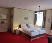
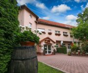
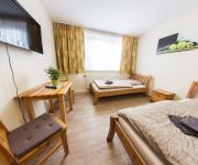
If you need a hotel, we compiled a list of available hotels close to the map centre further down the page.
While being here, you might want to pay a visit to some of the following locations: Heygendorf, Kalbsrieth, Voigtstedt, Nausitz and Gehofen. To further explore this place, just scroll down and browse the available info.
Local weather forecast
Todays Local Weather Conditions & Forecast: 18°C / 65 °F
| Morning Temperature | 9°C / 48 °F |
| Evening Temperature | 17°C / 62 °F |
| Night Temperature | 12°C / 54 °F |
| Chance of rainfall | 0% |
| Air Humidity | 52% |
| Air Pressure | 1026 hPa |
| Wind Speed | Light breeze with 3 km/h (2 mph) from South-East |
| Cloud Conditions | Clear sky, covering 9% of sky |
| General Conditions | Sky is clear |
Friday, 10th of May 2024
18°C (65 °F)
11°C (53 °F)
Light rain, gentle breeze, broken clouds.
Saturday, 11th of May 2024
19°C (66 °F)
13°C (55 °F)
Light rain, light breeze, overcast clouds.
Sunday, 12th of May 2024
19°C (67 °F)
11°C (53 °F)
Few clouds, gentle breeze.
Hotels and Places to Stay
Friedchen
Weinberg
Rosen Hotel
Holli's Rasthaus
Videos from this area
These are videos related to the place based on their proximity to this place.
Wasserkraftwerk und Wehr Artern Unstrut
Kurzes Video vom Wasserkraftwerk und Wehr an der Unstrut in Artern.
Hochwasser an der Unstrut in Artern (Salinepark) Januar 2011
Hier ein kleinen eindruck davon wie viel Hochwasser die Unstrut zur zeit führt.
Artern Schleuse3 12082008
Für die Fertigstellung des Unstrutwehres Artern wurde der Fluss durch die Schleusenkammer umgeleitet. Da die Schleusenkammer in dieser Zeit als Behelfswehr diente wurde die bereits rekonstruierte ...
BEST!!! Красивый Сильный удар Маваши...mp4...Жестокий ринг...
BEST!!! Красивый Сильный удар Маваши...mp4... Бои без правил..Бокс..Жестокий ринг. Сильные спортсмены..Спорт. Самые...
Schalmeienorchester Mönchpfiffel/Nikolausrieht spielt das Rennsteiglied LIVE
Rennsteiglied / Sportplatz Gehofen 2014.
Cold Water Challenge 2014
Nominiert sind die Feuerwehren aus: ALLSTEDT RIESTEDT SANGERHAUSEN. Ultimatum ist Mittwoch, der 04.06.2014 um 20 Uhr. Viel Spaß :)
Einsatzfahrt ELW 1 Oberröblingen Containerbrand
Einsatzfahrt ELW 1 Oberröblingen Containerband am 17.01.2010 Weitere Infos auf http://www.feuerwehroberroeblingen.net/
Jugendfeuerwehr Oberröblingen - Training Löschangriff
Jugendfeuerwehr Oberröblingen - Training Löschangriff "Nass". Mehr auf http://www.feuerwehroberroeblingen.net/ !
Historische Aufnahme - Einsatz Feuerwehr Oberröblingen Hilfeleistung Riestedt
Inzwischen wurden alle drei Fahrzeuge ersetzt. Heute stehen in der Halle unserer Feuerwehr ein ELW 1, ein HLF 20 und ein LF 16-TS einsatzbereit. Einsatz Feuerwehr Oberröblingen Hilfeleistung...
Videos provided by Youtube are under the copyright of their owners.
Attractions and noteworthy things
Distances are based on the centre of the city/town and sightseeing location. This list contains brief abstracts about monuments, holiday activities, national parcs, museums, organisations and more from the area as well as interesting facts about the region itself. Where available, you'll find the corresponding homepage. Otherwise the related wikipedia article.
Nebra sky disk
The Nebra sky disk is a bronze disk of around 30 cm diameter and a weight of 2,2 kg, with a blue-green patina and inlaid with gold symbols. These are interpreted generally as a sun or full moon, a lunar crescent, and stars (including a cluster interpreted as the Pleiades). Two golden arcs along the sides, marking the angle between the solstices, were added later.
Allstedt-Kaltenborn
Allstedt-Kaltenborn was a Verwaltungsgemeinschaft ("collective municipality") in the Mansfeld-Südharz district, in Saxony-Anhalt, Germany. It was situated east of Sangerhausen. The seat of the Verwaltungsgemeinschaft was in Allstedt. It was disbanded on 1 January 2010. The Verwaltungsgemeinschaft Allstedt-Kaltenborn consisted of the following municipalities:
Sittichenbach Abbey
Sittichenbach Abbey (Kloster Sittichenbach), sometimes also known as Sichem Abbey, is a Cistercian monastery in Sittichenbach, now part of Osterhausen near Eisleben in the Mansfeld-Südharz district, Saxony-Anhalt, Germany.
Mansfeld-Südharz
Mansfeld-Südharz is a district in Saxony-Anhalt, Germany.
An der Schmücke
An der Schmücke is a Verwaltungsgemeinschaft ("collective municipality") in the district Kyffhäuserkreis, in Thuringia, Germany. The seat of the Verwaltungsgemeinschaft is in Heldrungen. The Verwaltungsgemeinschaft An der Schmücke consists of the following municipalities: Bretleben Etzleben Gorsleben Hauteroda Heldrungen Hemleben Oberheldrungen
Mittelzentrum Artern
Mittelzentrum Artern is a Verwaltungsgemeinschaft ("collective municipality") in the district Kyffhäuserkreis, in Thuringia, Germany. The seat of the Verwaltungsgemeinschaft is in Artern, itself not part of the Verwaltungsgemeinschaft. The Verwaltungsgemeinschaft Mittelzentrum Artern consists of the following municipalities: Borxleben Gehofen Heygendorf Ichstedt Kalbsrieth Mönchpfiffel-Nikolausrieth Nausitz Reinsdorf Ringleben
Europa-Rosarium
The Europa-Rosarium (12.5 hectares), formerly the Rosarium Sangerhausen, is a municipal rose garden located at Steinberger Weg 3, Sangerhausen, Saxony-Anhalt, Germany, which describes itself at the largest rose collection in the world. It is open daily in the warmer months; an admission fee is charged. The blossoming season is nevertheless shorter than the opening season; the admission fee is charged anyway.
Schmücke
The Schmücke is a ridge of hills in Thuringia, Germany.
Hohe Schrecke
The Hohe Schrecke is a ridge of hills in central Germany. It lies mainly within Thuringia; the southeastern part around Lossa belongs to the state of Saxony-Anhalt.
Gonna (Helme)
Gonna (Helme) is a river of Saxony-Anhalt, Germany.
Rohne (Helme)
Rohne (Helme) is a river of Saxony-Anhalt, Germany.
Moltke Watchtower
The Moltke Watchtower is an observation tower in Sangerhausen in the district of Mansfeld-Südharz in the German state of Saxony-Anhalt. It is located on the hill of Schlößchenkopf on the southern edge of the Harz Mountains and south of the village of Lengefeld. The Moltke tower was inaugurated on 26 October 1903 and thoroughly renovated in 1995 as part of a job creation scheme by the municipal redevelopment company, Sangerhausen mbH.
Röhrigschacht
The Röhrigschacht ("Röhrig Shaft") is an old copper slate mine which, today, is a mining museum and show mine in the village of Wettelrode in the county of Mansfeld-Südharz in the German state of Saxony-Anhalt.


