Safety Score: 3,0 of 5.0 based on data from 9 authorites. Meaning we advice caution when travelling to Germany.
Travel warnings are updated daily. Source: Travel Warning Germany. Last Update: 2024-05-20 08:01:38
Discover Mellenbach
The district Mellenbach of Blumenau in Free State of Thuringia is a subburb in Germany about 166 mi south-west of Berlin, the country's capital city.
If you need a hotel, we compiled a list of available hotels close to the map centre further down the page.
While being here, you might want to pay a visit to some of the following locations: Meuselbach, Mellenbach-Glasbach, Wildenspring, Cursdorf and Drobischau. To further explore this place, just scroll down and browse the available info.
Local weather forecast
Todays Local Weather Conditions & Forecast: 19°C / 66 °F
| Morning Temperature | 9°C / 49 °F |
| Evening Temperature | 19°C / 66 °F |
| Night Temperature | 12°C / 53 °F |
| Chance of rainfall | 0% |
| Air Humidity | 49% |
| Air Pressure | 1010 hPa |
| Wind Speed | Gentle Breeze with 6 km/h (3 mph) from North-East |
| Cloud Conditions | Scattered clouds, covering 26% of sky |
| General Conditions | Scattered clouds |
Tuesday, 21st of May 2024
23°C (73 °F)
14°C (57 °F)
Moderate rain, moderate breeze, overcast clouds.
Wednesday, 22nd of May 2024
12°C (53 °F)
11°C (52 °F)
Moderate rain, gentle breeze, overcast clouds.
Thursday, 23rd of May 2024
17°C (63 °F)
10°C (50 °F)
Light rain, light breeze, overcast clouds.
Hotels and Places to Stay
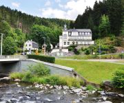
Boutique Hotel Schieferhof
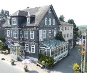
Waldfrieden Flair Hotel
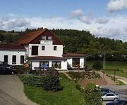
Burghof
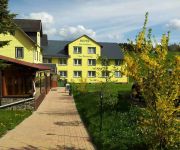
Zur Lärche
Jägerhof Hotel-Restaurant
Rennsteighotel Herrnberger Hof
Am Rennsteig
Videos from this area
These are videos related to the place based on their proximity to this place.
Oberweißbacher Bergbahn; Flachstrecke (Lichtenhain-Cursdorf)
Oberweißbacher Berg- und Schwarzatalbahn ------------------------------------------------------------------- Im Süden Thüringens, in der Nähe von Bad Blankenburg, fährt die Schwarzatalbahn....
Sonnenfinsternis vom 20.03.2015 in Thüringen
Die Sonnenfinsternis vom 20.03.2015 war ein sehr schönes Ereignis, dazu gibt es bei uns ein Video dazu. Wem es gefällt Daumen hoch und teilen. Besucht uns auf http://www.facebook.com/stwmbach.
Schwarzatalbahn
Schwarzatalbahn ------------------------------------------------------------------- Im Süden Thüringens, in der Nähe von Bad Blankenburg, fährt die Schwarzatalbahn. Sie fährt von Rottenbach...
Ausfahrt BR 641 aus Mellenbach-Glasbach
Eine Reise, die mich aus meiner gewohnten Umgebung herausführte, musste ich unternehmen, um diesen Walfisch in seinem natürlichen Lebensraum erlegen zu können: Ein Zug der BR 641 fährt...
Oberweißbacher Bergbahn (Talfahrt)
Oberweißbacher Berg- und Schwarzatalbahn ------------------------------------------------------------------- Im Süden Thüringens, in der Nähe von Bad Blankenburg, fährt die Schwarzatalbahn....
Oberweißbacher Bergbahn (Bergfahrt)
Oberweißbacher Berg- und Schwarzatalbahn ------------------------------------------------------------------- Im Süden Thüringens, in der Nähe von Bad Blankenburg, fährt die Schwarzatalbahn....
Oberweißbacher Bergbahn und Schwarzatalbahn - Standseilbahn in Thüringen
Fotoreportage van de Oberweißbacher Bergbahn und Schwarzatalbahn. Die Oberweißbacher Bergbahn ist eine Bahnstrecke im Thüringer Schiefergebirge. Sie verbindet seit 1922 den an der ...
Güterfahrt auf der Oberweißbacher Bergbahn
Einmal im Jahr (am 1. Mai) wird an der Bergstation Lichtenhain das Auf- und Absetzen eines Güterwagens auf die Güterbühne demonstriert. Die einzelnen Handgriffe werden ausführlich beschrieben...
118 749-1 im Schwarzatal 2
118-749-1 mit dem "Raanzer" von Katzhütte nach Rottenbach auf der Schwarztatalbahn, gefilmt aus einem Auto von der parallellaufenden Schwarzatalstraße.
Videos provided by Youtube are under the copyright of their owners.
Attractions and noteworthy things
Distances are based on the centre of the city/town and sightseeing location. This list contains brief abstracts about monuments, holiday activities, national parcs, museums, organisations and more from the area as well as interesting facts about the region itself. Where available, you'll find the corresponding homepage. Otherwise the related wikipedia article.
Nuremberg–Erfurt high-speed railway
|} The Nuremberg-Erfurt high-speed rail line is a 190 km-long German high-speed railway under construction, between Nuremberg and Erfurt. It consists of an upgraded line between Nuremberg and Ebensfeld and a new line between Ebensfeld and Erfurt. Parts of the new line have been under construction since 1996.
Großbreitenbach (Verwaltungsgemeinschaft)
Großbreitenbach is a Verwaltungsgemeinschaft ("collective municipality") in the district Ilm-Kreis, in Thuringia, Germany. The seat of the Verwaltungsgemeinschaft is in Großbreitenbach. The Verwaltungsgemeinschaft Großbreitenbach consists of the following municipalities: Altenfeld Böhlen Friedersdorf Gillersdorf Großbreitenbach
Langer Berg
Langer Berg is a Verwaltungsgemeinschaft ("collective municipality") in the district Ilm-Kreis, in Thuringia, Germany. The seat of the Verwaltungsgemeinschaft is in Gehren. The Verwaltungsgemeinschaft Langer Berg consists of the following municipalities: Gehren Herschdorf Möhrenbach Neustadt am Rennsteig
Oberes Geratal
Oberes Geratal is a Verwaltungsgemeinschaft ("collective municipality") in the district Ilm-Kreis, in Thuringia, Germany. The seat of the Verwaltungsgemeinschaft is in Gräfenroda. The Verwaltungsgemeinschaft Oberes Geratal consists of the following municipalities: Frankenhain Gehlberg Geschwenda Gossel Gräfenroda Liebenstein
Bergbahnregion/Schwarzatal
Bergbahnregion/Schwarzatal is a Verwaltungsgemeinschaft ("municipal association") in the district Saalfeld-Rudolstadt, in Thuringia, Germany. The seat of the Verwaltungsgemeinschaft is in Oberweißbach. The Verwaltungsgemeinschaft Bergbahnregion/Schwarzatal consists of the following municipalities: Cursdorf Deesbach Katzhütte Meuselbach-Schwarzmühle
Lichtetal am Rennsteig
Lichtetal am Rennsteig is a municipal association in the district of Saalfeld-Rudolstadt, in Thuringia, Germany. The seat of government is in Lichte (in the Wallendorf section). At present the municipal association is supervised by Christoph Theis. The municipal association consists of the following municipalities:
Mittleres Schwarzatal
Mittleres Schwarzatal is a Verwaltungsgemeinschaft ("municipal association") in the district Saalfeld-Rudolstadt, in Thuringia, Germany. The seat of the Verwaltungsgemeinschaft is in Sitzendorf. The Verwaltungsgemeinschaft Mittleres Schwarzatal consists of the following municipalities: Allendorf Bechstedt Döschnitz Dröbischau Mellenbach-Glasbach Meura Oberhain Rohrbach Schwarzburg Sitzendorf Unterweißbach
Thuringian Highland
The Thuringian Highland or Thuringian Highlands (German: Thüringer Schiefergebirge or Thüringisches Schiefergebirge, literally "Thuringian Slate Hills") is a low range of mountains in the German state of Thuringia.
Dreistromstein
The Dreistromstein (Three Rivers Stone) is a three-sided obelisk that has marked the watershed of the Weser, Elbe and Rhine rivers in the Thuringian Forest since 1906. The base of the obelisk is made of stone typical of each of the river systems—Elbe: granite; Weser: greywacke; Rhein: quartz.
Tierberg (Swabian Alb)
Tierberg (Schwäbische Alb) is a mountain of Baden-Württemberg, Germany. It is located in Zollernalbkreis.
Burgstein (Thuringia)
The Burgstein is a rock formation, about 10 metres high in the valley of the Ilm in Langewiesen in the central German state of Thuringia. It is made from quartz porphyry and has been a geological natural monument since 1939. It was formed when the Ilm carved out its valley and washed away the surrounding rock. When the Ilmenau–Großbreitenbach railway was built in 1881 it was exposed again because rock at its foot was removed in order to lay the railway track.
Wallendorfer Porzellan
Wallendorfer Porzellan or Wallendorf Porcelain is a porcelain manufacturing company which has been in operation since 1764 in Lichte (Wallendorf) in the Thuringian Highlands. Wallendorf is one of the oldest porcelain trademarks in Germany and the whole of Europe.
Morassina
Morassina is an inactive mine in Schmiedefeld, Thuringia, Germany. Today it is a tourist attraction known for its stalactites.
Lichte (river)
The Lichte River is a right tributary of the Schwarza in Thuringia, Germany, and is 17 km long.
Lichte Porzellan
The Lichte porcelain (GmbH) (German: Lichte Porzellan) was founded 1822 in Lichte, Thuringian Highlands.
Lichte station (Thuringia)
The Lichte station (Thuringia) German: Bahnhof Lichte (Thüringen) was a Deutsche Reichsbahn station in the Thuringian municipality of Lichte in the district of Saalfeld-Rudolstadt. The station is elevated 623 m above Sea Level.
Lichte station (Thuringia) east
The Lichte station (Thuringia) east (German: Bahnhof Lichte Ost) was a Deutsche Reichsbahn station of the Thuringian municipality of Lichte (Wallendorf) in the district of Saalfeld-Rudolstadt. This now-defunct station is located on an altitude of 618.54 m above NN. There are two platforms, three transit tracks, one street connection, one cargo street, one deposit track, and one track to the goods shed.
Cultural monuments in Lichte
This is a list of the cultural monuments in Lichte containing all cultural monuments of the Thuringian municipality of Lichte / Lichtetal am Rennsteig, including its sections (Bock-und-Teich, Geiersthal, Lichte and Wallendorf) as of December 2, 2009.
Piesau (river)
The Piesau River is a right tributary of the Lichte River in Thuringia, Germany, and is approximately 7 km long. The name is derived from the municipality of Piesau.
Ascherbach (river)
The Ascherbach is a left tributary of the Lichte in Thuringia, Germany, and is 4 km long.
Kieselbach (river)
The Kieselbach is a right tributary of the Lichte in Thuringia, Germany, and is 4 km long.
Oelze (river)
Oelze is a river of Thuringia, Germany.
Blambach
Blambach is a river of Thuringia, Germany.
Schobse
Schobse is a river of Thuringia, Germany.
Wohlrose
Wohlrose is a river of Thuringia, Germany.


