Safety Score: 3,0 of 5.0 based on data from 9 authorites. Meaning we advice caution when travelling to Germany.
Travel warnings are updated daily. Source: Travel Warning Germany. Last Update: 2024-04-28 08:22:10
Discover Klausberg
Klausberg in Upper Franconia (Bavaria) is a place in Germany about 216 mi (or 348 km) south-west of Berlin, the country's capital city.
Current time in Klausberg is now 10:35 PM (Sunday). The local timezone is named Europe / Berlin with an UTC offset of 2 hours. We know of 12 airports near Klausberg, of which 5 are larger airports. The closest airport in Germany is Nuremberg Airport in a distance of 20 mi (or 32 km), South-West. Besides the airports, there are other travel options available (check left side).
There are several Unesco world heritage sites nearby. The closest heritage site in Germany is Margravial Opera House Bayreuth in a distance of 21 mi (or 34 km), North. If you need a hotel, we compiled a list of available hotels close to the map centre further down the page.
While being here, you might want to pay a visit to some of the following locations: Obertrubach, Kirchensittenbach, Hartenstein, Simmelsdorf and Vorra. To further explore this place, just scroll down and browse the available info.
Local weather forecast
Todays Local Weather Conditions & Forecast: 19°C / 66 °F
| Morning Temperature | 7°C / 44 °F |
| Evening Temperature | 19°C / 67 °F |
| Night Temperature | 10°C / 50 °F |
| Chance of rainfall | 0% |
| Air Humidity | 47% |
| Air Pressure | 1013 hPa |
| Wind Speed | Moderate breeze with 9 km/h (6 mph) from South-East |
| Cloud Conditions | Broken clouds, covering 80% of sky |
| General Conditions | Broken clouds |
Monday, 29th of April 2024
17°C (63 °F)
11°C (51 °F)
Overcast clouds, light breeze.
Tuesday, 30th of April 2024
22°C (71 °F)
14°C (57 °F)
Sky is clear, light breeze, clear sky.
Wednesday, 1st of May 2024
22°C (71 °F)
13°C (55 °F)
Sky is clear, gentle breeze, clear sky.
Hotels and Places to Stay
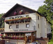
Eibtaler Hof Pension
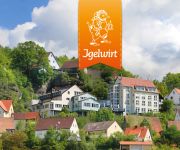
Igelwirt Berggasthof-Hotel
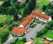
Bauernschmitt Landgasthof
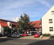
Motel Hormersdorf
Zur Burgruine
Videos from this area
These are videos related to the place based on their proximity to this place.
Wandern Franken: Frankenweg Etappe_12 Obertrubach-Gräfenberg
Abwechslungsreiche Etappe mit nicht allzu vielen Höhenmetern und noch mit frischem Herbstgrün!
Wandern Franken: Obertrubach-Bärnfels-Leienfels
Leichte Wanderung mit wenig Höhenmetern, meist im Schatten.
Wandern Franken: Obertrubach-Bärnfels-Leienfels
Leichte Wanderung mit wenig Höhenmetern, meist im Schatten.
Wandern Franken: Rupprechtstegen- Velden
Schöne einfache Wanderung durchs Pegnitztal und über die Höhen zurück.
Seltene hydrologische Verhältnisse im Ankatal, Franken
Das Ankatal in Franken ist ein so genanntes Trockental in der fränkischen Karstlandschaft. Im Normalfall versickern die Niederschläge oder verschwinden in Ponoren. Nur wenn nach lang ...
140 Jahre alte Bahnbrücken Pegnitztal kurz vor dem Abriss?
http://www.bahnbruecken.info Die Bahn plant nun gegen den Willen der Bevölkerung und unter sehr mysteriösen Begründungen den Abriss der historischen, denkmalgeschützten und ...
Pegnitz ab Lungsdorf
Die Pegnitz ist ein flotter Wald- und Wiesenfluss, der durch die Hersbrucker Schweiz führt. Der Abschnitt zwischen Lungsdorf und Hohenstedt ist sicher einer der schönsten Abschnitte. Anfangs...
Outdoor-Tag 2012
Outdoor-Tag im Pegnitztal am Pfingstmontag, den 28.05.2012. Aktivitäten im Frankenalb-Dorf mit Radeln, Kanufahren, Lama-Trekking, Bogenschießen, Reiten u.v.m..
Haste noch Töne? Verrückte Kleinbildkamera Happy Smile von Maginon
Manchmal haben Kamerakonstrukteure seltsame Einfälle und erfinden eine Kamera, die auf Knopfdruck Töne von sich gibt wie aus einem frühen Computerspiel... Mehr zum Thema auf ...
Bikepark Osternohe
19.10.2008 - Bikepark Osternohe bei Nürnberg. Kleiner, aber feiner Bikepark mit sehr vielen Details liebevoll aufgebaut - ein Besuch lohnt!!! www.bikepark-osternohe.de Leider musste ich...
Videos provided by Youtube are under the copyright of their owners.
Attractions and noteworthy things
Distances are based on the centre of the city/town and sightseeing location. This list contains brief abstracts about monuments, holiday activities, national parcs, museums, organisations and more from the area as well as interesting facts about the region itself. Where available, you'll find the corresponding homepage. Otherwise the related wikipedia article.
Spieser Schlossberg
Spieser Schlossberg is a mountain of Bavaria, Germany.


