Safety Score: 3,0 of 5.0 based on data from 9 authorites. Meaning we advice caution when travelling to Germany.
Travel warnings are updated daily. Source: Travel Warning Germany. Last Update: 2024-04-28 08:22:10
Explore Kälberberg
Kälberberg in Upper Franconia (Bavaria) is located in Germany about 211 mi (or 339 km) south-west of Berlin, the country's capital.
Local time in Kälberberg is now 10:54 PM (Sunday). The local timezone is named Europe / Berlin with an UTC offset of 2 hours. We know of 12 airports in the wider vicinity of Kälberberg, of which 5 are larger airports. The closest airport in Germany is Bamberg-Breitenau Airport in a distance of 8 mi (or 13 km), North-West. Besides the airports, there are other travel options available (check left side).
There are several Unesco world heritage sites nearby. The closest heritage site in Germany is Town of Bamberg in a distance of 8 mi (or 13 km), West. We found 3 points of interest in the vicinity of this place. If you need a place to sleep, we compiled a list of available hotels close to the map centre further down the page.
Depending on your travel schedule, you might want to pay a visit to some of the following locations: Altendorf, Litzendorf, Strullendorf, Weilersbach and Hallerndorf. To further explore this place, just scroll down and browse the available info.
Local weather forecast
Todays Local Weather Conditions & Forecast: 20°C / 68 °F
| Morning Temperature | 8°C / 46 °F |
| Evening Temperature | 16°C / 62 °F |
| Night Temperature | 11°C / 53 °F |
| Chance of rainfall | 0% |
| Air Humidity | 44% |
| Air Pressure | 1013 hPa |
| Wind Speed | Moderate breeze with 10 km/h (6 mph) from East |
| Cloud Conditions | Scattered clouds, covering 40% of sky |
| General Conditions | Scattered clouds |
Monday, 29th of April 2024
19°C (66 °F)
11°C (51 °F)
Light rain, light breeze, overcast clouds.
Tuesday, 30th of April 2024
23°C (73 °F)
15°C (59 °F)
Sky is clear, light breeze, clear sky.
Wednesday, 1st of May 2024
23°C (73 °F)
14°C (57 °F)
Few clouds, gentle breeze.
Hotels and Places to Stay
Schiller Landhaus
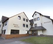
Schiller Gasthof
Schloss Buttenheim Landhotel
Schuberths am Schloss
Drive Inn
Lohntal
Göller
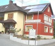
Landgasthof Zehner Landhotel
Schneider
Am Markt
Videos from this area
These are videos related to the place based on their proximity to this place.
3 Stück DS 700 am Energiepark Hirschaid
Nun sind insgesamt fünf Anlagen am Energiepark Hirschaid installiert. Bei dieser Aufnahme waren die Anlagen entkoppelt und konnten frei drehen. Dadurch erreichen sie diese hohe Drehzahl schon...
Zwei KENOVENT DS 300 am Energiepark Hirschaid
Dies sind die beiden KENOVENT Referenzanlagen am Energiepark Hirschaid. Nach Terminabsprache können die Anlagen gerne vor Ort und hautnah "erlebt" werden. Nehmen sie Kontakt mit uns auf: ...
Hagelschauer im Hof, Hirschaid 23. März 2014
Hagelschauer am Mittag - Aprilwetter Ende März Aufnahme: 23.03.2014, 13:28 h, Hirschaid Kamera: HTC One X, 720p (unbearbeitet)
Hagelschauer auf der Terrasse, Hirschaid 13. April 2013
Hagelschauer am Nachmittag - Aprilwetter Aufnahme: 13.04.2013, 15:10 h, Hirschaid Kamera: HTC One X, 720p.
Oster-Hase, am 25. März 2013 an einem Radweg zwischen Hirschaid u. Altendorf
Als ich am 25. März 2013 am späten Nachmittag mit dem Rad auf dem Weg nach Altendorf war, zwischen Baggersee und Bahnlinie, saß da plötzlich ein Hase links am Wegrand. Eine 3/4 Stunde später ...
Nelly auf der Terrasse + Rotschwänzchen - Hirschaid 28. Mai 2013
Katze "Das Nelly" auf der Terrasse, und ein schimpfendes Rotschwänzchen, das unter'm Dach ein Nest hat. Kamera: HTC One X, 720p.
I Love Rock'n Roll - Anna-Maria Zimmermann
Anna-Maria Zimmermann (von DSDS 2006) singt "I Love Rock'n Roll" Livemitschnitt vom Nevio Konzert vom 09.04.06 in Hirschaid.
Frankens Spargelkönigin Sabrina I. eröffnet die Spargelsaison
Hier der Artikel dazu: http://bit.ly/17Slfrr Kamera: Barbara Herbst Schnitt: Christian Bauriedel InFranken auf Twitter: http://www.twitter.com/infranken InFranken auf Facebook: http://www.facebo...
Videos provided by Youtube are under the copyright of their owners.
Attractions and noteworthy things
Distances are based on the centre of the city/town and sightseeing location. This list contains brief abstracts about monuments, holiday activities, national parcs, museums, organisations and more from the area as well as interesting facts about the region itself. Where available, you'll find the corresponding homepage. Otherwise the related wikipedia article.
Friesener Warte
Friesener Warte is a mountain of Bavaria, Germany.
Geisberg (Geisberger Forst)
Geisberg (Geisberger Forst) is a mountain of Bavaria, Germany.
Tiefenhöchstadt
Tiefenhöchstadt is a small village located in Bavaria, Germany. It is in Upper Franconia, in the Bamberg district. Tiefenhöchstadt is a constituent community of Buttenheim. In 2007, the village had a population of 90.
Stackendorf (Buttenheim)
Stackendorf is a small village located in Bavaria, Germany. It is in Upper Franconia, in the Bamberg district. Stackendorf is a constituent community of Buttenheim. In 2007, it had a population of 270.
Frankendorf (Buttenheim)
Frankendorf is a small village located in Bavaria, Germany. It is in Upper Franconia, in the Bamberg district. Frankendorf is a constituent community of Buttenheim. In 2007, the village had a population of 146.
Schlammbach
Schlammbach is a river of Saxony, Germany.


