Safety Score: 3,0 of 5.0 based on data from 9 authorites. Meaning we advice caution when travelling to Germany.
Travel warnings are updated daily. Source: Travel Warning Germany. Last Update: 2024-05-04 08:22:41
Delve into Sonnenwiechs
The district Sonnenwiechs of Bruckmühl in Upper Bavaria (Bavaria) is a district located in Germany about 327 mi south of Berlin, the country's capital town.
In need of a room? We compiled a list of available hotels close to the map centre further down the page.
Since you are here already, you might want to pay a visit to some of the following locations: Irschenberg, Feldkirchen-Westerham, Tuntenhausen, Weyarn and Miesbach. To further explore this place, just scroll down and browse the available info.
Local weather forecast
Todays Local Weather Conditions & Forecast: 17°C / 62 °F
| Morning Temperature | 8°C / 46 °F |
| Evening Temperature | 16°C / 61 °F |
| Night Temperature | 9°C / 49 °F |
| Chance of rainfall | 0% |
| Air Humidity | 57% |
| Air Pressure | 1014 hPa |
| Wind Speed | Light breeze with 3 km/h (2 mph) from South-West |
| Cloud Conditions | Overcast clouds, covering 90% of sky |
| General Conditions | Light rain |
Sunday, 5th of May 2024
19°C (66 °F)
10°C (51 °F)
Light rain, gentle breeze, overcast clouds.
Monday, 6th of May 2024
21°C (70 °F)
10°C (50 °F)
Moderate rain, fresh breeze, overcast clouds.
Tuesday, 7th of May 2024
9°C (48 °F)
9°C (47 °F)
Light rain, light breeze, overcast clouds.
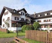
Hotels and Places to Stay
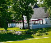
B&O Parkhotel
Lindners Hotels & Restaurants
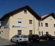
Dieterle Gästehaus
Demmel Garni
Kramerwirt
Autobahnmotel Irschenberg Süd
Land-gut-Hotel Zur schönen Aussicht
Gasthof Höhenrain
Videos from this area
These are videos related to the place based on their proximity to this place.
World of Tanks #001 | Dadadadadada... NEIN!!! :( [GERMAN][HD]
Hi Leute, dies ist mein 1. wot LP und ich muss sagen, ich habe mich echt DUMM angestellt!!! Ich hoffe das video gefällt euch, wenn ja dann likt es und/oder a...
Irschenberg: Lkw-Unfall und Pkw-Brand
08.02.2013 - Auf dem Irschenberg kam es am Freitag zu einem Lkw-Unfall. Einige hundert Meter weiter fing dann auch noch ein BMW Feuer (jre). Fotos zum Unfall und zum Brand finden Sie hier:...
Totale Mondfinsternis 2011.mpg
Gemeinschaftsproduktion von Patrick, Rüdiger und Ingmar Aufgenommen am 15.06.2011 am Irschenberg.
Ellmaier Karl Installateur in Bruckmühl - Heizung, Gas, Sanitär, Photovoltaik, Badsanierung
https://www.firmen.tv Zu Installateur und Haustechnik Ellmaier Karl Heizung-Sanitär-Solartechnik-Badsanierung aus Bruckmühl in Bayern finden Sie ein ausführliches Porträt unter https://www.fi...
Kunze Baumaschinen Vermietung und Service GmbH in Bruckmühl, Bayern
https://www.firmen.tv Zu Baumschinen Kunze Vermietung und Service GmbH aus Bruckmühl in Bayern finden Sie ein ausführliches Porträt unter ...
Lkw Wäsche Fa. Schmid Bruckmühl Högling Noderwiechs
So kann man seinen Lkw auch Waschen, Umweltschutz zählt hier nicht.
Videos provided by Youtube are under the copyright of their owners.
Attractions and noteworthy things
Distances are based on the centre of the city/town and sightseeing location. This list contains brief abstracts about monuments, holiday activities, national parcs, museums, organisations and more from the area as well as interesting facts about the region itself. Where available, you'll find the corresponding homepage. Otherwise the related wikipedia article.
Miesbach (district)
Miesbach is a district in Bavaria, Germany. It is bounded by (from the west and clockwise) the districts of Bad Tölz-Wolfratshausen, Munich and Rosenheim, and by the Austrian state of Tyrol.
Sulzberg (Bavaria)
Sulzberg is a mountain in the Bavarian Alps. It is located between Litzldorf, Großholzhausen and Brannenburg, south of Rosenheim, Bavaria in Germany.
Fischbachau Priory
Fischbachau Priory (Kloster Fischbachau) was a Benedictine monastery located in Fischbachau, Bavaria, Germany. The monastery was founded in 1087 as a priory of Hirsau Abbey against the background of the Investiture Controversy and the Hirsau Reforms, by the monks who had previously formed the small monastery founded in 1077 at Bayrischzell by Haziga of Aragon, wife of Count Otto II of Scheyern, ancestors of the Wittelsbachs.
Feldolling
Feldolling is a village in the municipality Feldkirchen-Westerham in the district of Rosenheim, in Bavaria, Germany. It is situated 22 km west of Rosenheim and about 45 km south of Munich.
Schliersee (lake)
Schliersee is a natural lake in Upper Bavaria in the Bavarian Alps. It is located next to the small town of Schliersee in the Miesbach district. The lake has a surface of 2.241 square kilometres at an elevation of 777 metres AMSL, expanding 2.3 kilometres by 1.3 kilometres maximum. The average depth is 20 metres The maximum depth is 40 metres . The only island is Wörth island, located almost in the middle of the lake.
Bad Aibling Station
The Bad Aibling Station was until 2004 a large monitoring base of the US intelligence organization NSA in Bad Aibling, Bavaria.
Seehamer See
Seehamer See is a lake in Alpenvorland, Bavaria, Germany. At an elevation of 653 m, its surface area is 1.47 km².
Hochsalwand
Hochsalwand is a mountain of Bavaria, Germany.
Neureut (mountain)
Neureut (Berg) is a mountain of Bavaria, Germany.
Taubenberg
Taubenberg is a mountain of Bavaria, Germany.
Riesenberg (Ore Mountains)
Riesenberg (Erzgebirge) is a mountain of Saxony, southeastern Germany.
Wendelstein Rack Railway
|} The Wendelstein Rack Railway, sometimes just referred to as the Wendelstein Railway, is an electrically-driven metre gauge rack railway that runs up the Wendelstein in the Upper Bavarian Limestone Alps. Together with the Wendelstein Cable Car (Wendelstein-Seilbahn) it is operated by the Wendelsteinbahn GmbH. The mountain railway climbs through a total height of 1,217.27 metres .
Braunau (river)
Braunau is a river of Bavaria, Germany.
Hainerbach (Mangfall)
Hainerbach is a river of Bavaria, Germany.
Leitzach
Leitzach is a river of Bavaria, Germany.
Schlierach
Schlierach is a river of Bavaria, Germany.
Grafing station
Grafing station is a station in the Bavarian town of Grafing and a station of the Munich S-Bahn. There is also the S-Bahn station of Grafing Stadt ("Grafing town") in central Grafing. The station has six platform tracks and is classified by Deutsche Bahn as a category 3 station. It is served daily by about 160 trains, 110 of which are S-Bahn trains. Grafing station is located on the Munich–Rosenheim railway and is the beginning of the Grafing–Wasserburg railway to Wasserburg.






!['World of Tanks #001 | Dadadadadada... NEIN!!! :( [GERMAN][HD]' preview picture of video 'World of Tanks #001 | Dadadadadada... NEIN!!! :( [GERMAN][HD]'](https://img.youtube.com/vi/U-2BCn6GjxA/mqdefault.jpg)


