Safety Score: 2,8 of 5.0 based on data from 9 authorites. Meaning we advice caution when travelling to Canada.
Travel warnings are updated daily. Source: Travel Warning Canada. Last Update: 2024-04-26 08:02:42
Explore Foster Farm
Foster Farm in Ontario is located in Canada a little south-west of Ottawa, the country's capital.
Local time in Foster Farm is now 12:42 PM (Friday). The local timezone is named America / Toronto with an UTC offset of -4 hours. We know of 9 airports in the wider vicinity of Foster Farm, of which 4 are larger airports. The closest airport in Canada is Ottawa Macdonald-Cartier International Airport in a distance of 6 mi (or 9 km), East. Besides the airports, there are other travel options available (check left side).
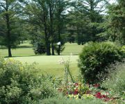
There is one Unesco world heritage site nearby. It's Rideau Canal in a distance of 79 mi (or 128 km), East. Also, if you like golfing, there are multiple options in driving distance. If you need a place to sleep, we compiled a list of available hotels close to the map centre further down the page.
Depending on your travel schedule, you might want to pay a visit to some of the following locations: Ottawa, Canton, Watertown, Saint-Polycarpe and Malone. To further explore this place, just scroll down and browse the available info.
Local weather forecast
Todays Local Weather Conditions & Forecast: 11°C / 52 °F
| Morning Temperature | -1°C / 30 °F |
| Evening Temperature | 10°C / 50 °F |
| Night Temperature | 4°C / 39 °F |
| Chance of rainfall | 0% |
| Air Humidity | 38% |
| Air Pressure | 1032 hPa |
| Wind Speed | Light breeze with 5 km/h (3 mph) from West |
| Cloud Conditions | Few clouds, covering 23% of sky |
| General Conditions | Few clouds |
Friday, 26th of April 2024
15°C (59 °F)
9°C (48 °F)
Moderate rain, moderate breeze, overcast clouds.
Saturday, 27th of April 2024
15°C (59 °F)
10°C (50 °F)
Moderate rain, gentle breeze, overcast clouds.
Sunday, 28th of April 2024
9°C (48 °F)
10°C (50 °F)
Moderate rain, moderate breeze, overcast clouds.
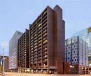
Hotels and Places to Stay
Sheraton Ottawa Hotel
Delta Hotels Ottawa City Centre
Crowne Plaza GATINEAU-OTTAWA
MINTO SUITE HOTEL
Ottawa Marriott Hotel
DoubleTree by Hilton Gatineau - Ottawa
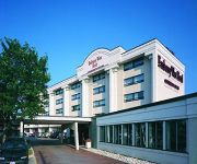
Four Points by Sheraton Hotel & Conference Centre Gatineau-Ottawa
TRAVELODGE OTTAWA WEST
DAYS INN - OTTAWA WEST
EMBASSY WEST HOTEL
Videos from this area
These are videos related to the place based on their proximity to this place.
ready2move.ca - 81B Sandcastle Dr. Ottawa, ON
Location, Location Location!!! Minutes to Bell's Corners, College Square and Bayshore Shopping Centre. Short commute to Kanata and Downtown. Wonderful, bright condo in a quiet neighbourhood...
Colombiano en Canada - Great Canadian Chill, Polar Bear Dip - Britannia Beach Ottawa
Colombiano en Canada - Great Canadian Chill, Polar Bear Dip - Britannia Beach Ottawa, January 1st 2013. Sobrevivi! Entre todos recogimos mas de 50.000 dolares para los centros de oncologia!...
803-2625 Regina Street at Britannia
http://www.ericmanherz.com/node/263 Ottawa Condo Living at Nature's Doorstep near Britannia Beach and next to Mud Lake - spacious 2 bedroom plus a den.
Ottawa Vacation Rental
Welcome to mckellar Park. We provide Ottawa vacation rentals consisting of spacious one and two bedroom units with: •separate living room •separate bedrooms ...
Lessons from The Big Apple - A Conversation with Kim Wiley-Schwartz
Ms. Wiley-Schwartz visited Ottawa and met with City officials and a variety of community groups with a focus of sharing the successes that New York City has achieved when it comes to active...
BYC Sailpast 2012 - Mali Losinj
We salute our Commodore at sail-past at the Britannia Yacht Club in Ottawa, Canada. Chris, Shane and Shaun on board Mali Losinj, a sailboat once owned by General John Knight Waters. A good sail ...
Putting the ketch Scotfree into the water 2014
John Quarterman's ketch, Scotfree, is launched at Britannia Yacht Club on 17 May 2014. After the crane returned her to the water of the harbour then we raised and rigged the two masts. My...
Videos provided by Youtube are under the copyright of their owners.
Attractions and noteworthy things
Distances are based on the centre of the city/town and sightseeing location. This list contains brief abstracts about monuments, holiday activities, national parcs, museums, organisations and more from the area as well as interesting facts about the region itself. Where available, you'll find the corresponding homepage. Otherwise the related wikipedia article.
Ottawa West—Nepean
For the provincial electoral district, see Ottawa West—Nepean (provincial electoral district). Ottawa West—Nepean is a federal electoral district in Ontario, Canada, that has been represented in the House of Commons since 1997. Its population in 2001 was 112,509.
Lincoln Fields Station
Lincoln Fields Station is a station on Ottawa's transitway located at Carling Avenue and the Sir John A. Macdonald Parkway. It is adjacent but not connected to nearby Lincoln Heights Galleria Shopping Centre. It is the main western hub of the transitway system and has a ticket sales and information office as well as a small convenience store.
Queensway Station (OC Transpo)
Queensway Transitway Station is located around and under the Queensway along the southwest transitway leg. The upper platforms provide access to the crosstown route 101, while the lower platforms are for transitway routes such as route 95 and eastbound trips of route 96. Despite its seemingly isolated location, this station serves nearby residential areas through the bikepath which is to the west of the transit station.
Iris Station
Iris Transitway Station is located at a grade-level crossing at the southwest transitway and Iris Street (a collector road through several neighborhoods in west end Ottawa). It is one of the smallest stations and one of the least used, because it is located only 400m (1/4 mile) south of Queensway Station, has no trip generators apart from residential areas in the area, and does not have any major routes connecting at the station.
Whitehaven, Ottawa
Whitehaven is a neighbourhood about 10 kilometres west of downtown Ottawa. It is bounded by Carling Avenue to the north, Woodroffe Avenue to the east, the OC Transpo Transitway to the west and highway 417 to the south. Whitehaven was developed on the lands of Fox farm starting in the 1950s. The Fox farm homestead can still be found on Fox Crescent in the north part of the neighbourhood with its windmill tower now shaded by a large tree.
Pinecrest Station
Pinecrest Station is a Transitway station in Ottawa, Ontario, that began service on September 6, 2009. The name is due to the station's close proximity to Pinecrest Road. On June 9, 2006, Then-Ottawa Mayor Bob Chiarelli announced an extension of the West Transitway that include a 1.8 kilometre stretch of transitway from Bayshore Station to Pinecrest Road including the new station and located near the road previously served as a regular stop for westbound buses such as route 96 and route 101.
Woodroffe High School (Ottawa)
Woodroffe High School is a secondary school situated in the west end of Ottawa, Ontario. Woodroffe High School an extensive variety of 20 school clubs, organizations and inter-school and intramural athletics are offered. Woodroffe High School is a secondary school with high academic standards, a large athletic program, and a wide range of extra-curricular activities. The staff is qualified and dedicated to the students in the classroom.
St. Paul High School (Ottawa)
St. Paul High School (formerly known as St. Paul's) is a Catholic high school in Ottawa, Ontario, Canada. The 2007-2008 school census indicated that about 1,300 students were enrolled, but the estimate for the 2008-2009 year is about 1,450.
Ottawa West—Nepean (provincial electoral district)
For the federal electoral district, see Ottawa West—Nepean. Ottawa West—Nepean is a provincial electoral district in eastern Ontario, Canada. It elects one member to the Legislative Assembly of Ontario. The riding has been represented in the Ontario legislature by Liberal Bob Chiarelli since 2010. The riding is fairly solidly Liberal. In the 1999 provincial election, however, former Member of Provincial Parliament Alex Cullen lost the nomination to Rick Chiarelli following fierce party battles.
St. Stephen's Anglican Church (Ottawa)
Craig Henry
Craig Henry is a residential neighbourhood in Ottawa, Canada and part of the former city of Nepean. It is a mature residential subdivision in the west/central part of Ottawa, developed from 1971 onwards. Bordered by Woodroffe to the east, Greenbank to the west, Knoxdale Road to the south and the CN railroad separating it from Centrepointe to the north, Craig Henry is a neighbourhood close to many major roads. The land previously belonged to the Craig Henry farm, and was developed by Jack Aaron.
D. Roy Kennedy Public School
D. Roy Kennedy is a public elementary and middle school in the Bay Ward of Ottawa, Ontario, Canada, offering classes from kindergarten to grade 8. It is located at the corner of Woodroffe Avenue and Lenester Avenue in Ottawa's Glabar Park neighbourhood. The school is named after D. Roy Kennedy, who would in later years become a prominent Kiwanian and Ottawa educator. The school is notable for its music program, and its emphasis on French immersion.


