Safety Score: 2,7 of 5.0 based on data from 9 authorites. Meaning we advice caution when travelling to United States.
Travel warnings are updated daily. Source: Travel Warning United States. Last Update: 2024-05-20 08:01:38
Discover Moler Crossroads
Moler Crossroads in Jefferson County (West Virginia) is a place in United States about 52 mi (or 84 km) north-west of Washington DC, the country's capital city.
Current time in Moler Crossroads is now 11:34 PM (Monday). The local timezone is named America / New York with an UTC offset of -4 hours. We know of 8 airports near Moler Crossroads, of which 3 are larger airports. The closest airport in United States is Hagerstown Regional Richard A Henson Field in a distance of 22 mi (or 35 km), North. Besides the airports, there are other travel options available (check left side).
There is one Unesco world heritage site nearby. It's Monticello and the University of Virginia in Charlottesville in a distance of 95 mi (or 153 km), South. Also, if you like playing golf, there are a few options in driving distance. We encountered 1 points of interest in the vicinity of this place. If you need a hotel, we compiled a list of available hotels close to the map centre further down the page.
While being here, you might want to pay a visit to some of the following locations: Charles Town, Martinsburg, Hagerstown, Berryville and Leesburg. To further explore this place, just scroll down and browse the available info.
Local weather forecast
Todays Local Weather Conditions & Forecast: 26°C / 79 °F
| Morning Temperature | 15°C / 59 °F |
| Evening Temperature | 25°C / 77 °F |
| Night Temperature | 19°C / 65 °F |
| Chance of rainfall | 0% |
| Air Humidity | 61% |
| Air Pressure | 1015 hPa |
| Wind Speed | Gentle Breeze with 7 km/h (4 mph) from North-West |
| Cloud Conditions | Clear sky, covering 0% of sky |
| General Conditions | Light rain |
Tuesday, 21st of May 2024
29°C (85 °F)
21°C (69 °F)
Light rain, light breeze, scattered clouds.
Wednesday, 22nd of May 2024
20°C (68 °F)
18°C (64 °F)
Light rain, gentle breeze, overcast clouds.
Thursday, 23rd of May 2024
24°C (75 °F)
17°C (62 °F)
Few clouds, light breeze.
Hotels and Places to Stay
Bavarian Inn
Clarion Hotel & Conference Center
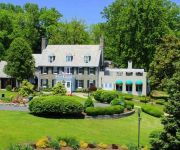
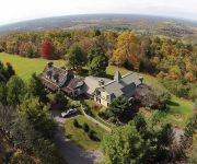
Antietam Overlook Farm
Lily Garden Bed and Breakfast
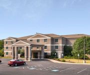
Quality Inn Shepherdstown
Clarion Inn Harpers Ferry-Charles Town
KNIGHTS INN KNOXVILLE HARPERS
Videos from this area
These are videos related to the place based on their proximity to this place.
Norfolk Southern OCS in Shepherdstown
Norfolk Southern Office Car Special executive train going through Shepherdstown, West Virginia.
BNSF Leads Norfolk Southern in Shepherdstown
intermodal train over the potomac river in shepherdstown, west virginia.
Norfolk Southern in Shepherdstown, W Virginia
ADVERTISE YOURSELF on my channel & my videos! -- I encourage spamming on my channel, so anyone can advertise...
Gumption Goes To Shepherdstown's Rumsey Park!
Gumption the Dragon found a great park in Shepherdstown, West Virginia. Rumsey Park is dedicated to James Rumsey--a little known inventor of steam-powered boats. Gumption loved climbing the...
Norfolk Southern Intermodal @ Shepherdstown, WV
I allow ALL video responses on all of my vids, so u can advertise ur videos ! (I also allow 'spamming' on my channel, so anyone can advertise themselves however they want on my channel)
Videos provided by Youtube are under the copyright of their owners.
Attractions and noteworthy things
Distances are based on the centre of the city/town and sightseeing location. This list contains brief abstracts about monuments, holiday activities, national parcs, museums, organisations and more from the area as well as interesting facts about the region itself. Where available, you'll find the corresponding homepage. Otherwise the related wikipedia article.
Shepherdstown, West Virginia
Shepherdstown is a town in Jefferson County, West Virginia, United States, located along the Potomac River. It is the arguably the oldest town in the state, having been chartered in 1762 by Colonial Virginia's General Assembly. Its status as the oldest town in West Virginia is only contested by Romney, which was chartered in the same year. The town's population was 1,734 at the 2010 United States Census. The town is home to Shepherd University.
Battle of Shepherdstown
The Battle of Shepherdstown, also known as the Battle of Boteler's Ford, took place September 19–20, 1862, in Jefferson County, Virginia (now West Virginia), at the end of the Maryland Campaign of the American Civil War.
Antietam Creek
Antietam Creek is a 41.7-mile-long tributary of the Potomac River located in south central Pennsylvania and western Maryland in the United States, a region known as the Hagerstown Valley. The creek became famous as a focal point of the Battle of Antietam during the American Civil War.
WSHC
WSHC is an Adult Album Alternative formatted broadcast radio station licensed to Shepherdstown, West Virginia, serving the Shepherdstown/Sharpsburg area. WSHC is owned and operated by Shepherd College Board of Governors.
Ram Stadium
Ram Stadium is a 5,000-seat stadium in Shepherdstown, West Virginia. It is home to the Shepherd University Rams football and soccer teams. The stadium was built in 2000.
Antietam, Maryland
Antietam is an unincorporated community in Washington County, Maryland, United States. It is the site of Antietam Iron Furnace Site and Antietam Village, added to the National Register of Historic Places in 1975.
Dargan, Maryland
Dargan is an unincorporated community in Washington County, Maryland, United States.


