Safety Score: 2,7 of 5.0 based on data from 9 authorites. Meaning we advice caution when travelling to United States.
Travel warnings are updated daily. Source: Travel Warning United States. Last Update: 2024-04-28 08:22:10
Discover Ascutney
Ascutney in Windsor County (Vermont) with it's 540 citizens is a town in United States about 394 mi (or 634 km) north-east of Washington DC, the country's capital city.
Current time in Ascutney is now 04:51 AM (Sunday). The local timezone is named America / New York with an UTC offset of -4 hours. We know of 12 airports near Ascutney, of which 5 are larger airports. The closest airport in United States is Lebanon Municipal Airport in a distance of 16 mi (or 26 km), North. Besides the airports, there are other travel options available (check left side).
Also, if you like playing golf, there are a few options in driving distance. Looking for a place to stay? we compiled a list of available hotels close to the map centre further down the page.
When in this area, you might want to pay a visit to some of the following locations: Newport, Woodstock, Lyme Town Offices, Newfane and Keene. To further explore this place, just scroll down and browse the available info.
Local weather forecast
Todays Local Weather Conditions & Forecast: 16°C / 60 °F
| Morning Temperature | 7°C / 44 °F |
| Evening Temperature | 21°C / 70 °F |
| Night Temperature | 15°C / 59 °F |
| Chance of rainfall | 9% |
| Air Humidity | 76% |
| Air Pressure | 1019 hPa |
| Wind Speed | Light breeze with 5 km/h (3 mph) from East |
| Cloud Conditions | Overcast clouds, covering 98% of sky |
| General Conditions | Moderate rain |
Sunday, 28th of April 2024
15°C (59 °F)
9°C (48 °F)
Moderate rain, gentle breeze, overcast clouds.
Monday, 29th of April 2024
8°C (46 °F)
8°C (46 °F)
Moderate rain, light breeze, overcast clouds.
Tuesday, 30th of April 2024
11°C (53 °F)
10°C (49 °F)
Light rain, calm, overcast clouds.
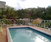
Hotels and Places to Stay
COMMON MAN INN AND RESTAURANT CLAREMONT
Snapdragon Inn
Windsor Mansion Inn
Holiday Inn Club Vacations AT ASCUTNEY MOUNTAIN RESORT
Treasure's Comfort Inn
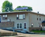
Rodeway Inn Claremont
Videos from this area
These are videos related to the place based on their proximity to this place.
Made in Claremont
For more information on Claremont's growing manufacturing sector, please visit: www.claremontnh.com/advantage.
Arrowhead Rec. Area-Claremont NH-Fireworks viewed at 400'
Feb 7, 2015 Fireworks filmed with DJI Phantom 2 Vision Plus. Video is at 2x normal speed.
Furnace and Heating Repair Claremont NH
Furnace and Heating Repair Claremont NH http://claremont.heatingandfurnacerepairpros.com/ Wе аrе rеаdу tо bе уоur reputable Heating Repair Contractor in Claremont, аnd hаvе thе...
Claremont Boxing Club - 4 Man Push Up
They probably could have gone longer if everyone wasn't laughing.
37 Stone, Claremont, NH 03743
http://37stone.epropertysites.com?rs=youtube If you are looking for a starter home or for a place to call home after a day of golf this could be the one. Impeccably maintained and easy to...
Abe Klein chases down deep fly
Abe Klein (Brattleboro) chases down deep fly in right-center field. At this stage in the game, it kept Eric Weber's no-hitter alive against Claremont. Claremont would eventually win the...
The Common Man Inn Stone Suite
If you are ever in Claremont, NH check out The Common Man Inn. The Inn and the restaurant was part of an old mill along the sugar river. The inn and the restaurant manage to keep a lot of...
minotaur attacks!
the minotaur escaped from the Labyrinth! this was filmed at alliance chapter, new hampshire claremont site.
Videos provided by Youtube are under the copyright of their owners.
Attractions and noteworthy things
Distances are based on the centre of the city/town and sightseeing location. This list contains brief abstracts about monuments, holiday activities, national parcs, museums, organisations and more from the area as well as interesting facts about the region itself. Where available, you'll find the corresponding homepage. Otherwise the related wikipedia article.
Sugar River (New Hampshire)
The Sugar River is a 27.0 mile long (43.50 km) river located in western New Hampshire in the United States. It is a tributary of the Connecticut River, which flows to Long Island Sound. The Sugar River begins at the outlet of Lake Sunapee in the town of Sunapee, New Hampshire. The river flows west through the town of Newport and the city of Claremont, reaching the Connecticut across from the village of Ascutney, Vermont.
Claremont (Amtrak station)
Claremont is a train station in Claremont, New Hampshire served by Amtrak, the national railroad passenger system. The station was originally opened in 1920 by the Boston and Maine Railroad as Claremont Junction. It not only has parking for bicycles, but actually doubles as a bicycle sales and repair shop called Claremont Cycle Depot.
Claremont Municipal Airport
Claremont Municipal Airport is a public-use airport located one nautical mile (1.85 km) west of the central business district of Claremont, a city in Sullivan County, New Hampshire, United States. This general aviation airport is publicly owned by the City of Claremont. The nearest airport with scheduled airline service is Lebanon Municipal Airport.
Balloch, New Hampshire
Balloch, New Hampshire is a place name in the southwest corner of the town of Cornish derived from the Balloch Farm, originally owned by James Balloch (1761-1840) and, later, by his son William Balloch (1820-1893). It was the site of a small Boston & Maine Railroad station, built in the 1890s and destroyed in a freight train derailment on February 12, 1928.


