Safety Score: 2,7 of 5.0 based on data from 9 authorites. Meaning we advice caution when travelling to United States.
Travel warnings are updated daily. Source: Travel Warning United States. Last Update: 2024-04-28 08:22:10
Delve into Farrell
Farrell in Mercer County (Pennsylvania) with it's 4,792 habitants is a city located in United States about 243 mi (or 391 km) north-west of Washington DC, the country's capital town.
Current time in Farrell is now 07:50 PM (Sunday). The local timezone is named America / New York with an UTC offset of -4 hours. We know of 11 airports closer to Farrell, of which 5 are larger airports. The closest airport in United States is Youngstown Warren Regional Airport in a distance of 10 mi (or 16 km), West. Besides the airports, there are other travel options available (check left side).
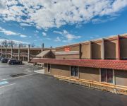
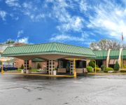
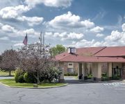
Also, if you like playing golf, there are some options within driving distance. In need of a room? We compiled a list of available hotels close to the map centre further down the page.
Since you are here already, you might want to pay a visit to some of the following locations: Youngstown, New Castle, Mercer, Warren and Lisbon. To further explore this place, just scroll down and browse the available info.
Local weather forecast
Todays Local Weather Conditions & Forecast: 23°C / 73 °F
| Morning Temperature | 15°C / 60 °F |
| Evening Temperature | 21°C / 70 °F |
| Night Temperature | 17°C / 62 °F |
| Chance of rainfall | 3% |
| Air Humidity | 69% |
| Air Pressure | 1019 hPa |
| Wind Speed | Gentle Breeze with 8 km/h (5 mph) from East |
| Cloud Conditions | Overcast clouds, covering 89% of sky |
| General Conditions | Light rain |
Sunday, 28th of April 2024
25°C (77 °F)
17°C (62 °F)
Light rain, moderate breeze, clear sky.
Monday, 29th of April 2024
17°C (63 °F)
12°C (53 °F)
Moderate rain, gentle breeze, overcast clouds.
Tuesday, 30th of April 2024
20°C (67 °F)
15°C (58 °F)
Light rain, light breeze, broken clouds.
Hotels and Places to Stay
Park Inn By Radisson Sharon
Holiday Inn Express & Suites SHARON-HERMITAGE
Hampton Inn - Suites Sharon PA
Travelodge Hubbard OH
BEST WESTERN PENN OHIO INN
Econo Lodge Hermitage
Quality Inn Hermitage
Red Roof Inn and Suites Hermitage
SUPER 8 WEST MIDDLESEX SHARON
ROYAL MOTEL-HERMITAGE
Videos from this area
These are videos related to the place based on their proximity to this place.
Western PA Coal Mine Towns !
Sorry about the wind noise ! If anyone would like to learn more about the Grove City area . Here is a link ...
Sharon Fire Dept. Local 417, Capt. Mike Unrue's helmet cam at apartment fire.
Sharon Pennsylvania Fire Dept. Capt. Mike Unrue's helmet cam captures an apartment fire from a first person perspective. This allows you to see and then not see what we actually deal with when...
Hide en seek in Sharon PA
If you are in Sharon Pa . Stop and get a shot of this plack and link it up too my video . Just remember my land marks and you will find it . So many walk by it and do not know it is there .
Sharon Speedway Oval race- 501-600 cc feature
I created this video with the YouTube Video Editor (http://www.youtube.com/editor)
BIG BIG MEET UP IN SHARON PA !
From what I have herd there might be fire works and a parade along with games for the Kids and the Corn Whole game for the Adults ! This is going to be the Biggest deal since PBJ ! We still...
RC helicopter over Sharon Sewer Plant
Sharon, PA Waste Water Treatment Plant under construction. Taken on a windy day on 12-27-08 using a remote control helicopter flown by Ken J.
Riding In GroveCity PA !
A nice day to show down town GroveCity PA ! I talked about a train accident that happened . To read up on it . http://www.grovecityhistoricalsociety.org/PDF/History/Grove%20City%201910%20-%20191 ...
What I Have been up to ?
I have been busy . Just getting things ready for a trip . I am looking forward to a couple of short trips . https://www.youtube.com/user/DanteFox.
Hong Kong Coin !
The last coin I could get from my fathers trip around the world . It is not worth much to anyone but myself . It is a cool coin . Tracking Treasures https://www.youtube.com/user/diggingtreasuresmoto.
Videos provided by Youtube are under the copyright of their owners.
Attractions and noteworthy things
Distances are based on the centre of the city/town and sightseeing location. This list contains brief abstracts about monuments, holiday activities, national parcs, museums, organisations and more from the area as well as interesting facts about the region itself. Where available, you'll find the corresponding homepage. Otherwise the related wikipedia article.
West Hill, Ohio
West Hill is a census-designated place (CDP) in Trumbull County, Ohio, United States. The population was 2,523 at the 2000 census. It is part of the Youngstown–Warren–Boardman, OH-PA Metropolitan Statistical Area.
Sharon, Pennsylvania
Sharon is a city in Mercer County, Pennsylvania, in the United States, 75 miles northwest of Pittsburgh. It is part of the Youngstown–Warren–Boardman, OH-PA Metropolitan Statistical Area.
Wheatland, Pennsylvania
Wheatland is a borough in Mercer County, Pennsylvania, along the Shenango River. The population was 748 at the 2000 census. It is part of the Youngstown–Warren–Boardman, OH-PA Metropolitan Statistical Area. Wheatland suffered extensive damage on May 31, 1985, when an F5 tornado struck the area. The tornado killed 18 (seven of whom were Wheatland residents), injured over 300, and was easily the most powerful and damaging in Pennsylvania's history.
Penn State Shenango
Penn State Shenango is a Commonwealth Campus of the Pennsylvania State University, located on a 14-acre campus in downtown Sharon, Pennsylvania. Penn State Shenango has the distinction of being the only urban campus in the Penn State system, although some parts of Penn State Altoona that are located in the heart of Altoona's downtown are urban in nature.
WLOA
WLOA is a radio station licensed to Farrell, Pennsylvania. It serves the Sharon, Pennsylvania and Youngstown, Ohio areas. Though licensed to Farrell, WLOA transmits from a facility on South State Line Road in Masury, Ohio. The Farrell city limit is across South State Line Road in Pennsylvania. WLOA and WGRP 940 AM are owned by Vilkie Communications. Vilkie Communications assumed control of the stations from Educational Media Foundation on December 15, 2011.
Buhl Farm Golf Course
Buhl Farm Golf Course, located in Sharon, Pennsylvania, is the only free public golf course in the United States. The 9-hole course is open from mid-April to November between 8 a.m. to sundown (closing times vary on season, so call ahead). The course is known for its flat greens, high rough and little room between each hole. It is also known for its easy layout including straight and wide fairways. The course is also known for its one artificial turf tee box, and eight other natural tee boxes.
Kennedy Catholic High School (Hermitage, Pennsylvania)
Kennedy Catholic High School is a private, Roman Catholic high school in Hermitage, Pennsylvania. It is located in the Roman Catholic Diocese of Erie.
WPIC
WPIC is a radio station broadcasting a News Talk Information format. Licensed to Sharon, Pennsylvania, USA, the station serves Mercer County, Pennsylvania, though its signal covers much of the Youngstown radio market from its facility on North Stateline Road in Masury, Ohio. The station is currently owned by Cumulus Media and features programing from ABC Radio, Jones Radio Network and Westwood One.


