Safety Score: 2,7 of 5.0 based on data from 9 authorites. Meaning we advice caution when travelling to United States.
Travel warnings are updated daily. Source: Travel Warning United States. Last Update: 2024-05-05 08:24:42
Delve into Emmaville
Emmaville in Fulton County (Pennsylvania) is located in United States about 95 mi (or 154 km) north-west of Washington DC, the country's capital town.
Current time in Emmaville is now 07:16 AM (Sunday). The local timezone is named America / New York with an UTC offset of -4 hours. We know of 12 airports close to Emmaville, of which 5 are larger airports. The closest airport in United States is Altoona Blair County Airport in a distance of 27 mi (or 43 km), North. Besides the airports, there are other travel options available (check left side).
Also, if you like playing golf, there are some options within driving distance. If you need a hotel, we compiled a list of available hotels close to the map centre further down the page.
While being here, you might want to pay a visit to some of the following locations: McConnellsburg, Bedford, Berkeley Springs, Hollidaysburg and Martinsburg. To further explore this place, just scroll down and browse the available info.
Local weather forecast
Todays Local Weather Conditions & Forecast: 13°C / 55 °F
| Morning Temperature | 11°C / 51 °F |
| Evening Temperature | 15°C / 60 °F |
| Night Temperature | 15°C / 58 °F |
| Chance of rainfall | 13% |
| Air Humidity | 98% |
| Air Pressure | 1019 hPa |
| Wind Speed | Gentle Breeze with 7 km/h (4 mph) from North-West |
| Cloud Conditions | Overcast clouds, covering 100% of sky |
| General Conditions | Moderate rain |
Sunday, 5th of May 2024
22°C (71 °F)
16°C (61 °F)
Moderate rain, light breeze, overcast clouds.
Monday, 6th of May 2024
22°C (71 °F)
18°C (65 °F)
Light rain, light breeze, overcast clouds.
Tuesday, 7th of May 2024
26°C (78 °F)
18°C (64 °F)
Light rain, moderate breeze, broken clouds.
Hotels and Places to Stay
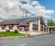
Econo Lodge Breezewood
Videos from this area
These are videos related to the place based on their proximity to this place.
Everett Apartment Fire July 18 2010.wmv
Apartment Fire on North Spring St in Everett, PA on July 18, 2010 at 9:17 am. This video begins approx 15 minutes after the initial dispatch and Everett and Breezewood Fire Co's were already...
Win by fall vs Everett in 1st period @ Bloody Run Brawl - Dec 2014
9-10 / 55 lbs Everett Bloody Run Brawl Wrestling Tournament Win by fall vs Everett in 1st period @ Bloody Run Brawl - Dec 2014.
Bedford County Invitational - All Bands
1st Annual Bedford County Invitational Featuring: Tussey Mountain High School, Bedford High School, Northern Bedford County High School and Everett High School.
US 30/Lincoln Highway Through Breezewood
When the Lincoln Highway was designated through here in 1913, Breezewood was just a collection of a few homes. That all changed when the Turnpike was completed in 1940 and even more so ...
Abandoned Ramada Inn Breezewood Oct 2014
Across from the Quality Inn Breezewood is an old abandoned motel, the Ramada. In pretty rough shape and unable to gain access I still shot a little video of what I did find before leaving to...
Our Trip to the Abandoned Turnpike-5/13/08
On May 13, 2008, I finally got the chance to take my daughter Michaela and her friend Dorothy to the abandoned stretch of the Pennsylvania Turnpike. I learned a lot on this trip: 1.) It's...
Breezewood Proving Grounds July 7th 2012
04 Randi Buri CRF150R Breezewood Proving Grounds July 7th 2012. 3 Races. First race is Supermini place 3rd of 6. Second Race is Womens open combined with something else, placed 2nd of 3....
Videos provided by Youtube are under the copyright of their owners.
Attractions and noteworthy things
Distances are based on the centre of the city/town and sightseeing location. This list contains brief abstracts about monuments, holiday activities, national parcs, museums, organisations and more from the area as well as interesting facts about the region itself. Where available, you'll find the corresponding homepage. Otherwise the related wikipedia article.
East Providence Township, Bedford County, Pennsylvania
East Providence Township is a township in Bedford County, Pennsylvania in the United States of America. The population was 1,858 at the 2000 census. Breezewood lies inside it.
Rays Hill
Rays Hill is a mountain ridge in Pennsylvania's Ridge and Valley Appalachians region. It is bordered to the east by Sideling Hill. About halfway along its run, the west side of Rays Hill ties into Broad Top Mountain, a large plateau. On its west it is bordered by Tussey Mountain south of Broad Top Mountain and Rocky Ridge north of Broad Top Mountain. The ridge is known both as "Rays" and "Wrays".
Crystal Spring, Pennsylvania
Crystal Spring is an unincorporated community in Brush Creek Township, Fulton County, Pennsylvania, south of Breezewood. Just to the west, across the county line in Bedford County, is Gapsville. The community lies in east of a water gap, where Brush Creek passes through Rays Hill, which forms the western border of Fulton County. The elevation is approximately 1161 feet.


