Safety Score: 2,7 of 5.0 based on data from 9 authorites. Meaning we advice caution when travelling to United States.
Travel warnings are updated daily. Source: Travel Warning United States. Last Update: 2024-04-29 08:03:39
Delve into Miles
Miles in Cuyahoga County (Ohio) is located in United States about 299 mi (or 481 km) north-west of Washington DC, the country's capital town.
Current time in Miles is now 04:01 AM (Monday). The local timezone is named America / New York with an UTC offset of -4 hours. We know of 11 airports close to Miles, of which 5 are larger airports. The closest airport in United States is Burke Lakefront Airport in a distance of 6 mi (or 10 km), North-West. Besides the airports, there are other travel options available (check left side).
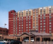
Also, if you like playing golf, there are some options within driving distance. We encountered 7 points of interest near this location. If you need a hotel, we compiled a list of available hotels close to the map centre further down the page.
While being here, you might want to pay a visit to some of the following locations: Cleveland, Peninsula, Akron, Medina and Painesville. To further explore this place, just scroll down and browse the available info.
Local weather forecast
Todays Local Weather Conditions & Forecast: 24°C / 76 °F
| Morning Temperature | 16°C / 60 °F |
| Evening Temperature | 20°C / 68 °F |
| Night Temperature | 18°C / 64 °F |
| Chance of rainfall | 4% |
| Air Humidity | 54% |
| Air Pressure | 1014 hPa |
| Wind Speed | Moderate breeze with 10 km/h (7 mph) from North-East |
| Cloud Conditions | Scattered clouds, covering 44% of sky |
| General Conditions | Light rain |
Monday, 29th of April 2024
18°C (65 °F)
13°C (56 °F)
Moderate rain, gentle breeze, overcast clouds.
Tuesday, 30th of April 2024
21°C (69 °F)
15°C (59 °F)
Light rain, gentle breeze, overcast clouds.
Wednesday, 1st of May 2024
25°C (78 °F)
19°C (66 °F)
Light rain, gentle breeze, few clouds.
Hotels and Places to Stay
InterContinental Hotels CLEVELAND
InterContinental Hotels SUITES HOTEL CLEVELAND
The Tudor Arms Cleveland - a DoubleTree by Hilton
Crowne Plaza CLEVELAND SOUTH - INDEPENDENCE
Embassy Suites by Hilton Cleveland Rockside
DoubleTree by Hilton Cleveland - Independence
Hilton Garden Inn Cleveland Downtown
Hampton Inn - Suites Oakwood Village-Cleveland
Home2 Suites by Hilton Cleveland Independence
La Quinta Inn Cleveland Independence
Videos from this area
These are videos related to the place based on their proximity to this place.
cleveland zoo wild hogs playing very cute
cleveland zoo the wild hogs are chasing each other around there pen very cute.
Water Damage Garfield Heights OH 44105 216-206-8747 Wind Damage
Water Damage Garfield Heights OH 44105 216-206-8747 Wind Damage Ohio http://disasterrecon.com/services/water-damage/ohio/ Flood Damage Water Damage Fire Smoke Soot Restoration, Wind ...
Garfield Heights City Schools - Wiliam Foster - School Days According to HumphreyChapter 2
William Foster Elementary School is participating in One Book One School. They are reading School Days According to Humphrey.
Videos provided by Youtube are under the copyright of their owners.
Attractions and noteworthy things
Distances are based on the centre of the city/town and sightseeing location. This list contains brief abstracts about monuments, holiday activities, national parcs, museums, organisations and more from the area as well as interesting facts about the region itself. Where available, you'll find the corresponding homepage. Otherwise the related wikipedia article.
Garfield Heights, Ohio
Garfield Heights is a city in Cuyahoga County, Ohio, United States. The population was 28,849 at the time of the 2010 census.
Conrail
The Consolidated Rail Corporation, commonly known as Conrail, was the primary Class I railroad in the Northeast U.S. between 1976 and 1999. The federal government created it to take over the potentially profitable lines of multiple bankrupt carriers, including the Penn Central Transportation Company and Erie Lackawanna Railway. With the benefit of regulatory changes, Conrail began to turn a profit in the 1980s and was turned over to private investors in 1987.
Benedictine High School (Cleveland, Ohio)
Benedictine High School is a private, Roman Catholic, college preparatory high school for men, located in Cleveland, Ohio, United States. The school serves grades 9–12 and has an enrollment of over 420 young men for the 2005–06 school year. It is a part of the Roman Catholic Diocese of Cleveland.
Garfield Heights High School
Garfield Heights High School is a public high school located in Garfield Heights, Ohio, about 10 miles southeast of downtown Cleveland, Ohio. It is part of the Garfield Heights City School District. The school currently contains approximately 1500 students. The mascot is the Bulldog and the school colors are navy blue and gold. The current Principal is Tammy Hager as of 8/1/2012. On July 16, 2012, Mr. Terrance Olszewski will become superintendent of the Garfield Heights City School District.
South High School (Cleveland, Ohio)
South High School was a public high school located in Cleveland, Ohio in the historic Slavic Village neighborhood. It is part of the Cleveland Metropolitan School District. Opened in 1894, it is the second high school established in the city and is currently the oldest. Their nickname was the Flyers. On June 2010 South High was closed by the 2010 Academic Transformation Plan that was issued by the Cleveland Public School System.
John Adams High School (Cleveland, Ohio)
For schools with similar names, see Adams High School. John Adams High School is a public high school located on the east side of Cleveland, Ohio, United States. It is part of the Cleveland Metropolitan School District.
Calvary Cemetery (Cleveland)
Calvary Cemetery is the largest Roman Catholic cemetery in Cleveland, and one of the largest in Ohio. It is operated by the Catholic Cemeteries Association and was dedicated on November 26, 1893. The original purchase of land was approximately 105 acres . There are now over 305,000 interments and the cemetery sprawls over more than 300 acres . Calvary is located on the border between Cleveland and Garfield Heights, Ohio. The first burial was on November 30, 1893.
Transfiguration Church (Cleveland, Ohio)
Transfiguration (Polish: Parafia Przemienienia Pańskiego w Cleveland), was a Catholic parish church in Cleveland, Ohio and part of the Roman Catholic Diocese of Cleveland. It was located at the south-west corner of intersection of Broadway Ave. and Fullerton Ave. , in a part of the South Broadway neighborhood previously known in Polish as Warszawa, also referred to today as Slavic Village.


