Safety Score: 2,7 of 5.0 based on data from 9 authorites. Meaning we advice caution when travelling to United States.
Travel warnings are updated daily. Source: Travel Warning United States. Last Update: 2024-05-21 08:19:37
Discover Dogtown
Dogtown in Washington County (Maryland) is a place in United States about 57 mi (or 93 km) north-west of Washington DC, the country's capital city.
Current time in Dogtown is now 04:05 AM (Tuesday). The local timezone is named America / New York with an UTC offset of -4 hours. We know of 8 airports near Dogtown, of which 3 are larger airports. The closest airport in United States is Hagerstown Regional Richard A Henson Field in a distance of 14 mi (or 23 km), North. Besides the airports, there are other travel options available (check left side).
There is one Unesco world heritage site nearby. It's Monticello and the University of Virginia in Charlottesville in a distance of 103 mi (or 165 km), South. Also, if you like playing golf, there are a few options in driving distance. We encountered 1 points of interest in the vicinity of this place. If you need a hotel, we compiled a list of available hotels close to the map centre further down the page.
While being here, you might want to pay a visit to some of the following locations: Hagerstown, Martinsburg, Charles Town, Frederick and Berryville. To further explore this place, just scroll down and browse the available info.
Local weather forecast
Todays Local Weather Conditions & Forecast: 26°C / 78 °F
| Morning Temperature | 16°C / 60 °F |
| Evening Temperature | 25°C / 77 °F |
| Night Temperature | 20°C / 67 °F |
| Chance of rainfall | 0% |
| Air Humidity | 65% |
| Air Pressure | 1015 hPa |
| Wind Speed | Gentle Breeze with 6 km/h (4 mph) from North-West |
| Cloud Conditions | Clear sky, covering 0% of sky |
| General Conditions | Light rain |
Tuesday, 21st of May 2024
29°C (85 °F)
21°C (71 °F)
Light rain, gentle breeze, scattered clouds.
Wednesday, 22nd of May 2024
20°C (67 °F)
18°C (65 °F)
Moderate rain, gentle breeze, overcast clouds.
Thursday, 23rd of May 2024
24°C (75 °F)
17°C (62 °F)
Few clouds, light breeze.
Hotels and Places to Stay
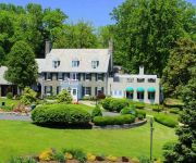
Bavarian Inn
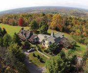
Antietam Overlook Farm
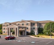
Clarion Hotel & Conference Center
Quality Inn Shepherdstown
Videos from this area
These are videos related to the place based on their proximity to this place.
Rodeo to benefit Clear Spring FFA alumni
http://www.herald-mail.com/?cmd=displaystory&story_id=197560&format=html Click or copy and paste the link to view the story that ran June 30, 2008. A rodeo was held Sunday at the Washington...
July 4th Celebration at Antietam NB Maryland (Part 1 of 4)
July 4th celebration at Antietam National Battlefield Maryland. 110th Field Artillery Battery Maryland Army National Guard firing an opening salvo to start the event.
Antietam, America's Bloodiest Day
A photo essay of the battle near Sharpsburg on the banks of the Antietam Creek. daviddarcy@topproducer.com.
Antietam Bloody Lane
A second video from the Sunken Road (Bloody Lane) on the Antietam National Battlefield, near Sharpsburg, Maryland. This is a tour of the Bloody Lane area starting with the view from the...
Tours-TV.com: Antietam National Battlefield Memorial
Memorial in commemoration of 3600 soldiers, fallen in one of the most bloody battles of Civil War, which occured at the town of Sharpsburg on the Antietam Creek in september of 1867. United...
The Opening Shots - Antietam 150th
Antietam National Battlfefield Volunteers fire the first artillery shots during the early morning "Cornfield walk" on the 150th Anniversary of the Battle of Antietam. 09/17/12.
July 4th Celebration at Antietam NB Maryland (Part 4 of 4)
July 4th celebration with fireworks at Antietam National Battlefield Maryland.
NS 37Q at St. James, MD 11/8/09
In my first video from the state of Maryland, a fast-moving 37Q passes the MD Route 68 grade crossing just south of Hagerstown. NS Hagerstown District MP H5.7 NS 9280 (D9-40CW) NS 9176...
CSX Train & Dump Truck Near Miss???
dump truck took a chance at point of rocks. plus graffiti'd chessie hoppers!
Videos provided by Youtube are under the copyright of their owners.
Attractions and noteworthy things
Distances are based on the centre of the city/town and sightseeing location. This list contains brief abstracts about monuments, holiday activities, national parcs, museums, organisations and more from the area as well as interesting facts about the region itself. Where available, you'll find the corresponding homepage. Otherwise the related wikipedia article.
Battle of Antietam
The Battle of Antietam also known as the Battle of Sharpsburg, particularly in the South, fought on Wednesday, September 17, 1862, near Sharpsburg, Maryland, and Antietam Creek, as part of the Maryland Campaign, was the first major battle in the American Civil War to take place on Union soil. It was the bloodiest single-day battle in American history, with 22,717 dead, wounded and missing on both sides combined. After pursuing Confederate General Robert E. Lee into Maryland, Union Army Maj.
Van Lear, Maryland
Van Lear is an unincorporated community in Washington County, Maryland. The community is part of the Hagerstown-Martinsburg, MD-WV MSA (Metropolitan Statistical Area). Van Lear is located between Halfway, Maryland and Williamsport, Maryland.
Fairplay, Maryland
Fairplay is an unincorporated community not considered as a census-designated place (CDP) in Washington County, Maryland, United States. It is sometimes recognized along with neighboring Tilghmanton as Fairplay-Tilghmanton; the two communities share a post office as well as a fire company. Fairplay is between Hagerstown, Maryland and Sharpsburg, Maryland along Maryland Route 65 and is part of the Hagerstown Metropolitan Area.
Downsville, Maryland
Downsville is an unincorporated community not considered as a census-designated place (CDP) in southwestern Washington County, Maryland, United States. It is southeast of Williamsport, Maryland on Maryland Route 63 and on Maryland Route 632 southwest of Hagerstown, Maryland. It is officially included in the Hagerstown Metropolitan Area (Hagerstown-Martinsburg, MD-WV Metropolitan Statistical Area).
Mercersville, Maryland
Mercersville is an unincorporated community in Washington County, Maryland. It lies at an elevation of 341 feet (104 m).
Spielman, Maryland
Spielman is an unincorporated community in Washington County, Maryland, United States.


