Safety Score: 3,0 of 5.0 based on data from 9 authorites. Meaning we advice caution when travelling to United Kingdom.
Travel warnings are updated daily. Source: Travel Warning United Kingdom. Last Update: 2024-05-05 08:24:42
Discover Legbourne
Legbourne in Lincolnshire (England) with it's 644 citizens is a town in United Kingdom about 127 mi (or 204 km) north of London, the country's capital city.
Current time in Legbourne is now 05:30 PM (Sunday). The local timezone is named Europe / London with an UTC offset of one hour. We know of 10 airports near Legbourne, of which 3 are larger airports. The closest airport in United Kingdom is RAF Coningsby in a distance of 19 mi (or 31 km), South-West. Besides the airports, there are other travel options available (check left side).
There are several Unesco world heritage sites nearby. The closest heritage site in United Kingdom is Derwent Valley Mills in a distance of 32 mi (or 51 km), South-West. Also, if you like playing golf, there is an option about 26 mi (or 42 km). away. Looking for a place to stay? we compiled a list of available hotels close to the map centre further down the page.
When in this area, you might want to pay a visit to some of the following locations: Wold Newton, Thimbleby, Waltham, Grimsby and Grimbsy. To further explore this place, just scroll down and browse the available info.
Local weather forecast
Todays Local Weather Conditions & Forecast: 17°C / 62 °F
| Morning Temperature | 7°C / 45 °F |
| Evening Temperature | 16°C / 60 °F |
| Night Temperature | 9°C / 49 °F |
| Chance of rainfall | 1% |
| Air Humidity | 67% |
| Air Pressure | 1008 hPa |
| Wind Speed | Gentle Breeze with 7 km/h (4 mph) from North |
| Cloud Conditions | Overcast clouds, covering 100% of sky |
| General Conditions | Light rain |
Monday, 6th of May 2024
15°C (59 °F)
9°C (48 °F)
Light rain, gentle breeze, overcast clouds.
Tuesday, 7th of May 2024
16°C (61 °F)
8°C (47 °F)
Light rain, gentle breeze, few clouds.
Wednesday, 8th of May 2024
14°C (57 °F)
9°C (49 °F)
Broken clouds, gentle breeze.
Hotels and Places to Stay
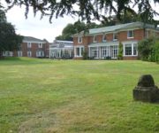
BW PLUS KENWICK PARK HTL
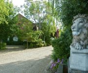
The Brackenborough
Videos from this area
These are videos related to the place based on their proximity to this place.
FREEDOM OF LOUTH FOR RAF MANBY 1965
582 FREEDOM OF LOUTH FOR RAF MANBY Louth, Lincolnshire, UK. 1965 Parade and civic ceremony at which officers from the College of Aerial Warfare, Manby, receive a silver framed plaque from.
Scaffold Disaster on Eastgate, Louth
Another day in the life of Louth, Lincolnshire. The whole town centre will be cut off for two hours, but good for me because the 60 seconds I'd planned couldn't happen because of the weather.
Louth Navigation Trust - Willow's Lock Survey May 2010
Survey of Willows Lock undertaken by Louth Navigation Trust on 15th May 2010. Video is just a quick impression to show some of the work the Trust undertakes. The reason for depth measurement...
Louth Poppies
For all you office bound, city bound souls heres a breath of the open country...see you soon.
Louth, Lincs. Travelling Mercer Row westwards (2)
Many people in Louth believe that Mercer Row is a one-way street. It ain't Watch . . .
Slate and Travertine Floor Restoration in Louth
Http://www.kleenz-hardfloorcleaners.co.uk Stripping, cleaning and sealing slate an travertine floors in Louth.
Messing about with the Tamiya in louth, lincolnshire.
Me giving my Tamiya Mad Spirit (Nitro RC Buggy) some stick.
Videos provided by Youtube are under the copyright of their owners.
Attractions and noteworthy things
Distances are based on the centre of the city/town and sightseeing location. This list contains brief abstracts about monuments, holiday activities, national parcs, museums, organisations and more from the area as well as interesting facts about the region itself. Where available, you'll find the corresponding homepage. Otherwise the related wikipedia article.
Louth Rural District
Louth was a rural district in Lincolnshire, Parts of Lindsey from 1894 to 1974. It was created in 1894 from Louth rural sanitary district. It did not include Louth, which was a separate municipal borough entirely surrounded by the rural district. Its boundaries changed little, losing Trusthorpe to the Mablethorpe and Sutton urban district in 1925 and ceding suburbs to Louth. It was abolished by the Local Government Act 1972 in 1974 and made part of the new East Lindsey district.
Carlton Castle
Carlton Castle was in the county of Lincolnshire, some 7 miles south-east of Louth, between the villages of North and South Reston. It was founded in the 12th century by Hugh Bardolf. Only the motte and some ditching remain and even they are now overgrown.
Legbourne Road railway station
Legbourne Road was a railway station on the East Lincolnshire Railway{{#invoke:Footnotes|sfn}} which served the village of Legbourne in Lincolnshire between 1848 and 1964. The station was closed to passengers in 1953, and withdrawal of goods facilities took place in 1964. The line through the station is closed. The station once housed a museum containing railway memorabilia; this closed in 1998 and the building is once again a private residence.
Grimoldby railway station
Grimoldy railway station was a station in Grimoldby, Lincolnshire; opened in 1877 br the Louth and East Coast Railway; and closed in 1960. Preceding station Disused railways Following station Saltfleetby Great Northern Railway Louth
Burwell Priory
Burwell Priory was a priory in the village of Burwell, Lincolnshire, England. The priory was built around 1110 for Benedictine monks, by Ansgot of Burwell, who addressed his charter to Robert, Bishop of Lincoln 1094-1123. The priory motherhouse was Grande-Sauve Abbey, in Aquitaine, France, which at the time was ruled by the Kings of England.
Legbourne Priory
Legbourne Priory was a priory in the village of Legbourne, Lincolnshire, England. Founded by Robert Fitz Gilbert around 1150, the priory was for the nuns of Keddington (sometimes Hallington). The earliest visitation that survives is from 1440 when Bishop Alnwick reported a few irregularities which needed correction, but found most fault with the Prioress. She had been too fond of entertaining her own relations, and partly supported them with revenue from the priory.
St Michael's Church, Burwell
St Michael's Church, Burwell, is a redundant Anglican church in the village of Burwell, Lincolnshire, England. It has been designated by English Heritage as a Grade I listed building, and is under the care of the Churches Conservation Trust. It stands on a hillside by the A16 road as it passes through the village.
St Helen's Church, Little Cawthorpe
St Helen's Church, Little Cawthorpe, is a redundant Anglican church in the village of Little Cawthorpe, Lincolnshire, England. It has been designated by English Heritage as a Grade II listed building, and is under the care of the Churches Conservation Trust. Little Cawthorpe is about 1 mile southwest of the village of Legbourne, and 3 miles southeast of Louth.


