Safety Score: 3,0 of 5.0 based on data from 9 authorites. Meaning we advice caution when travelling to United Kingdom.
Travel warnings are updated daily. Source: Travel Warning United Kingdom. Last Update: 2024-05-10 08:04:54
Delve into Holton
Holton in Lincolnshire (England) is a city located in United Kingdom about 124 mi (or 200 km) north of London, the country's capital town.
Current time in Holton is now 06:08 AM (Saturday). The local timezone is named Europe / London with an UTC offset of one hour. We know of 11 airports closer to Holton, of which 4 are larger airports. The closest airport in United Kingdom is RAF Scampton in a distance of 9 mi (or 14 km), West. Besides the airports, there are other travel options available (check left side).
There are several Unesco world heritage sites nearby. The closest heritage site in United Kingdom is Derwent Valley Mills in a distance of 20 mi (or 32 km), South. Also, if you like playing golf, there are some options within driving distance. In need of a room? We compiled a list of available hotels close to the map centre further down the page.
Since you are here already, you might want to pay a visit to some of the following locations: Thimbleby, Lincoln, Wold Newton, Redbourne and Hibaldstow. To further explore this place, just scroll down and browse the available info.
Local weather forecast
Todays Local Weather Conditions & Forecast: 18°C / 64 °F
| Morning Temperature | 10°C / 50 °F |
| Evening Temperature | 17°C / 63 °F |
| Night Temperature | 10°C / 50 °F |
| Chance of rainfall | 0% |
| Air Humidity | 73% |
| Air Pressure | 1022 hPa |
| Wind Speed | Gentle Breeze with 8 km/h (5 mph) from West |
| Cloud Conditions | Overcast clouds, covering 100% of sky |
| General Conditions | Overcast clouds |
Sunday, 12th of May 2024
20°C (68 °F)
13°C (56 °F)
Light rain, moderate breeze, overcast clouds.
Monday, 13th of May 2024
18°C (64 °F)
12°C (54 °F)
Light rain, moderate breeze, broken clouds.
Tuesday, 14th of May 2024
16°C (60 °F)
11°C (52 °F)
Light rain, moderate breeze, overcast clouds.
Hotels and Places to Stay
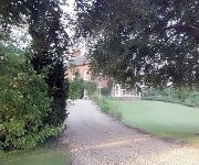
Buslingthorpe Manor B&B
Videos from this area
These are videos related to the place based on their proximity to this place.
Trout on the fly at Toft Newton
My mate John taking 1 of a bag of 30+ fish at Toft Newton, Nice work :)
The Works - Your independent local business directory
Do you want more enquiries, more work and more sales? Look no further. The Works is a powerful yet cheap advertising opportunity in Lincolnshire. The Works is a local directory linking local...
Souled out
Souled Out- is a Christian Discipleship Group run by the Vine Community Church serving Cherry Willingham, Fiskerton and Reepham. The group is aimed at 11 -14 year olds. Souled Out contains...
AWESOME Night Routine!
its better in HD ALWAYS REMEMBER TO SUBSCRIBE THIS VIDEO IF YOU WANT MORE FUN & ACTION.
Wragby Firefighter Recruitment
On-call firefighter vacancies in Wragby. On-call firefighters undertake the same work as their wholte colleagues so if you live or work within 5 minutes of the station, come join the team.
Wildcat Aerobatics display at Market Rasen Racecourse
Market Rasen Racecourse was the venue for an RAF Benevolent Fund day where Wildcat Aerobatics was invited to perform an aerobatic display for the crowd. This video contains footage of the...
Videos provided by Youtube are under the copyright of their owners.
Attractions and noteworthy things
Distances are based on the centre of the city/town and sightseeing location. This list contains brief abstracts about monuments, holiday activities, national parcs, museums, organisations and more from the area as well as interesting facts about the region itself. Where available, you'll find the corresponding homepage. Otherwise the related wikipedia article.
A157 road
The A157 is an A-road in Lincolnshire, England. It runs between Wragby and Maltby le Marsh and is single carriageway for its entire length (approximately 26 miles).
Kingthorpe railway station
Kingthorpe railway station was a station in Kingthorpe, Lincolnshire which closed to passengers in 1951. The station was on the Louth to Bardney Branch Line and opened on 9 November 1874. Former Services Preceding station Disused railways Following station Bardney Great Northern Railway Wragby
Wragby railway station
Wragby railway station was a station in Wragby, Lincolnshire. The station opened in 1874 and finally closed in 1960, although the passenger service from Bardney to Louth was withdrawn in 1951. The station building remains standing adjacent to the A158 road on the outskirts of the village, and has been converted into a private residence. Former Services Preceding station Disused railways Following station Kingsthorpe Great Northern Railway East Barkwith
Wickenby railway station
Wickenby railway station was a station in Wickenby, Lincolnshire on the line between Lincoln and Grimsby, opened in 1848 and closed in 1965. Preceding station Disused railways Following station Snelland Great Central Railway Market Rasen
Bullington Priory
Bullington Priory was a priory in Bullington, Lincolnshire, England. The priory was a house of the Gilbertine Order and dedicated to Saint Mary. It was founded as a double house between 1148 and 1154 by Simon, son of William de Kyme, who gave part of his park for the site, along with wood and land, the churches of Bullington and Langton, and Hackthorn Mill.
St George's Church, Goltho
St George's Church, Goltho, is a redundant Anglican church in the former village of Goltho, Lincolnshire, England. It is designated by English Heritage as a Grade II* listed building, and is under the care of the Churches Conservation Trust. The church is situated in a field surrounded by a clump of trees, and can be approached only by footpaths. It stands to the south of the A158 road, 2 miles southwest of Wragby, and 11 miles northeast of Lincoln.


