Safety Score: 3,0 of 5.0 based on data from 9 authorites. Meaning we advice caution when travelling to United Kingdom.
Travel warnings are updated daily. Source: Travel Warning United Kingdom. Last Update: 2024-04-27 08:23:39
Explore Upper Sapey
Upper Sapey in Herefordshire (England) is located in United Kingdom about 113 mi (or 181 km) north-west of London, the country's capital.
Local time in Upper Sapey is now 03:32 PM (Saturday). The local timezone is named Europe / London with an UTC offset of one hour. We know of 9 airports in the wider vicinity of Upper Sapey, of which 5 are larger airports. The closest airport in United Kingdom is Gloucestershire Airport in a distance of 29 mi (or 46 km), South-East. Besides the airports, there are other travel options available (check left side).
There are several Unesco world heritage sites nearby. The closest heritage site in United Kingdom is Blaenavon Industrial Landscape in a distance of 39 mi (or 63 km), South-West. Also, if you like golfing, there are multiple options in driving distance. If you need a place to sleep, we compiled a list of available hotels close to the map centre further down the page.
Depending on your travel schedule, you might want to pay a visit to some of the following locations: Collington, Thornbury, Wacton, Evesbatch and Cotheridge. To further explore this place, just scroll down and browse the available info.
Local weather forecast
Todays Local Weather Conditions & Forecast: 7°C / 45 °F
| Morning Temperature | 3°C / 38 °F |
| Evening Temperature | 7°C / 45 °F |
| Night Temperature | 6°C / 43 °F |
| Chance of rainfall | 0% |
| Air Humidity | 78% |
| Air Pressure | 1005 hPa |
| Wind Speed | Moderate breeze with 11 km/h (7 mph) from South-West |
| Cloud Conditions | Overcast clouds, covering 100% of sky |
| General Conditions | Light rain |
Sunday, 28th of April 2024
6°C (42 °F)
5°C (41 °F)
Moderate rain, moderate breeze, overcast clouds.
Monday, 29th of April 2024
12°C (54 °F)
6°C (43 °F)
Light rain, moderate breeze, broken clouds.
Tuesday, 30th of April 2024
14°C (58 °F)
9°C (48 °F)
Light rain, fresh breeze, overcast clouds.
Hotels and Places to Stay
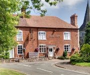
The Lion Inn
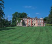
The Elms Hotel
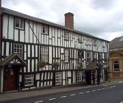
The Falcon Hotel
Videos from this area
These are videos related to the place based on their proximity to this place.
Driving Along High Street, Cruxwell Street, Rowberry Street & Sherford Street, Bromyard, England
Driving along High Street (B4203), Cruxwell Street (B4203), Rowberry Street (B4203) & Sherford Street (B4203), Bromyard, Herefordshire, England Videoed on Friday, 23rd March 2012 Playlist:...
Bromyard floods 20th July 2007
Bromyard, Herefordshire floods on 20th July 2007 - the worst for over 75 years!
MOTOR BIKE STUNT RIDERS SHOW BROMYARD GALA 2011
MOTOR BIKE STUNT SHOW AT BROMYARD GALA 201 GOOD RIDING SKILLS ON TRAIL BIKES.
fire in bromyard
fire in bromyard herefordshire, the garages at the top of york road / firs orchard.
HEAVY HORSE PARADE Inc SUFFOLK PUNCH BROMYARD GALA 2011
HEAVY HORSE PARADE Inc SOME SUFFOLK PUNCH HORSES SEEN AT THE BROMYARD GALA 2011.
fire in bromyard
fire in bromyard herefordshire, the garages at the top of york road / firs orchard.
A musical journey through England and Scotland
Impressions from a very special journey through England and Scotland a few years back.
SASHA FUSSING HEREFORD CATTLE AT THE BROMYARD GALA 2011
A GOOD DAY OUT AT THE BROMYARD GALA 2011 & SASHA FELL IN LOVE WITH THE HEREFORD CATTLE.
Tad Newton's Jazz Friends - 'Lester Leaps In'
The Jazz Friends perform the number written by Lester Young which he originally recorded with the Count Basie Orchestra. Recorded at the Bromyard Jazz Festival on 20th August 2011. The Jazz...
Videos provided by Youtube are under the copyright of their owners.
Attractions and noteworthy things
Distances are based on the centre of the city/town and sightseeing location. This list contains brief abstracts about monuments, holiday activities, national parcs, museums, organisations and more from the area as well as interesting facts about the region itself. Where available, you'll find the corresponding homepage. Otherwise the related wikipedia article.
Wolferlow
Wolferlow is a village in northern Herefordshire, England, 7 km north of Bromyard.
Sapey Common
Sapey Common is a small village in Herefordshire, England, near the border with Worcestershire, 10 km north east of Bromyard . Although the area is in Herefordshire, the post town is Worcester and the postcode WR6. Recently introduced to the area were the newly-built 'Manors of Shelsley' which, although claimed to be in the heart of the Teme Valley, are in fact in Sapey Common - which overlooks the heart of the Teme Valley.
Tedstone Delamere
Tedstone Delamere is a village in Herefordshire, England, 5.5 km north east of Bromyard. St James' Church chancel was added by Sir George Gilbert Scott in 1856-57. At Tedstone Delamere the Sapey Brook runs its course from Upper Sapey, joining the river Teme just beyond Whitbourne. A story is told locally of a mare and a colt that had been stolen and the hoofprints when followed stopped at the bank of the Sapey brook.
Upper Sapey
Upper Sapey is a small village and civil parish in Herefordshire, England, located 4 miles northeast of Bromyard.
Old St Bartholomew's Church, Lower Sapey
Old St Bartholomew's Church, Lower Sapey, is a redundant Anglican church near the village of Lower Sapey, Worcestershire, England. It has been designated by English Heritage as a Grade II* listed building, and is under the care of the Churches Conservation Trust. The church is also a Scheduled Ancient Monument. It stands on a steep bank above a stream at the end of a winding lane.


