Safety Score: 3,0 of 5.0 based on data from 9 authorites. Meaning we advice caution when travelling to United Kingdom.
Travel warnings are updated daily. Source: Travel Warning United Kingdom. Last Update: 2024-04-27 08:23:39
Discover Treen
Treen in Cornwall (England) is a city in United Kingdom about 256 mi (or 411 km) west of London, the country's capital city.
Local time in Treen is now 04:55 PM (Saturday). The local timezone is named Europe / London with an UTC offset of one hour. We know of 9 airports in the vicinity of Treen, of which two are larger airports. The closest airport in United Kingdom is Land's End Airport in a distance of 6 mi (or 10 km), South-West. Besides the airports, there are other travel options available (check left side).
There is one Unesco world heritage site nearby. It's Cornwall and West Devon Mining Landscape in a distance of 44 mi (or 70 km), East. Looking for a place to stay? we compiled a list of available hotels close to the map centre further down the page.
When in this area, you might want to pay a visit to some of the following locations: Penzance, St. Buryan, Sennen, Germoe and Wendron. To further explore this place, just scroll down and browse the available info.
Local weather forecast
Todays Local Weather Conditions & Forecast: 10°C / 51 °F
| Morning Temperature | 9°C / 47 °F |
| Evening Temperature | 9°C / 48 °F |
| Night Temperature | 9°C / 49 °F |
| Chance of rainfall | 3% |
| Air Humidity | 82% |
| Air Pressure | 1000 hPa |
| Wind Speed | Fresh Breeze with 13 km/h (8 mph) from South |
| Cloud Conditions | Broken clouds, covering 52% of sky |
| General Conditions | Light rain |
Sunday, 28th of April 2024
10°C (50 °F)
10°C (50 °F)
Light rain, fresh breeze, broken clouds.
Monday, 29th of April 2024
11°C (52 °F)
11°C (52 °F)
Moderate rain, high wind, near gale, overcast clouds.
Tuesday, 30th of April 2024
11°C (52 °F)
10°C (51 °F)
Light rain, strong breeze, overcast clouds.
Hotels and Places to Stay
Hotel Penzance
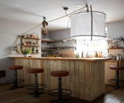
Artist Residence
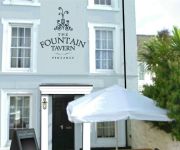
The Fountain Tavern
Penmorvah
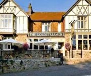
The Coldstreamer
The Dolphin Tavern
UNION HOTEL PENZANCE
Videos from this area
These are videos related to the place based on their proximity to this place.
Skateboarding at Penzance Skate Park, Cornwall
For http://www.intocornwall.com - Skateboarding at Penzance Bowl, Cornwall.
TOLVER ROAD PENZANCE TR18---1977 QUEENS SILVER JUBILEE STREET PARTY.mpg
The Tolver Road street party was held in the methodist chapel room at the end of Tolver rd.Were you there? If anyone wants the pictures loaded on to a USB drive just call at the house with...
Penzance 400 Boundary Stone rededication.
The rededication of the Wherrytown Penzance Borough boundary stone. A multi-faith service conducted by the Rev Julyan Drew and leaders of the faith communities in Penzance in the presence...
The Pendennis, Guest House, Bed & Breakfast, B&B, Penzance, Cornwall, UK
The Pendennis, Guest House, Bed & Breakfast, B&B, En / Suite Rooms, All with colour TV, Tea & Coffee Facilities - Phone: 01736 363823 - Accommodation, Penzance, Cornwall ...
Journey To Umbria.mpg
Journey to Umbria is a short video to introduce the team that are planning to re-enact the same trip that Paul Konody and his friends made in 1911, inspiring the book Through The Alps to the...
Guest Lodge Penzance
Guest Lodge Penzance provides comfortable accommodation at affordable prices. Located near the seafront in Penzance, Cornwall, we have 10 en-suite rooms with double beds plus a family room...
St Ives 01xii07 - The First Storm
1st Storm of the season surfing bodyboarding St Ives Cornwall and some photo's at the end.
Carn Euny Ancient Village Near Roselands Caravan Park, Cornwall
Carn Euny Ancient Village Near Roselands Caravan Park, West Penwith, Cornwall.
Cornwall September 2010
Weekend in Cornwall. Overnight sleeper train from London Paddington to Penzance. Return on a day train. The planned day trip to the Isles of Scilly was cancelled due to technical problems with...
Videos provided by Youtube are under the copyright of their owners.
Attractions and noteworthy things
Distances are based on the centre of the city/town and sightseeing location. This list contains brief abstracts about monuments, holiday activities, national parcs, museums, organisations and more from the area as well as interesting facts about the region itself. Where available, you'll find the corresponding homepage. Otherwise the related wikipedia article.
Mên-an-Tol
The Mên-an-Tol (also Men an Toll) is a small formation of standing stones near the Madron–Morvah road in Cornwall, United Kingdom. It is about three miles northwest of Madron. It is also known locally as the "Crick Stone". The name Mên-an-Tol in the Cornish Language literally means "the hole stone". It consists of three upright granite stones: a round stone with its middle holed out with two small standing stones to each side, in front of and behind the hole.
A. W. Andrews
Arthur Westlake Andrews (1868 – 1959) was a British geographer, poet, rock-climber, and mountaineer. He trained as a geographer (FRGS 1896) and became a teacher of geography and history in Southwark. In 1913 he published 'a text-book of geography', reprinted in 1922. As a climber, his first contribution appears to have been, in 1899, the route now called 'Andrews' renne' on Storen, Norway. He is especially remembered for two later climbing contributions :- for his co-authorship, with J. M. A.
Gurnard's Head
Gurnard's Head (Cornish: Ynyal, meaning desolate one) is a prominent headland on the north coast of the Penwith peninsula in Cornwall, England, United Kingdom. It is near the hamlet of Treen in the parish of Zennor, one mile to the west of Zennor Head. The name is supposed to reflect the fact that the rocky peninsula resembles the head of the gurnard fish. The headland is the site of an Iron Age promontory fort known as Trereen Dinas.
Pendour Cove
Pendour Cove is a beach in Cornwall, UK. It is about 1 mile northwest of the village of Zennor, and immediately to the west of Zennor Head. The name originates from the Cornish 'pen' (end, head) and 'dour' (water)
Treen Cove
Treen Cove is a tidal beach on the north coast of the Penwith peninsula, Cornwall, UK. It is about half a mile northwest of the hamlet of Treen, and nestles between Lean Point to the east and Gurnard's Head to the west.
Boskednan stone circle
Boskednan stone circle is a partially restored prehistoric stone circle near Boskednan, around 4 miles (6 kilometres) northeast of the town of Penzance in Cornwall, United Kingdom. The megalithic monument is traditionally known as the Nine Maidens or Nine Stones of Boskednan, although the original structure may have contained as many as 22 upright stones around its 69 metre perimeter.
Veor Cove
Veor Cove is a beach in Cornwall, UK. It is about 1 mile northwest of the village of Zennor, and immediately to the west of Pendour Cove. The name of this cove is from the Cornish 'veor' meaning large or great.
Zennor Head
Zennor Head /ˈzɛnʊər hɛd/ is a 750 metre (2,460 ft) long promontory on the Cornish coast of England, between Pendour Cove and Porthzennor Cove. Facing the Atlantic Ocean, it lies 1 kilometre north-west of the village of Zennor and 1.6 kilometres east of the next promontory, Gurnard's Head. The granite cliffs rise over 200 feet from the sea and the highest point of the headland is 314 feet above sea level, with an Ordnance Survey triangulation station.


