Safety Score: 4,2 of 5.0 based on data from 9 authorites. Meaning please reconsider your need to travel to Israel.
Travel warnings are updated daily. Source: Travel Warning Israel. Last Update: 2024-04-26 08:02:42
Touring Nes Harim
Nes Harim in Jerusalem is a town located in Israel a little west of Jerusalem, the country's capital place.
Time in Nes Harim is now 03:08 PM (Friday). The local timezone is named Asia / Jerusalem with an UTC offset of 3 hours. We know of 11 airports nearby Nes Harim, of which 5 are larger airports. The closest airport in Israel is Ben Gurion International Airport in a distance of 21 mi (or 34 km), North-West. Besides the airports, there are other travel options available (check left side).
There are several Unesco world heritage sites nearby. The closest heritage site is Palestine: Land of Olives and Vines – Cultural Landscape of Southern Jerusalem, Battir in Palestinian territory at a distance of 5 mi (or 7 km). The closest in Israel is Caves of Maresha and Bet-Guvrin in the Judean Lowlands as a Microcosm of the Land of the Caves in a distance of 14 mi (or 7 km), East. We collected 9 points of interest near this location. Need some hints on where to stay? We compiled a list of available hotels close to the map centre further down the page.
Being here already, you might want to pay a visit to some of the following locations: Jerusalem, Ramla, Jericho, Karney Shomron and Tel Aviv. To further explore this place, just scroll down and browse the available info.
Local weather forecast
Todays Local Weather Conditions & Forecast: 24°C / 75 °F
| Morning Temperature | 16°C / 61 °F |
| Evening Temperature | 18°C / 64 °F |
| Night Temperature | 16°C / 62 °F |
| Chance of rainfall | 0% |
| Air Humidity | 50% |
| Air Pressure | 1010 hPa |
| Wind Speed | Moderate breeze with 12 km/h (8 mph) from East |
| Cloud Conditions | Overcast clouds, covering 100% of sky |
| General Conditions | Overcast clouds |
Saturday, 27th of April 2024
21°C (70 °F)
16°C (61 °F)
Overcast clouds, gentle breeze.
Sunday, 28th of April 2024
21°C (69 °F)
16°C (61 °F)
Light rain, moderate breeze, overcast clouds.
Monday, 29th of April 2024
24°C (75 °F)
19°C (67 °F)
Light rain, gentle breeze, overcast clouds.
Hotels and Places to Stay
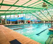
CRAMIM SPA HOTEL BY ISROTEL
Cramim Resort & Spa
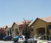
Shoresh Green Hills Family Suites Hotel
C-Hotel Neve Illan
YAD HASHMONA
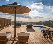
Tzuba Hotel
Gordonia Private Hotel - Adults Only
Ye'arim Hotel
Videos from this area
These are videos related to the place based on their proximity to this place.
Where To Eat Near Jerusalem for Your Family Barmitzvah
When he had his Batmitzvah family meal at our house, it was such a great success. Book now if you are near Jerusalem. http://www.justgoodfood.org.
Новое оружие Иудеи и Самарии
Съезд поселенческой молодежи "Иудея и Самария - это история каждого еврея"
GoPro Motorcycle Trip Israel Kawasaki ER-5 - טיול אופנועים כביש 395
We went on a ride on a great Saturday morning day through the mountains coming up to Jerusalem in the beautiful road 395. The Road is amazing and crossing the Saints Forest, it has amazing...
Mountain biking. Israel. Over mount Refaim, Israel. По хар Рэфаим (Иудейские горы), Израиль.
13.06.2008. Велопоходы по Израилю.--- Подробное описание этого маршрута и фотографии: http://is-israel.com/tracks/refaim/index.htm --- Descriptions and Photo...
נסיעת הרצה, קימקו דאונטאון 125, מרמת רזיאל לצומת בילו
נסיעת הרצה לקימקו דאונטאון מרמת רזיאל לצומת בילו דרך כביש 395 (קיר המוות), כביש 44, 3 ו411 דרך מזכרת בתיה לצומת...
Driving from Jerusalem to Eshtaol Junction
Driving from my place in Jerusalem down to Eshtaol junction near Beit Shemesh. Includes orientation annotations in Hebrew. Soundtrack: Raash - Hanan Mashina - At Ba'ah Levaker Mashina...
Videos provided by Youtube are under the copyright of their owners.
Attractions and noteworthy things
Distances are based on the centre of the city/town and sightseeing location. This list contains brief abstracts about monuments, holiday activities, national parcs, museums, organisations and more from the area as well as interesting facts about the region itself. Where available, you'll find the corresponding homepage. Otherwise the related wikipedia article.
Nahal Sorek
Nahal Sorek, also Soreq, is one of the largest, most important drainage basins in the Judean Hills. It is mentioned in the Book of Judges 16:4 of the Bible as the border between the ancient Philistines and the Tribe of Dan of the ancient Israelites. It is known in Arabic as Wadi Surar.
Domaine du Castel
Domaine du Castel is a family owned winery in the Jerusalem corridor, Israel. It produces approximately 100,000 bottles of wine a year, half of which are exported.
Jaffa–Jerusalem railway
"Tel Aviv–Jerusalem railway" redirects here. For the new line under construction, see High-speed railway to Jerusalem. The Jaffa–Jerusalem railway (also J & J) is a railroad that connected Jaffa and Jerusalem. The line was built in Ottoman Palestine by the French company Société du Chemin de Fer Ottoman de Jaffa à Jérusalem et Prolongements and inaugurated in 1892, after previous attempts by the Jewish philanthropist Moses Montifiore failed.
Dayr al-Shaykh
Dayr al-Shaykh was a Palestinian Arab village in the District of Jerusalem, also known as the Jerusalem corridor. It was depopulated during the 1948 Arab-Israeli War. The village was located 16 kilometers west of Jerusalem, overlooking the Wadi al-Sarar stream to the northeast.
Sufla
Sufla was a Palestinian Arab village in the District of Jerusalem. It was depopulated during the 1948 Arab-Israeli War on October 19, 1948 by the Sixth Battalion of the Har'el Brigade under Operation ha-Har. It was located 18.5 km west of Jerusalem. In 1945, the village had a population of 60. A shrine was located in the village dedicated to a local sage called al-Shaykh Mu'annis.
Ras Abu 'Ammar
Ras Abu 'Ammar was a Palestinian Arab village in the District of Jerusalem. It was depopulated during the 1948 Arab-Israeli War on October 21, 1948 by the Har'el Brigade of Operation ha-Har. It was located 14 km west of Jerusalem, surrounded on three sides by the Wadi al-Sarar.
Al-Tannur, Khirbat
Al-Tannur, Khirbat was a Palestinian Arab village in the District of Jerusalem. It was depopulated during the 1948 Arab-Israeli War on October 21, 1948 under Operation Ha'ar. It was located 18.5 km west of Jerusalem.
Scroll of Fire
Scroll of Fire is a monument found in the Jerusalem hills, and it commemorates Jewish history from The Holocaust until Independence. The monument was inaugurated in 1971. The initiative for the monument came from B'nai B'rith of the United States, and was funded by them. The site was chosen by Yosef Weitz, the director of the Land and Afforestation Department of the Jewish National Fund. The monument was sculptured by the artist Nathan Rapoport, who is a Holocaust survivor.


