Safety Score: 3,0 of 5.0 based on data from 9 authorites. Meaning we advice caution when travelling to Germany.
Travel warnings are updated daily. Source: Travel Warning Germany. Last Update: 2024-05-15 08:00:47
Delve into Nord-Dedeleben
The district Nord-Dedeleben of Dedeleben in Saxony-Anhalt is a district located in Germany about 112 mi west of Berlin, the country's capital town.
In need of a room? We compiled a list of available hotels close to the map centre further down the page.
Since you are here already, you might want to pay a visit to some of the following locations: Jerxheim, Beierstedt, Sollingen, Ingeleben and Gevensleben. To further explore this place, just scroll down and browse the available info.
Local weather forecast
Todays Local Weather Conditions & Forecast: 18°C / 64 °F
| Morning Temperature | 12°C / 54 °F |
| Evening Temperature | 12°C / 54 °F |
| Night Temperature | 12°C / 54 °F |
| Chance of rainfall | 2% |
| Air Humidity | 68% |
| Air Pressure | 1008 hPa |
| Wind Speed | Fresh Breeze with 14 km/h (9 mph) from North-West |
| Cloud Conditions | Broken clouds, covering 52% of sky |
| General Conditions | Moderate rain |
Friday, 17th of May 2024
16°C (61 °F)
11°C (52 °F)
Light rain, moderate breeze, overcast clouds.
Saturday, 18th of May 2024
16°C (60 °F)
11°C (52 °F)
Light rain, gentle breeze, overcast clouds.
Sunday, 19th of May 2024
17°C (63 °F)
12°C (54 °F)
Light rain, gentle breeze, overcast clouds.
Hotels and Places to Stay
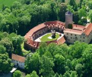
Wasserschloss Hotel & Spa
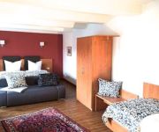
Gästehaus Rohrsheim Casa Culina -Demmel & Cie -
Videos from this area
These are videos related to the place based on their proximity to this place.
Schöninger Landmarkt 2012
Auf dem Schöninger Landmarkt stellten auch 2012 mehr als 60 Händler aus der Region ihre Waren aus. Zu den diesjährigen Highlights gehörte auch eine Vorführung des Geflügelzüchtervereins...
Eisparty des JFZ - 11.02.2012 - Schöningen unkommentiert
Bitte mindestens in 720p (HD) anschauen. Produziert für Mein-Schoeningen.de. Einbettung auf anderen Websiten erlaubt. Als neue Medien-Rubrik für Mein-Schoeningen.de präsentieren wir ihnen...
Die Wallgärtner August - September 2012 - Schöningen unkommentiert
Bitte mindestens in 720p (HD) anschauen. Produziert für Mein-Schoeningen.de. Einbettung auf anderen Websiten erlaubt. Mein-Schoeningen.de präsentiert ihnen die Video-Reihe „Schöningen...
Schloßfest der SPD - 07.07.2012 - Schöningen unkommentiert
Bitte mindestens in 720p (HD) anschauen. Produziert für Mein-Schoeningen.de. Einbettung auf anderen Websiten erlaubt. Als neue Medien-Rubrik für Mein-Schoeningen.de präsentieren wir ihnen...
Schöninger Osterfeuer - 30.03.2013 - Schöningen unkommentiert
Bitte mindestens in 720p (HD) anschauen. Produziert für Mein-Schoeningen.de. Einbettung auf anderen Websiten erlaubt. Mein-Schoeningen.de präsentiert ihnen die Video-Reihe „Schöningen...
Landmarkt der CWG - 29.04.2012 - Schöningen unkommentiert
Bitte mindestens in 720p (HD) anschauen. Produziert für Mein-Schoeningen.de. Einbettung auf anderen Websiten erlaubt. Als neue Medien-Rubrik für Mein-Schoeningen.de präsentieren wir ihnen...
Paläon: Buchvorstellung Fenster in die Archäologie - 31.05.2013 - Schöningen unkommentiert
Am 31.05.2013 fand im Paläon die erste öffentliche Veranstaltung, die Buchvorstellung "Fenster in die Archäologie", statt.. Bitte mindestens in 720p (HD) anschauen. Produziert für Mein-Schoeni...
Videos provided by Youtube are under the copyright of their owners.
Attractions and noteworthy things
Distances are based on the centre of the city/town and sightseeing location. This list contains brief abstracts about monuments, holiday activities, national parcs, museums, organisations and more from the area as well as interesting facts about the region itself. Where available, you'll find the corresponding homepage. Otherwise the related wikipedia article.
Schunter
The Schunter is a river in Lower Saxony, Germany, with a length of 58 km, right tributary of the Oker. It originates in the Elm hills near Räbke west of Helmstedt, flows northward to Süpplingenburg, then turns westward and joins the Oker at Schwülper, downstream of Braunschweig (Brunswick). Another municipality on the Schunter is Lehre. The river was first mentioned as Schuntra in a 781 deed. The name may be of Slavic origin as sukątora means "with many angles".
Elm (hills)
The Elm is a range of hills north of the Harz mountains in the Helmstedt and Wolfenbüttel districts of Lower Saxony, Germany. It has a length of about 25 km (15.5 mi) and a width of 3–8 km (2–5 mi) and rises to an elevation of 323 meters. Surrounded by the Northern European Lowlands, the Elm is almost uninhabited and the largest beech forest in Northern Germany. The hills are of a triassic limestone called Elmkalkstein.
Huysburg
Huysburg or Huysburg Priory (Priorat Huysburg), formerly Huysburg Abbey (Kloster Huysburg), is a Benedictine monastery situated on the Huy, a mountainous area near Halberstadt, in Saxony-Anhalt in Germany.
Heeseberg
Heeseberg is a Samtgemeinde ("collective municipality") in the district of Helmstedt, in Lower Saxony, Germany. It is situated approx. 20 km southwest of Helmstedt, and 35 km southeast of Braunschweig. Its seat is in the village Jerxheim. The Samtgemeinde Heeseberg consists of the following municipalities: Beierstedt Gevensleben Ingeleben Jerxheim Söllingen
Harzvorland-Huy
Harzvorland-Huy was a Verwaltungsgemeinschaft ("collective municipality") in the district of Harz, in Saxony-Anhalt, Germany. It was situated between Wernigerode and Halberstadt. The seat of the Verwaltungsgemeinschaft was in Ströbeck. It was disbanded on 1 January 2010. The Verwaltungsgemeinschaft Harzvorland-Huy consisted of the following municipalities: Aspenstedt Athenstedt Danstedt Langenstein Sargstedt
Osterwieck-Fallstein
Osterwieck-Fallstein was a Verwaltungsgemeinschaft ("collective municipality") in the district of Harz, in Saxony-Anhalt, Germany. It was situated north of the Harz, and north of Wernigerode. The seat of the Verwaltungsgemeinschaft was in Osterwieck. It was disbanded on 1 January 2010. The Verwaltungsgemeinschaft Osterwieck-Fallstein consisted of the following municipalities: Aue-Fallstein Berßel Bühne Lüttgenrode Osterwieck Rhoden Schauen
Nordharz (Verwaltungsgemeinschaft)
Nordharz was a Verwaltungsgemeinschaft ("collective municipality") in the district of Harz, in Saxony-Anhalt, Germany. It was situated north of the Harz mountain range and the town of Wernigerode. The seat of the Verwaltungsgemeinschaft was in Veckenstedt. It was disbanded on 1 January 2010.
Harz (district)
Harz is a district in Saxony-Anhalt, Germany.
Schöppenstedt (Samtgemeinde)
Schöppenstedt is a Samtgemeinde ("collective municipality") in the district of Wolfenbüttel, in Lower Saxony, Germany. Its seat is in the village Schöppenstedt. The Samtgemeinde Schöppenstedt consists of the following municipalities: Dahlum Kneitlingen Schöppenstedt Uehrde Vahlberg
Schöningen Spears
The Schöningen Spears are 8 wooden throwing spears from the Palaeolithic Age, that were found under the management of Dr. Hartmut Thieme from the Lower Saxony State Service for Cultural Heritage (NLD) between 1994 and 1998 in the open-cast lignite mine, Schöningen, county Helmstedt, Germany, together with approx. 16,000 animal bones.
Soltau (river)
Soltau is a river of Lower Saxony, Germany.
Daneil's Cave
Daneil's Cave, also called Robber's Cave (Räuberhöhle) is located on the northern side of the Huy ridge in the district of Harz in the German state of Saxony-Anhalt. It is named after the legend of a notorious robber, Daneil. It forms three caverns that a linked to one another inside a rock face of Middle Bunter Sandstone, each with their own entrance. It is protected as a nature reserve. The caverns apparently formed as a result of erosion during the Neogene Period or during the Ice Age, i.e.
Großer Fallstein
The Großer Fallstein is a wooded hill region in the German state of Saxony-Anhalt. It lies in the district of Harz on the territory of the town of Osterwieck, north of the Harz Mountains. Its highest point has an elevation of 288 metres above sea level (NN). The wood that lies not far from the former Inner German Border that ran along the Großes Bruch has an east-west extent of about 4 kilometres and also measures about 4 kilometres from north to south.


