Safety Score: 3,0 of 5.0 based on data from 9 authorites. Meaning we advice caution when travelling to Germany.
Travel warnings are updated daily. Source: Travel Warning Germany. Last Update: 2024-05-15 08:00:47
Delve into Bernser Landwehr
The district Bernser Landwehr of Rolfshagen in Lower Saxony with it's 103 habitants Bernser Landwehr is a district located in Germany about 181 mi west of Berlin, the country's capital town.
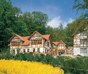
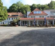
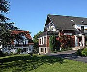
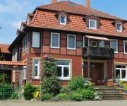
In need of a room? We compiled a list of available hotels close to the map centre further down the page.
Since you are here already, you might want to pay a visit to some of the following locations: Buchholz, Heessen, Bad Eilsen, Luhden and Ahnsen. To further explore this place, just scroll down and browse the available info.
Local weather forecast
Todays Local Weather Conditions & Forecast: 21°C / 69 °F
| Morning Temperature | 11°C / 52 °F |
| Evening Temperature | 20°C / 67 °F |
| Night Temperature | 17°C / 62 °F |
| Chance of rainfall | 0% |
| Air Humidity | 56% |
| Air Pressure | 1008 hPa |
| Wind Speed | Moderate breeze with 12 km/h (8 mph) from West |
| Cloud Conditions | Clear sky, covering 0% of sky |
| General Conditions | Sky is clear |
Thursday, 16th of May 2024
18°C (65 °F)
14°C (57 °F)
Light rain, fresh breeze, scattered clouds.
Friday, 17th of May 2024
12°C (53 °F)
11°C (52 °F)
Light rain, moderate breeze, overcast clouds.
Saturday, 18th of May 2024
17°C (63 °F)
11°C (52 °F)
Light rain, moderate breeze, overcast clouds.
Hotels and Places to Stay
Ringhotel Der Waldkater
Weserlounge Garni
Schaumburger Ritter
Lahmann Landhaus
Hof Klostermann Bett & Frühstück
Hotel Brückentor
Stadt Kassel
Schewe Gästehaus
Klein Eilsen Landgasthof
Steinberger Hof
Videos from this area
These are videos related to the place based on their proximity to this place.
Auf dem Dach der IGS Obernkirchen
Ein ausblick vom dach der IGS. Ich habe es genossen oben gewesen zu sein nur leider wurde mir der einziegste weg abgschlossen :) Bin aber wieder unten.......
Mountainbike-Tour Klippenturm 31737 Rinteln inkl. Downhill-Abfahrt 06.10.2014
Mountainbike-Tour rund um den Klippenturm ("Luhdener Klippe")bei 31737 Rinteln, Start v. Porta Westfalica Kleinenbremen (siehe Karte), inkl. Downhill-Abfahrt v. Klippenturm. Gefilmt wurde mit...
Bad Eilsen 2014 Maibaum aufstellen
Der Schützenverein bewirtet die Gäste mit Kaffee, Kuchen, leckere Bratwurst und Nackensteak von der Sau. Dazu gibt es Getränke vom Fass. Wer kann und möchte, kann ausprobieren, ob er auch...
Osterfeuer Bad Eilsen am 07.04.2012 mit Alarmeinsatz der Wehren.
Das Osterfeuer in Bad Eilsen am 07.04.2012 war besonders aufregend. Kurz nachdem das Feuer von der Eilser Kinderfeuerwehr erfolgreich angezündet wurde, wurde die Wehr zu einem Einsatz ...
Spaziergang durch den historischen Kurpark in Bad Eilsen
Bad Eilsen ist das älteste Schwefel-Schlammbad Deutschlands. Gegründet um 1800 wurde das fürstliche Kurbad zum mondänen Treffpunkt für Europas Prominenz. Bis in 20. Jahrhundert traf sich...
BAB A 2 Abfahrt Bad Eilsen
heute ging es mit dem Verkehr, sonst ist hier schon mal die Hölle los ... oder nichts geht mehr!
Strohvorräte verbrennen am Harrl in Bad Eilsen
Am Samstag, den 28.07.2012 verbrannten gegen 22.00 Uhr die Strohvorräte beim Reitstall in Bad Eilsen. Über die Ursache sagt die Gerüchteküche des Kurortes noch nichts. Ein rauchendes Pferd...
Videos provided by Youtube are under the copyright of their owners.
Attractions and noteworthy things
Distances are based on the centre of the city/town and sightseeing location. This list contains brief abstracts about monuments, holiday activities, national parcs, museums, organisations and more from the area as well as interesting facts about the region itself. Where available, you'll find the corresponding homepage. Otherwise the related wikipedia article.
Schaumburg
Landkreis Schaumburg — District — File:Lower Saxony SHG. svg Country 22x20px Germany State Lower Saxony Capital Stadthagen Area • Total 676 km Population (31 December 2011) • Total 159,733 • Density Bad rounding here{{#invoke:Math|precision_format| 236.29142011834 | 1-2 }}/km Time zone CET • Summer CEST Vehicle registration SHG Website landkreis-schaumburg.
Angria
For the sunken atoll in India, see Angria Bank. Angria is also the name of a paracosm (fictional world) created and written about by English novelist Charlotte Brontë and her brother Branwell during their childhood. Angria or Angaria is a historical region in the present-day German states of Lower Saxony and North Rhine-Westphalia.
Fischbeck Abbey
Fischbeck Abbey is a convent for canonesses in Fischbeck near Hessisch Oldendorf, Lower Saxony, Germany. It was founded in 955 by the noblewoman Helmburgis, a relation of the powerful family of the Ecbertiner, on land that had been given to her for the purpose by King Otto I, and is still a house of canonesses today, although now Lutheran women's convent rather than a Roman Catholic monastery.
Heyden Power Station
Heyden power station is located near Petershagen in Germany. The current station was commissioned in 1987, but the site has been used for power generation since 1950. It is owned and operated by the German energy corporation E. ON. It is a coal-fired station with the largest unit capacity of any European power station: 865 MW.
Eilsen (Samtgemeinde)
Eilsen is a Samtgemeinde ("collective municipality") in the district of Schaumburg, in Lower Saxony, Germany. Its seat is in the village Bad Eilsen. The Samtgemeinde Eilsen consists of the following municipalities: Ahnsen Bad Eilsen Buchholz Heeßen
Lindhorst (Samtgemeinde)
Lindhorst is a Samtgemeinde ("collective municipality") in the district of Schaumburg, in Lower Saxony, Germany. Its seat is in the village Lindhorst. The Samtgemeinde Lindhorst consists of the following municipalities: Beckedorf Heuerßen Lindhorst
Niedernwöhren (Samtgemeinde)
Niedernwöhren is a Samtgemeinde ("collective municipality") in the district of Schaumburg, in Lower Saxony, Germany. Its seat is in the village Niedernwöhren. The Samtgemeinde Niedernwöhren consists of the following municipalities: Lauenhagen Meerbeck Niedernwöhren Nordsehl Pollhagen
Nienstädt (Samtgemeinde)
Nienstädt is a Samtgemeinde ("collective municipality") in the district of Schaumburg, in Lower Saxony, Germany. Its seat is in the village Helpsen. The Samtgemeinde Nienstädt consists of the following municipalities: Helpsen Hespe Nienstädt
Sachsenhagen (Samtgemeinde)
Sachsenhagen is a Samtgemeinde ("collective municipality") in the district of Schaumburg, in Lower Saxony, Germany. Its seat is in the town Sachsenhagen. The Samtgemeinde Sachsenhagen consists of the following municipalities: Auhagen Hagenburg Sachsenhagen
School of Army Aviation (Germany)
School of Army Aviation (Germany) Heeresfliegerwaffenschule 80px Active 1 July 1959 — present Country Germany Branch Army Type Training School Role Flight Training, Development Part of German Army Aviation Corps Garrison/HQ Bückeburg Celle Le Luc Commanders Currentcommander Brigadier General Reinhard Wolski Insignia APP-6A symbol 100px The German School of Army Aviation (Heeresfliegerwaffenschule) based at Bückeburg, is one of the schools of the German Army and is responsible for the training and development of the German Army Aviation Corps' personnel and equipment.
Calenberg Uplands
The Calenberg Uplands are a landscape unit in the Weser-Leine Uplands in Lower Saxony, Germany. They border on the Calenberg Land to the north and merge into the Weser Uplands in the west and the Leine Uplands in the east. They are dissected by the Deister-Süntel and Aue valleys.
Bückeberg
The Bückeberg (also the Bückeberge) is a ridge in the Calenberg Uplands between the Harrl and the Deister in central Germany, and is often considered part of the Weser Uplands. It lies in the district of Schaumburg, and stretches for some 20 km from west to east from Bückeburg and the village of Bad Eilsen towards Bad Nenndorf.
Deister-Süntel valley
The Deister-Süntel valley lies in the northeast Weser Uplands in the north German state of Lower Saxony between the ridges of the Bückeberg, Süntel and Deister in the districts of Schaumburg and Hameln-Pyrmont.
Schaumburg Forest
The Schaumburg Forest is a wooded region, about 80 m above sea level with an area of around 40 km², in the district of Schaumburg in the German federal state of Lower Saxony.
Beberbach (Schunter)
Beberbach is a river of Lower Saxony, Germany.
Nährenbach
Nährenbach is a river of Lower Saxony, Germany.
Schaumburg Castle, Lower Saxony
Schaumburg Castle is a castle in the town of Rinteln in the district of Schaumburg in Lower Saxony, Germany.


