Safety Score: 3,0 of 5.0 based on data from 9 authorites. Meaning we advice caution when travelling to Germany.
Travel warnings are updated daily. Source: Travel Warning Germany. Last Update: 2024-04-26 08:02:42
Explore Nienstädt
Nienstädt in Lower Saxony with it's 4,984 inhabitants is a city in Germany about 180 mi (or 289 km) west of Berlin, the country's capital.
Local time in Nienstädt is now 03:38 AM (Saturday). The local timezone is named Europe / Berlin with an UTC offset of 2 hours. We know of 11 airports in the vicinity of Nienstädt, of which 5 are larger airports. The closest airport in Germany is Hannover Airport in a distance of 25 mi (or 40 km), North-East. Besides the airports, there are other travel options available (check left side).
There are several Unesco world heritage sites nearby. The closest heritage site in Germany is St Mary's Cathedral and St Michael's Church at Hildesheim in a distance of 34 mi (or 55 km), East. We found 1 points of interest in the vicinity of this place. If you need a place to sleep, we compiled a list of available hotels close to the map centre further down the page.
Depending on your travel schedule, you might want to pay a visit to some of the following locations: Stadthagen, Meerbeck, Helpsen, Nordsehl and Niedernwohren. To further explore this place, just scroll down and browse the available info.
Local weather forecast
Todays Local Weather Conditions & Forecast: 16°C / 60 °F
| Morning Temperature | 5°C / 41 °F |
| Evening Temperature | 16°C / 60 °F |
| Night Temperature | 12°C / 54 °F |
| Chance of rainfall | 0% |
| Air Humidity | 63% |
| Air Pressure | 1009 hPa |
| Wind Speed | Moderate breeze with 9 km/h (6 mph) from North |
| Cloud Conditions | Overcast clouds, covering 97% of sky |
| General Conditions | Overcast clouds |
Sunday, 28th of April 2024
20°C (67 °F)
10°C (51 °F)
Overcast clouds, moderate breeze.
Monday, 29th of April 2024
13°C (55 °F)
12°C (53 °F)
Light rain, light breeze, overcast clouds.
Tuesday, 30th of April 2024
21°C (70 °F)
16°C (61 °F)
Light rain, light breeze, broken clouds.
Hotels and Places to Stay
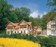
Ringhotel Der Waldkater
Parkhotel Stadthagen
Hotel Zur Amtspforte
Gerbergasse Stadthotel
Lahmann Landhaus
Schewe Gästehaus
Klein Eilsen Landgasthof
Steinberger Hof
Videos from this area
These are videos related to the place based on their proximity to this place.
Mindener Preußenzug mit der Preußischen Dampflok T 13
Mindener Preußenzug mit der Preußischen Dampflok T 13 (Großes Bahnhofsfest am 27.05.12 am Bahnhof Obernkirchen)
Dampfeisenbahn Weserbergland in Obernkirchen im Mai 2012
Güterzugdampflokomotive Br 52 8038 , Preußische Tenderlokomotive T13 und Vt 98 Triebwagen.
Flugplatzfeuerwehr Bückeburg FLF 80/125 in Obernkirchen
Dieses Video ist beim Sommerfest von Ardagh Glass in Obernkirchen, als die Flugplatzfeuerwehr Bückeburg eine Demonstration ihres FLF 80/125 gab, entstanden. Technische Daten des FLF 80/125:.
Fahrt durch Obernkirchen Teil 3
Liebe Leute, hier nun der Teil 3 der kleinen Reihe "Fahrt durch Obernkirchen!. Es geht raus aus Obernkirchen...Rintelner Str. - Bombeeke - Süße Mutter...bis kurz vor Buchholz. Am Ende, einige...
Fahrt durch Obernkirchen Teil 2
Dieses kleine Video wurde am 20.08.2013 um ca. 17 Uhr in Obernkirchen aufgenommen. Dieser Teilabschnitt führt über die Piepenbreite entlang der Ardagh Lagerhalle, weiter Vor den Büschen...
Gartenteich in Obernkirchen
Unser Gartenteich 31683 Obernkirchen. Das kleine Video wurde im Frühling 2013 aufgenommen.
Obernkirchen
Schon vor 100 Jahren wurde für Konsumprodukte geworben. Damals nannte man die Werbung jedoch Reklame und jede Firma welche was auf sich hielt, produzierte kleine Briefmarken ähnliche ...
Videos provided by Youtube are under the copyright of their owners.
Attractions and noteworthy things
Distances are based on the centre of the city/town and sightseeing location. This list contains brief abstracts about monuments, holiday activities, national parcs, museums, organisations and more from the area as well as interesting facts about the region itself. Where available, you'll find the corresponding homepage. Otherwise the related wikipedia article.
Schaumburg
Landkreis Schaumburg — District — File:Lower Saxony SHG. svg Country 22x20px Germany State Lower Saxony Capital Stadthagen Area • Total 676 km Population (31 December 2011) • Total 159,733 • Density Bad rounding here{{#invoke:Math|precision_format| 236.29142011834 | 1-2 }}/km Time zone CET • Summer CEST Vehicle registration SHG Website landkreis-schaumburg.
Bückeberg
The Bückeberg (also the Bückeberge) is a ridge in the Calenberg Uplands between the Harrl and the Deister in central Germany, and is often considered part of the Weser Uplands. It lies in the district of Schaumburg, and stretches for some 20 km from west to east from Bückeburg and the village of Bad Eilsen towards Bad Nenndorf.


