Safety Score: 3,0 of 5.0 based on data from 9 authorites. Meaning we advice caution when travelling to Germany.
Travel warnings are updated daily. Source: Travel Warning Germany. Last Update: 2024-05-22 08:01:51
Delve into Grove
The district Grove of Rodenberg in Lower Saxony is a subburb in Germany about 171 mi west of Berlin, the country's capital town.
If you need a hotel, we compiled a list of available hotels close to the map centre further down the page.
While being here, you might want to pay a visit to some of the following locations: Apelern, Pohle, Beckedorf, Hohnhorst and Messenkamp. To further explore this place, just scroll down and browse the available info.
Local weather forecast
Todays Local Weather Conditions & Forecast: 18°C / 64 °F
| Morning Temperature | 14°C / 57 °F |
| Evening Temperature | 18°C / 64 °F |
| Night Temperature | 14°C / 56 °F |
| Chance of rainfall | 7% |
| Air Humidity | 79% |
| Air Pressure | 1009 hPa |
| Wind Speed | Fresh Breeze with 15 km/h (9 mph) from West |
| Cloud Conditions | Overcast clouds, covering 100% of sky |
| General Conditions | Moderate rain |
Thursday, 23rd of May 2024
19°C (66 °F)
14°C (56 °F)
Few clouds, gentle breeze.
Friday, 24th of May 2024
20°C (67 °F)
14°C (57 °F)
Moderate rain, gentle breeze, scattered clouds.
Saturday, 25th of May 2024
16°C (61 °F)
14°C (58 °F)
Moderate rain, light breeze, overcast clouds.
Hotels and Places to Stay
Die Villa
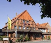
Schmiedegasthaus Gehrke Romantik Hotel
Harms Wellness-Hotel
Fischer Landgasthaus
Aparthotel Berlin
Wille
Deisterblick
Montana
DLRG Tagungszentrum Delphin
Ringhotel Tallymann
Videos from this area
These are videos related to the place based on their proximity to this place.
Hotel Berghof Ihr 3 Sterne Superior Hotel in Apelern.wmv
Das 3 Sterne Superior Hotel Berghof, liegt ruhig auf einer Anhöhe im Ort Rodenberg (Ortsteil Apelern). Unser 3 Sterne Superior Hotel Berghof verfügt über 20 Zimmer in drei verschiedenen...
Stau Leimkaute Rodenberg am Deister
Und wieder mal Stau auf der A2 in Richtung Hannover ab Lauenau. Tausende Autos quälen sich über Stunden die B442 in Richtung B65 direkt am neu geplanten Baugebiet Leimkaute II in Rodenberg.
YTPI Internetagentur stellt sich vor
Wir erstellen Internetseiten & Onlineshops und optimieren diese damit sie im Internet auch gefunden werden. Gute Beratung gehört dabei genauso dazu wie die k...
Traumhaftes Bad Nenndorf 2012 - Unterwegs in Niedersachsen - EVENT
In dieser Event-Folge zeigen wir die Veranstaltung "Traumhaftes Bad Nenndorf" welche im Kurpark in Bad Nenndorf vom 24. - 26. August 2012 statt fand. Musik: Sonias Theme - Hartwigmedia ...
Atelier AusZeit Bad Nenndorf www atelier auszeit com HD 1080p
Atelier AusZeit Bad Nenndorf - Kindergeburtstag feiern oder als offenes Atelier Auszeit Bad Nenndorf.
Galenberg Bad Nenndorf von oben - Juli 2013
Früh-morgens Aufnahmen am Galenberg Bad Nenndorf, Bubikopfallee und "Nabu-Oase".
Neujahrsleuchten Bad Nenndorf - Süntelbuchenallee von oben
Für das Projekt „Neujahrsleuchten" verwandelten Lichtkünstler Jörg Rost und Lichtdesigner Marcel Zink die knorrigen Bäume im Januar und Februar 2012 in ein begehbares Freiluftkunstwerk...
Mit dem Multicopter in der Süntelbuchenallee Bad Nenndorf
Aufnahmen vom September 2012, gerne hätte ich mehr gemacht! Denn ich denke es lohnt sich da diese ganze Allee in 2013 "renaturiert" wird. So könnte man eventuell den Vorschritt dokumentieren....
Videos provided by Youtube are under the copyright of their owners.
Attractions and noteworthy things
Distances are based on the centre of the city/town and sightseeing location. This list contains brief abstracts about monuments, holiday activities, national parcs, museums, organisations and more from the area as well as interesting facts about the region itself. Where available, you'll find the corresponding homepage. Otherwise the related wikipedia article.
Deister
The Deister is a chain of hills in the German state of Lower Saxony, about 15 mi (25 km) southwest of the city of Hanover. It runs in a north-westerly direction from Springe in the south to Rodenberg in the north. The next the chain of hills that attaches in the south is called Small Deister. It is surrounded by Springe, Wennigsen, Barsinghausen, Bad Nenndorf, Rodenberg and Bad Münder (counter-clockwise, starting in the south).
Bad Nenndorf interrogation centre
The Bad Nenndorf interrogation centre was a British Combined Services Detailed Interrogation Centre in the town of Bad Nenndorf, Germany, which operated from June 1945 to July 1947. Allegations of mistreatment of detainees by British troops resulted in a police investigation, a public controversy in both Britain and Germany and the camp's eventual closure. Four of the camp's officers were brought before courts-martial in 1948 and one of the four was convicted on charges of neglect.
Fischbeck Abbey
Fischbeck Abbey is a convent for canonesses in Fischbeck near Hessisch Oldendorf, Lower Saxony, Germany. It was founded in 955 by the noblewoman Helmburgis, a relation of the powerful family of the Ecbertiner, on land that had been given to her for the purpose by King Otto I, and is still a house of canonesses today, although now Lutheran women's convent rather than a Roman Catholic monastery.
Lindhorst (Samtgemeinde)
Lindhorst is a Samtgemeinde ("collective municipality") in the district of Schaumburg, in Lower Saxony, Germany. Its seat is in the village Lindhorst. The Samtgemeinde Lindhorst consists of the following municipalities: Beckedorf Heuerßen Lindhorst
Nenndorf (Samtgemeinde)
Nenndorf is a Samtgemeinde ("collective municipality") in the district of Schaumburg, in Lower Saxony, Germany. Its seat is in the town Bad Nenndorf. The Samtgemeinde Nenndorf consists of the following municipalities: Bad Nenndorf Haste Hohnhorst
Sachsenhagen (Samtgemeinde)
Sachsenhagen is a Samtgemeinde ("collective municipality") in the district of Schaumburg, in Lower Saxony, Germany. Its seat is in the town Sachsenhagen. The Samtgemeinde Sachsenhagen consists of the following municipalities: Auhagen Hagenburg Sachsenhagen
Steinhuder Meer
The Steinhuder Meer or Lake Steinhude is a lake in Lower Saxony, Germany located 30 kilometres northwest of Hanover. It is named after the nearby village of Steinhude. It has an area of about 30 square kilometres, making it the largest lake of northwestern Germany, but it is very shallow, with an average depth of only 1.35 metres and a maximum depth of less than 3 metres . It lies within a region known as the Hanoverian Moor Geest.
Calenberg Uplands
The Calenberg Uplands are a landscape unit in the Weser-Leine Uplands in Lower Saxony, Germany. They border on the Calenberg Land to the north and merge into the Weser Uplands in the west and the Leine Uplands in the east. They are dissected by the Deister-Süntel and Aue valleys.
Süntel
Suntel was Sri Lanka's 2nd largest fixed phone operator with an island wide digital wireless network. The company uses technologies such as CDMA 2000 1x, DECT, E-1 R2/PRI, CorDECT etc. , to connect thousands of residential customers and businesses. Dialog Axiata PLC acquired Suntel in 2012 under and now it is operated by its subsidiary Dialog Broadband Networks (Pvt) Ltd. The Suntel brand name is not used anymore.
Bückeberg
The Bückeberg (also the Bückeberge) is a ridge in the Calenberg Uplands between the Harrl and the Deister in central Germany, and is often considered part of the Weser Uplands. It lies in the district of Schaumburg, and stretches for some 20 km from west to east from Bückeburg and the village of Bad Eilsen towards Bad Nenndorf.
Steinhuder Meer Nature Park
The Steinhuder Meer Nature Park (German: Naturpark Steinhuder Meer), with northwest Germany's largest inland lake, the Steinhuder Meer, at its heart, covers an area of 310 square kilometres within the districts of Nienburg and Schaumburg and the region of Hanover. The sponsor of the nature park, founded in 1974, is Hanover Region.
Wunstorf station
Wunstorf is a railway station located in Wunstorf, Germany. The station opened in 1847 and is located on the Hanover–Minden railway and the Bremen–Hanover railway. The train services are operated by Deutsche Bahn. At this station the routes of S1 and S2 split, S1 continuing to Minden and the S2 to Nienburg. Both routes are operated independently once per hour, leading to two trains per hour between Wunstorf and Hanover. A 6 km / 4 mi single-track spur runs to Bokeloh.
Dedensen-Gümmer railway station
Dedensen-Gümmer is a railway station located in Dedensen and Gümmer, Germany. The station is located on the Hanover–Minden railway and the Bremen–Hanover railway. The train services are operated by Deutsche Bahn as part of the Hanover S-Bahn. Dedensen-Gümmer is served by the S1 and S2. It is in the Umland zone of Hannover. For information see http://www. gvh. de
Poggenhagen railway station
Poggenhagen is a railway station located in Poggenhagen, Germany. The station is located on the Bremen–Hanover railway. The train services are operated by Deutsche Bahn as part of the Hanover S-Bahn. Poggenhagen is served by the S2. It is in the Region zone of Hannover. For Information see www. gvh. de
Deister-Süntel valley
The Deister-Süntel valley lies in the northeast Weser Uplands in the north German state of Lower Saxony between the ridges of the Bückeberg, Süntel and Deister in the districts of Schaumburg and Hameln-Pyrmont.
Hölty-Gymnasium
Hölty-Gymnasium is a public high school established in 1922 in Wunstorf, Germany.
Bad Rehburg
Bad Rehburg is a former spa resort in the Rehburg Hills in central Germany. Today Bad Rehburg is a village in the borough of Rehburg-Loccum in the south of the district of Nienburg/Weser in Lower Saxony. The village lies at an elevation of 85 m above NN and has around 800 inhabitants.
Kirchwehrener Landwehr
Kirchwehrener Landwehr is a river of Lower Saxony, Germany.
Möseke
Möseke is a river of Lower Saxony, Germany.
Rodenberger Aue
Rodenberger Aue is a river of Lower Saxony, Germany.
Sachsenhäger Aue
Sachsenhäger Aue is a river of Lower Saxony, Germany.
Südaue
Südaue is a river of Lower Saxony, Germany.
Westaue
Westaue is a river of Lower Saxony, Germany.
Hülsede Water Castle
Hülsede Water Castle is a water castle in the Weser Renaissance style located in Hülsede in the German state of Lower Saxony between the Süntel and Deister ridges.
Wunstorf Air Base
Wunstorf Air Base is a German Air Force military air base, located 6 km south-southwest of Neustadt am Rübenberge in Lower Saxony, Germany. Wunstorf Air Base is the home to Air Transport Wing 62 (Lufttransportgeschwader 62). It flies the C-160D Transall transport aircraft.


