Safety Score: 3,0 of 5.0 based on data from 9 authorites. Meaning we advice caution when travelling to Germany.
Travel warnings are updated daily. Source: Travel Warning Germany. Last Update: 2024-04-27 08:23:39
Delve into Gräsebilde
Gräsebilde in Lower Saxony is a town located in Germany about 186 mi (or 299 km) west of Berlin, the country's capital town.
Time in Gräsebilde is now 01:36 AM (Sunday). The local timezone is named Europe / Berlin with an UTC offset of 2 hours. We know of 9 airports closer to Gräsebilde, of which 3 are larger airports. The closest airport in Germany is Hannover Airport in a distance of 29 mi (or 47 km), East. Besides the airports, there are other travel options available (check left side).
There are several Unesco world heritage sites nearby. The closest heritage site in Germany is Town Hall and Roland on the Marketplace of Bremen in a distance of 43 mi (or 70 km), North. We saw 1 points of interest near this location. In need of a room? We compiled a list of available hotels close to the map centre further down the page.
Since you are here already, you might want to pay a visit to some of the following locations: Raddestorf, Stolzenau, Leese, Warmsen and Landesbergen. To further explore this place, just scroll down and browse the available info.
Local weather forecast
Todays Local Weather Conditions & Forecast: 16°C / 61 °F
| Morning Temperature | 5°C / 42 °F |
| Evening Temperature | 16°C / 60 °F |
| Night Temperature | 11°C / 51 °F |
| Chance of rainfall | 1% |
| Air Humidity | 56% |
| Air Pressure | 1007 hPa |
| Wind Speed | Moderate breeze with 10 km/h (6 mph) from North |
| Cloud Conditions | Overcast clouds, covering 100% of sky |
| General Conditions | Light rain |
Sunday, 28th of April 2024
17°C (63 °F)
12°C (53 °F)
Overcast clouds, moderate breeze.
Monday, 29th of April 2024
16°C (61 °F)
13°C (56 °F)
Overcast clouds, gentle breeze.
Tuesday, 30th of April 2024
20°C (68 °F)
15°C (59 °F)
Light rain, gentle breeze, overcast clouds.
Hotels and Places to Stay
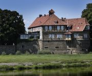
Romantik Hotel Schloss Petershagen
Videos from this area
These are videos related to the place based on their proximity to this place.
Stolzenau
Schon vor 100 Jahren wurde für Konsumprodukte geworben. Damals nannte man die Werbung jedoch Reklame und jede Firma welche was auf sich hielt, produzierte kleine Briefmarken ähnliche ...
Spaziergang durch Schlüsselburg an der Weser
Schlüsselburg an der Weser ist eine Ortschaft im Weserbogen zwischen Minden und Nienburg. Sie ist heute ein Ortsteil der Stadt Petershagen. Quelle: WIKIPEDIA.
bails vol 2
Ein paar Stürze, das sind die besten Bails aus 2 Jahren Skaten, die zufällig gefilmt wurden. Musik: Sayvinyl - Thats Entertainment.
Gopro Hero 4 Silver | Night lapse Time lapse with Settings #2
My new Video. I shot some awesome Nightlapses with my Gopro Hero 4 Silver. I hope you enjoy the video! Check out my other Time-lapse Video! Edited with Gopro Studio and FCP X. If you have...
Britische Streitkräfte üben Weserquerung in Petershagen
Petershagen-Ovenstädt/Jössen (mt). Fingerspitzengefühl war gefragt beim Übersetzen von großer Tonnage über die Weser zwischen Ovenstädt und Jössen. Britische Streitkräfte übten den...
Videos provided by Youtube are under the copyright of their owners.
Attractions and noteworthy things
Distances are based on the centre of the city/town and sightseeing location. This list contains brief abstracts about monuments, holiday activities, national parcs, museums, organisations and more from the area as well as interesting facts about the region itself. Where available, you'll find the corresponding homepage. Otherwise the related wikipedia article.
Weser Depression
The Weser Depression is the region north of Porta Westfalica in Germany, where the River Weser no longer flows through a valley, but a broad plain consisting of meadows and river terraces. The flat plain of the depression is interrupted by geest ridges in places. From Langwedel, as far as the River Lesum, it is separated from the Wümme Depression by a narrow ridge of dunes, on which the town of Achim and the older districts of the city of Bremen lie.
Gehle
Gehle is a river of Lower Saxony, Germany.


