Safety Score: 3,0 of 5.0 based on data from 9 authorites. Meaning we advice caution when travelling to Germany.
Travel warnings are updated daily. Source: Travel Warning Germany. Last Update: 2024-05-01 08:01:32
Discover Arlesberg
The district Arlesberg of Geraberg in Free State of Thuringia is a district in Germany about 167 mi south-west of Berlin, the country's capital city.
Looking for a place to stay? we compiled a list of available hotels close to the map centre further down the page.
When in this area, you might want to pay a visit to some of the following locations: Geschwenda, Elgersburg, Grafenroda, Gehlberg and Angelroda. To further explore this place, just scroll down and browse the available info.
Local weather forecast
Todays Local Weather Conditions & Forecast: 21°C / 70 °F
| Morning Temperature | 10°C / 51 °F |
| Evening Temperature | 15°C / 59 °F |
| Night Temperature | 11°C / 52 °F |
| Chance of rainfall | 3% |
| Air Humidity | 47% |
| Air Pressure | 999 hPa |
| Wind Speed | Gentle Breeze with 7 km/h (4 mph) from North-East |
| Cloud Conditions | Few clouds, covering 10% of sky |
| General Conditions | Light rain |
Friday, 3rd of May 2024
8°C (46 °F)
8°C (46 °F)
Light rain, gentle breeze, overcast clouds.
Saturday, 4th of May 2024
12°C (54 °F)
9°C (48 °F)
Light rain, light breeze, overcast clouds.
Sunday, 5th of May 2024
13°C (55 °F)
8°C (46 °F)
Moderate rain, moderate breeze, overcast clouds.
Hotels and Places to Stay
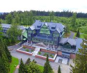
Gabelbach Berg- und Jagdhotel
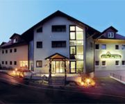
Am Wald
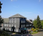
Zum Glasmacher Pension
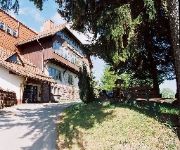
Zum Schneekopf Natur- & Aktivhotel
Am Gisselgrund
Ilmenauer Hof
Tanne
Morgentau Pension
Landhotel Plauescher Grund
Am Waldesrand Pension
Videos from this area
These are videos related to the place based on their proximity to this place.
Benefizspiel FSV Gräfenroda vs Wintersport Allstars des DSV Teil 1
Benefizspiel für das Kinderhospiz Mitteldeutschland in Gräfenroda.
JCL SUMMER SOUNDS 2013 in Gräfenroda (2)
das Gelände in der "Alten Lache" füllt sich mit fortschreitender Stunde.
Treffen 2010 in Gräfenroda Forsthaus Teil 1
Rockmusikfreunde Gräfenroda beim Wiedersehen nach 5 Jahren Pause.
Benefizspiel FSV Gräfenroda vs Wintersport Allstars des DSV Teil 2
Benefizspiel für das Kinderhospiz Mitteldeutschland in Gräfenroda.
Junge ohne Schuhe im Schnee
Hi hier in dem Video laufe ich ohne schuhe durch Schnee und das nur für Geld.
Videos provided by Youtube are under the copyright of their owners.
Attractions and noteworthy things
Distances are based on the centre of the city/town and sightseeing location. This list contains brief abstracts about monuments, holiday activities, national parcs, museums, organisations and more from the area as well as interesting facts about the region itself. Where available, you'll find the corresponding homepage. Otherwise the related wikipedia article.
Thuringian Forest
The Thuringian Forest (Thüringer Wald in German), running northwest to southeast, forms a continuous stretch of ancient rounded mountains posing ample difficulties in transit routing save through a few navigable passes in the southern reaches of the German state of Thuringia. It is about 120 km long and 35 km wide. The highest elevation is the Großer Beerberg, 982 m . The Rennsteig (sometimes called Rennweg) is an ancient path following its summits along the main ridge.
Gleichen
Gleichen is the name of two groups of castles in Germany, thus named from their resemblance to each other (German: gleich = like, or resembling).
Ohrdruf concentration camp
Ohrdruf concentration camp was a Nazi forced labor and concentration camp located near Weimar, Germany. It was part of the Buchenwald concentration camp network and the first Nazi concentration camp liberated by U.S. troops.
International Student Week in Ilmenau
International Student Week in Ilmenau is a student festival, held biennially in the town of Ilmenau, located in the district of Ilm-Kreis, Thuringia, Germany. Open to students of all faculties around the world. It was established in 1993 and has taken place every two years since then. At the conference participants discuss topics and experience a broad cultural range. On average about 350 participants from around 40-50 countries take part at the conference.
Jonas Valley
Jonastal (Jonas Valley), situated in the Ilm-Kreis district in Germany between Crawinkel and Arnstadt and near to the town of Ohrdruf, was a scene of military construction under the National Socialist regime during the last years of the Second World War. Thousands of prisoners from the Buchenwald concentration camp under the command of SS General Hans Kammler were forced to dig 25 tunnels into the surrounding mountain and the whole operation was performed under the strictest secrecy.
Michaeliskirche (Ohrdruf)
The Michaeliskirche (St. Michael's Church) in the Thuringian town of Ohrdruf was the site of Johann Sebastian Bach's first employment. J. S. Bach was orphaned at the age of 10 and went to live with his eldest brother, Johann Christoph Bach, who was the organist at the Michaeliskirche. It contained a three-manual German baroque organ in a historic case of Austrian origin. It was here that Bach learned about organ building.
Rennsteig Tunnel
Rennsteig Tunnel is the longest road tunnel in Germany with a length of 7,916 meters (4.919 mi). The Rennsteig Tunnel is part of the motorway Autobahn A 71 between Gräfenroda and Oberhof in Thuringia. It is also called the Christiane Tunnel for its "godmother" Christiane Herzog, wife of the former German President Roman Herzog. The tunnel was built between 26 June 1998 and 5 July 2003, when it was opened by German chancellor Gerhard Schröder.
Arnstadt Central Station
Arnstadt Central Station (Arnstadt Hauptbahnhof) is a railway station for the town of Arnstadt in Thuringia, Germany. It is situated on the meeting point of the Erfurt-Schweinfurt, Arnstadt–Saalfeld and Arnstadt-Ichtershausen lines.
Technische Universität Ilmenau
The Ilmenau University of Technology is a German public research university located in Ilmenau, Thuringia, Germany. It was founded in 1894, it has a total of 5 adacemic departments (faculties) and about 7,200 undergraduate students.
Ringberghaus
The Ringberghaus, also often called Ringberghotel is a hotel east of the German city Suhl. In the 1970s, it was one of the most controversially discussed new buildings in the Suhl area.
Geratal
Geratal is a Verwaltungsgemeinschaft ("collective municipality") in the district Ilm-Kreis, in Thuringia, Germany. The seat of the Verwaltungsgemeinschaft is in Geraberg. The Verwaltungsgemeinschaft Geratal consists of the following municipalities: Angelroda Elgersburg Geraberg Martinroda
Ehrenberg (Ilmenau)
The Ehrenberg (literally "mountain of honor") is a mountain to the east of Ilmenau, rising to a height of 528 meters and standing opposed to the Traugberg. The border between Ilmenau and Langewiesen runs through its apex, which is marked by a large wooden cross. It is home to part of the campus of the Technische Universität Ilmenau (Technical University of Ilmenau) and the Bundesanstalt für Wasserbau (Federal Institute for Hydraulic Engineering).
Oberhof bobsleigh, luge, and skeleton track
The Oberhof bobsleigh, luge, and skeleton track is a venue used for bobsled, luge and skeleton located in Oberhof, Germany.
2008–09 Biathlon World Cup – World Cup 4
The 2008-09 Biathlon World Cup/World Cup 4 has been held in Oberhof, Germany. From Wednesday January 7 until Sunday January 11, 2009.
Rennsteiggarten Oberhof
The Rennsteiggarten Oberhof (7 hectares) is a botanical garden specializing in mountain flora, located in Rennsteig at Am Pfanntalskopf 3, Oberhof, Thuringia, Germany. It is open daily in the warmer months; an admission fee is charged. The garden was established in 1970 on the grounds of a former quarry at an elevation of 868 meters on the Pfanntalskopf.
2009–10 Biathlon World Cup – World Cup 4
The 2009–10 Biathlon World Cup – World Cup 4 was the fourth event of the season and was held in Oberhof, Germany from Wednesday, January 6 until Sunday, January 10, 2010.
2010–11 Biathlon World Cup – World Cup 4
The 2010–11 Biathlon World Cup - World Cup 4 was held in Oberhof, Germany, from 5 January until 9 January 2011.
Burgstein (Thuringia)
The Burgstein is a rock formation, about 10 metres high in the valley of the Ilm in Langewiesen in the central German state of Thuringia. It is made from quartz porphyry and has been a geological natural monument since 1939. It was formed when the Ilm carved out its valley and washed away the surrounding rock. When the Ilmenau–Großbreitenbach railway was built in 1881 it was exposed again because rock at its foot was removed in order to lay the railway track.
Lütsche-Flößgraben
Lütsche-Flößgraben is a river of Thuringia, Germany.
Lütsche
Lütsche is a river of Thuringia, Germany.
Mühlwasser
Mühlwasser is a river of Thuringia, Germany.
Rottenbach (Ilmenau)
Rottenbach (Ilmenau) is a river of Thuringia, Germany.
Schorte
Schorte is a river of Thuringia, Germany.
Zahme Gera
Zahme Gera is a river of Thuringia, Germany.
2011–12 Biathlon World Cup – World Cup 4
The 2011–12 Biathlon World Cup – World Cup 4 was held in Oberhof, Germany, from 4 January until 8 January 2012. It was the fourth of nine scheduled events on the World Cup schedule, with both men and women competing in three different disciplines.


