Elgersburg
in Free State of Thuringia, Germany

Noteable things around
Location Summary
Decimal Coordinates (Latitude, Longitude):
50.706 and 10.853 (Lat./Lng.)
Coordinates by Time:
N 50° 42' 21" and E 10° 51' 11"
Currency and Currency Code:
Euro - EUR
Spoken languages:
German
Local electricity:
230 V - 50 Hz (plugs: G)
Mobile phone / cellular frequencies (MHz):
900 MHz, 1800 MHz, 3G, 4G
Local Time: 06:16 AM (Saturday)
Timezone: Europe/Berlin
UTC/GMT offset: 1 hours
Sunrise and Sunset:
5:56 am and 8:32 pm
Antipode Coordinates:
-44.033 and -176.367 (Lat./Lng.)
Closest place to antipode coordinates:
Ouwenga
References
This place on Wikipedia
This place on Geonames.org
Current travel safety evaluation for Germany in Western Europe

Safety Score: 3,0 of 5.0 based on data from 9 authorites. Meaning we advice caution when travelling to Germany.

Travel warnings are updated daily. Source: Travel Warning Germany. Last Update: 2024-04-26 08:02:42

Explore Elgersburg

Elgersburg in Free State of Thuringia with it's 1,234 inhabitants is a city in Germany about 167 mi (or 268 km) south-west of Berlin, the country's capital.

Local time in Elgersburg is now 06:16 AM (Saturday). The local timezone is named Europe / Berlin with an UTC offset of 2 hours. We know of 11 airports in the vicinity of Elgersburg, of which 5 are larger airports. The closest airport in Germany is Erfurt Airport in a distance of 19 mi (or 31 km), North. Besides the airports, there are other travel options available (check left side).

There are several Unesco world heritage sites nearby. The closest heritage site in Germany is Bauhaus and its Sites in Weimar and Dessau in a distance of 28 mi (or 45 km), North-East. If you need a place to sleep, we compiled a list of available hotels close to the map centre further down the page.

Depending on your travel schedule, you might want to pay a visit to some of the following locations: Geraberg, Geschwenda, Martinroda, Angelroda and Neusiss. To further explore this place, just scroll down and browse the available info.

Local weather forecast

Todays Local Weather Conditions & Forecast: 16°C / 61 °F

Morning Temperature 5°C / 41 °F
Evening Temperature 16°C / 60 °F
Night Temperature 9°C / 49 °F
Chance of rainfall 0%
Air Humidity 43%
Air Pressure 1010 hPa
Wind Speed Gentle Breeze with 6 km/h (4 mph) from North
Cloud Conditions Few clouds, covering 16% of sky
General Conditions Few clouds

Sunday, 28th of April 2024

19°C (67 °F)
11°C (52 °F)
Scattered clouds, gentle breeze.

Monday, 29th of April 2024

18°C (64 °F)
11°C (52 °F)
Overcast clouds, gentle breeze.

Tuesday, 30th of April 2024

22°C (71 °F)
14°C (57 °F)
Moderate rain, gentle breeze, broken clouds.

Hotels and Places to Stay

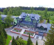
Gabelbach Berg- und Jagdhotel

Address
3,7 mi
Am Gabelbach 1
98693 Ilmenau
Germany

Time Information

Checkout: 11:00 - Checkin: 15:00
Reception
Weekday: 0:00 - 24:00
Weekend: 0:00 - 24:00


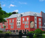
Am Wald

Address
0,4 mi
Schmücker Str. 20
98716 Elgersburg
Germany

Time Information

Checkout: 11:00 - Checkin: 14:00
Reception
Weekday: 7:00 - 20:00
Weekend: 8:00 - 20:00


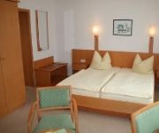
Ilmenauer Hof

Address
2,6 mi
Erfurter Str. 38
98693 Ilmenau
Germany

Time Information

Checkout: 12:00 - Checkin: 14:00
Reception
Weekday: 7:00 - 23:00
Weekend: 7:00 - 23:00


Tanne

Address
3,0 mi
Lindenstr. 38
98693 Ilmenau
Germany

Time Information

Checkout: 11:00 - Checkin: 14:00
Reception
Weekday: 0:00 - 24:00
Weekend: 0:00 - 24:00


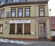
Morgentau Pension

Address
2,9 mi
Zwetschenberg 3
98693 Ilmenau
Germany

Time Information

Checkout: 12:00 - Checkin: 14:00
Reception
Weekday: 7:00 - 21:00
Weekend: 7:00 - 21:00


Melanie Garni

Address
3,2 mi
Heinrich-Heine-Str. 3
98693 Ilmenau
Germany

Time Information

Checkout: 12:00 - Checkin: 12:00
Reception
Weekday: 7:00 - 21:00
Weekend: 7:00 - 21:00


Am Kirchplatz Garni

Address
3,0 mi
Fachgraben 6
98693 Ilmenau
Germany

Time Information

Checkout: 11:00 - Checkin: 14:00
Reception
Weekday: 7:00 - 18:00
Weekend: 8:00 - 16:00 (lunchbreak: 11:00 - 14:00)


Zum Schneekopf Natur- & Aktivhotel

Address
3,4 mi
Ritterstrasse 16
98559 Gehlberg
Germany

Time Information

Checkout: 11:00 - Checkin: 14:00
Reception
Weekday: 7:00 - 20:00 (lunchbreak: 11:00 - 14:00)
Weekend: closed


Zum Glasmacher Pension

Address
3,4 mi
Glasmacherstraße 8
98559 Gehlberg
Germany

Time Information

Checkout: 10:30 - Checkin: 14:30
Reception
Weekday: 8:00 - 18:00 (lunchbreak: 11:00 - 15:00)
Weekend: 8:00 - 18:00 (lunchbreak: 11:00 - 15:00)


MARA Hotel

Address
3,3 mi
Krohnestraße 5
98693 Ilmenau
Germany

Time Information

Checkout: 11:00 - Checkin: 15:00
Reception
Weekday: 0:00 - 24:00
Weekend: 0:00 - 24:00


Videos from this area

These are videos related to the place based on their proximity to this place.

Der Kickelhahn

Published: June 14, 2014
Length: 53:02 min
Rating: 5 of 5
Author: Nils Juenemann

Flug mit einer DJI Phantom 2 über den 891m hohen Kickelhahn bei Ilmenau. Musik: Chris Zabriskie - The Temperature Of The Air On The Bow Of The Kaleetan.


Benefizspiel FSV Gräfenroda vs Wintersport Allstars des DSV Teil 1

Published: July 01, 2012
Length: 15:02 min
Rating: 5 of 5
Author: Raimund Flick

Benefizspiel für das Kinderhospiz Mitteldeutschland in Gräfenroda.


NetworkBrothers in Gräfenroda Teil 1

Published: September 02, 2012
Length: 34:27 min
Rating: 5 of 5
Author: Raimund Flick

JCL Summer Sounds - Open Air - Festplatz "Alte Lache"


Sankt Martin - Umzug in Gräfenroda

Published: November 17, 2014
Length: 06:23 min
Rating: 0 of 5
Author: Raimund Flick


JCL SUMMER SOUNDS 2013 in Gräfenroda (2)

Published: February 16, 2014
Length: 15:46 min
Rating: 5 of 5
Author: Raimund Flick

das Gelände in der "Alten Lache" füllt sich mit fortschreitender Stunde.


JCL SUMMER SOUNDS 2013 in Gräfenroda (1)

Published: February 15, 2014
Length: 50:19 min
Rating: 5 of 5
Author: Raimund Flick

die ersten Eindrücke in der "Alten Lache" mit "B3NSON"


Treffen 2010 in Gräfenroda Forsthaus Teil 1

Published: January 31, 2011
Length: 44:40 min
Rating: 5 of 5
Author: Raimund Flick

Rockmusikfreunde Gräfenroda beim Wiedersehen nach 5 Jahren Pause.


Benefizspiel FSV Gräfenroda vs Wintersport Allstars des DSV Teil 2

Published: July 01, 2012
Length: 10:22 min
Rating: 5 of 5
Author: Raimund Flick

Benefizspiel für das Kinderhospiz Mitteldeutschland in Gräfenroda.


NetworkBrothers in Gräfenroda Teil 2

Published: September 02, 2012
Length: 59:02 min
Rating: 5 of 5
Author: Raimund Flick

JCL Summer Sounds - Open Air - Festplatz "Alte Lache"


Blasmusik zum Maibaumsetzen 2014

Published: May 01, 2014
Length: 35:19 min
Rating: 0 of 5
Author: Raimund Flick

Aufstellen des Maibaumes in Gräfenroda bei bestem Wetter.


Videos provided by Youtube are under the copyright of their owners.

Attractions and noteworthy things

Distances are based on the centre of the city/town and sightseeing location. This list contains brief abstracts about monuments, holiday activities, national parcs, museums, organisations and more from the area as well as interesting facts about the region itself. Where available, you'll find the corresponding homepage. Otherwise the related wikipedia article.

Thuringian Forest

The Thuringian Forest (Thüringer Wald in German), running northwest to southeast, forms a continuous stretch of ancient rounded mountains posing ample difficulties in transit routing save through a few navigable passes in the southern reaches of the German state of Thuringia. It is about 120 km long and 35 km wide. The highest elevation is the Großer Beerberg, 982 m . The Rennsteig (sometimes called Rennweg) is an ancient path following its summits along the main ridge.

Located at 50.6667, 10.8333 (Lat. / Lng.), about 3 miles away.
Wikipedia Article
Mountain ranges of Germany, Geography of Thuringia, Biosphere reserves of Germany, Thuringian Forest

Geratal

Geratal is a Verwaltungsgemeinschaft ("collective municipality") in the district Ilm-Kreis, in Thuringia, Germany. The seat of the Verwaltungsgemeinschaft is in Geraberg. The Verwaltungsgemeinschaft Geratal consists of the following municipalities: Angelroda Elgersburg Geraberg Martinroda

Located at 50.733, 10.85 (Lat. / Lng.), about 2 miles away.
Wikipedia Article
Verwaltungsgemeinschaften in Thuringia

Zahme Gera

Zahme Gera is a river of Thuringia, Germany.

Located at 50.7167, 10.8167 (Lat. / Lng.), about 2 miles away.
Wikipedia Article
Rivers of Thuringia

capture of the webcam Manebach: Blick vom Kickelhahnturm Richtung Nordosten

Manebach: Blick vom Kickelhahnturm Richtung Nordosten, Manebach (source)

capture of the webcam Manebach: Blick vom Kickelhahnturm Richtung Westen

Manebach: Blick vom Kickelhahnturm Richtung Westen, Manebach (source)

capture of the webcam Mönchshof: WebCam Gasthaus hohe Warte, Elgersburg in Richtung Norden

Mönchshof: WebCam Gasthaus hohe Warte, Elgersburg in Richtung Norden, Mönchshof (source)

capture of the webcam Geraberg

Geraberg, Geraberg (source)

Webcams provided by webcam.travel are under the copyright of their owners.


This place is known by different names. Here the ones we know:
Elgersburg, Эльгерсбург, Елгерсбург, 埃尔格尔斯堡