Safety Score: 3,0 of 5.0 based on data from 9 authorites. Meaning we advice caution when travelling to Germany.
Travel warnings are updated daily. Source: Travel Warning Germany. Last Update: 2024-04-19 08:03:45
Touring Gehlberg
Gehlberg in Free State of Thuringia with it's 763 residents is a town located in Germany about 170 mi (or 274 km) south-west of Berlin, the country's capital place.
Time in Gehlberg is now 09:38 PM (Friday). The local timezone is named Europe / Berlin with an UTC offset of 2 hours. We know of 12 airports nearby Gehlberg, of which 5 are larger airports. The closest airport in Germany is Erfurt Airport in a distance of 22 mi (or 36 km), North. Besides the airports, there are other travel options available (check left side).
There are several Unesco world heritage sites nearby. The closest heritage site in Germany is Wartburg Castle in a distance of 29 mi (or 47 km), North-West. Need some hints on where to stay? We compiled a list of available hotels close to the map centre further down the page.
Being here already, you might want to pay a visit to some of the following locations: Geraberg, Geschwenda, Elgersburg, Grafenroda and Schmiedefeld am Rennsteig. To further explore this place, just scroll down and browse the available info.
Local weather forecast
Todays Local Weather Conditions & Forecast: 3°C / 38 °F
| Morning Temperature | 2°C / 36 °F |
| Evening Temperature | 3°C / 37 °F |
| Night Temperature | 2°C / 36 °F |
| Chance of rainfall | 7% |
| Air Humidity | 95% |
| Air Pressure | 1006 hPa |
| Wind Speed | Moderate breeze with 13 km/h (8 mph) from North-East |
| Cloud Conditions | Overcast clouds, covering 100% of sky |
| General Conditions | Rain and snow |
Saturday, 20th of April 2024
4°C (39 °F)
0°C (32 °F)
Snow, moderate breeze, overcast clouds.
Sunday, 21st of April 2024
5°C (41 °F)
-0°C (31 °F)
Light rain, gentle breeze, few clouds.
Monday, 22nd of April 2024
3°C (38 °F)
0°C (33 °F)
Light snow, light breeze, overcast clouds.
Hotels and Places to Stay
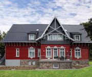
Villa Silva Oberhof
Ringberg
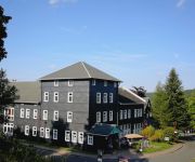
Berghotel Oberhof
Zum Glasmacher Pension
Chalet Sonnenhang
Obere Schweizerhütte
Am Gisselgrund
810 M Oberhof Pension
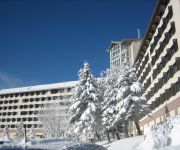
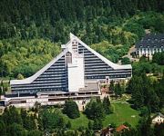
Treff Hotel Panorama
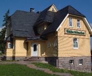
Waldschlösschen Pension
Videos from this area
These are videos related to the place based on their proximity to this place.
BÜ Meyersgrund mit RegioShuttle
Zu einem Festwochenende im Bahnhof Rennsteig wurden auf der Rennsteigbahn, einer der wenigen verbleibenden Steilstrecken, Sonderzüge eingesetzt. Wir sehen zur Abwechslung mal fernab ...
Lütsche Tour
Ohne Witz lies die Beschreibung! \(°_°)/ Hier seht ihr mal die Lütsche Talsperre mit Campingplatz. Die Lütsche Talsperre ist ein beliebter Badeort im Thüringer Wald :) Dann hab ich nochmal...
Jonglage Felix Eschrich im Freibad Geraberg - 2012_06_24
Video of Juggling at OpenAir Pool - Jubilee in Geraberg Also watch my first video: http://www.youtube.com/watch?v=iJF0tk3byFE&feature=youtu.be Have fun and SHARE IT if you like it! Felix...
CHS Marketing - Ilmenau: ASG Autoservice Geraberg (The Making Of)
Für Autoservice Geraberg in Geraberg/Thür. wurden die Dreharbeiten zum Imagefilm aufgenommen. Es handelt sich um ein "Making Of"! CHS Marketing und t&b digital, Weimar, beide Mitglieder von...
Christian Wiegand 100 km auf dem Fahrrad mit einem Bein - HD
2012 habe ich als Oberschenkel-Amputierter erfolgreich eine 100 km lange Strecke bewältigt (Geraberg-Bad Berka-Geraberg). Ich bin also mit einem Bein (ohne Prothese) gefahren.
Jonglage Felix Eschrich - Keulen/Clubs - BeginnerTricks - Juli 2012
Video of Juggling Clubs - Beginner Skill Tricks Also watch my first video (Balls and Clubs): http://www.youtube.com/watch?v=iJF0tk3byFE&feature=youtu.be Have fun and SHARE IT if you like...
Am Rennsteig
Ich war ein Paar Tage im Thüringer Wald in einer tollen Winterlandschaft unterwegs. Leider mußte ich die Tour schon mittags abbrechen, da mir erkältungsbedingt die Luft wegblieb. Aber jetzt...
RC-Line-Treffen 2012 - Turbinenjet over Geschwenda
Dieser Jet-Trainer war eines von zwei Turbinenmodellen beim diesjährigen RC-Line-Treffen im thüringischen Geschwenda.
Videos provided by Youtube are under the copyright of their owners.
Attractions and noteworthy things
Distances are based on the centre of the city/town and sightseeing location. This list contains brief abstracts about monuments, holiday activities, national parcs, museums, organisations and more from the area as well as interesting facts about the region itself. Where available, you'll find the corresponding homepage. Otherwise the related wikipedia article.
Thuringian Forest
The Thuringian Forest (Thüringer Wald in German), running northwest to southeast, forms a continuous stretch of ancient rounded mountains posing ample difficulties in transit routing save through a few navigable passes in the southern reaches of the German state of Thuringia. It is about 120 km long and 35 km wide. The highest elevation is the Großer Beerberg, 982 m . The Rennsteig (sometimes called Rennweg) is an ancient path following its summits along the main ridge.
Zahme Gera
Zahme Gera is a river of Thuringia, Germany.


