Safety Score: 3,0 of 5.0 based on data from 9 authorites. Meaning we advice caution when travelling to Germany.
Travel warnings are updated daily. Source: Travel Warning Germany. Last Update: 2024-04-27 08:23:39
Explore Manebach
Manebach in Free State of Thuringia is located in Germany about 168 mi (or 271 km) south-west of Berlin, the country's capital.
Local time in Manebach is now 08:59 PM (Saturday). The local timezone is named Europe / Berlin with an UTC offset of 2 hours. We know of 11 airports in the wider vicinity of Manebach, of which 5 are larger airports. The closest airport in Germany is Erfurt Airport in a distance of 21 mi (or 34 km), North. Besides the airports, there are other travel options available (check left side).
There are several Unesco world heritage sites nearby. The closest heritage site in Germany is Bauhaus and its Sites in Weimar and Dessau in a distance of 29 mi (or 47 km), North-East. If you need a place to sleep, we compiled a list of available hotels close to the map centre further down the page.
Depending on your travel schedule, you might want to pay a visit to some of the following locations: Elgersburg, Geraberg, Stutzerbach, Martinroda and Geschwenda. To further explore this place, just scroll down and browse the available info.
Local weather forecast
Todays Local Weather Conditions & Forecast: 17°C / 62 °F
| Morning Temperature | 5°C / 40 °F |
| Evening Temperature | 15°C / 60 °F |
| Night Temperature | 8°C / 47 °F |
| Chance of rainfall | 0% |
| Air Humidity | 45% |
| Air Pressure | 1009 hPa |
| Wind Speed | Gentle Breeze with 7 km/h (4 mph) from North-East |
| Cloud Conditions | Scattered clouds, covering 26% of sky |
| General Conditions | Scattered clouds |
Sunday, 28th of April 2024
18°C (64 °F)
9°C (49 °F)
Broken clouds, gentle breeze.
Monday, 29th of April 2024
13°C (56 °F)
9°C (49 °F)
Light rain, gentle breeze, overcast clouds.
Tuesday, 30th of April 2024
18°C (65 °F)
13°C (55 °F)
Light rain, gentle breeze, overcast clouds.
Hotels and Places to Stay
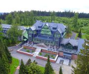
Gabelbach Berg- und Jagdhotel
Am Wald
Ilmenauer Hof
Tanne
Morgentau Pension
Melanie Garni
Am Kirchplatz Garni
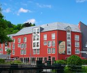
MARA Hotel
Zum Schneekopf Natur- & Aktivhotel
Zum Glasmacher Pension
Videos from this area
These are videos related to the place based on their proximity to this place.
BÜ Stützerbach Auerhahnstr. mit 94 1538
Zu einem Festwochenende im Bahnhof Rennsteig wurden auf der Rennsteigbahn, einer der wenigen verbleibenden Steilstrecken, Sonderzüge eingesetzt. Wir sehen zur Abwechslung mal fernab ...
94 1538 Ortsdurchfahrt Stützerbach
94 1538 mit Sonderzug zum "Schmiedefeuer am Bahnhof Rennsteig" von Stützerbach nach Rennsteig, Ortsdurchfahrt Stützerbach.
94 1538 bei Stützerbach
94 1538 mit Sonderzug zum "Schmiedefeuer am Bahnhof Rennsteig" von Stützerbach nach Rennsteig, im Legwitztal kurz hinter Stützerbach.
94 1538 bei Stützerbach
Zu einem Festwochenende im Bahnhof Rennsteig wurden auf der Rennsteigbahn, einer der wenigen verbleibenden Steilstrecken, Sonderzüge eingesetzt. Wir sehen zur Abwechslung mal fernab ...
94 1538 hinter Stützerbach
94 1538 mit Sonderzug zum "Schmiedefeuer am Bahnhof Rennsteig" von Stützerbach nach Rennsteig, am Teichkopf kurz hinter Stützerbach.
BÜ Meyersgrund mit RegioShuttle
Zu einem Festwochenende im Bahnhof Rennsteig wurden auf der Rennsteigbahn, einer der wenigen verbleibenden Steilstrecken, Sonderzüge eingesetzt. Wir sehen zur Abwechslung mal fernab ...
Brandt Druck mit neuer Druckmaschine
Hier sehen Sie was ein Andruck ist. Die ersten 10 Drucke werden hier geprüft nach Farbe und Eindruck. Wenn der Kunde es möchte, kann er sogar dabei sein und selber prüfen ob ihm die Farbgestaltu ...
Der Kickelhahn
Flug mit einer DJI Phantom 2 über den 891m hohen Kickelhahn bei Ilmenau. Musik: Chris Zabriskie - The Temperature Of The Air On The Bow Of The Kaleetan.
Videos provided by Youtube are under the copyright of their owners.
Attractions and noteworthy things
Distances are based on the centre of the city/town and sightseeing location. This list contains brief abstracts about monuments, holiday activities, national parcs, museums, organisations and more from the area as well as interesting facts about the region itself. Where available, you'll find the corresponding homepage. Otherwise the related wikipedia article.
Thuringian Forest
The Thuringian Forest (Thüringer Wald in German), running northwest to southeast, forms a continuous stretch of ancient rounded mountains posing ample difficulties in transit routing save through a few navigable passes in the southern reaches of the German state of Thuringia. It is about 120 km long and 35 km wide. The highest elevation is the Großer Beerberg, 982 m . The Rennsteig (sometimes called Rennweg) is an ancient path following its summits along the main ridge.
Zahme Gera
Zahme Gera is a river of Thuringia, Germany.


