Safety Score: 3,0 of 5.0 based on data from 9 authorites. Meaning we advice caution when travelling to Germany.
Travel warnings are updated daily. Source: Travel Warning Germany. Last Update: 2024-05-22 08:01:51
Discover Lichtenberg
The district Lichtenberg of Pagram in Brandenburg is a district in Germany about 46 mi east of Berlin, the country's capital city.
Looking for a place to stay? we compiled a list of available hotels close to the map centre further down the page.
When in this area, you might want to pay a visit to some of the following locations: Jacobsdorf, Treplin, Gross Lindow, Mixdorf and Slubice. To further explore this place, just scroll down and browse the available info.
Local weather forecast
Todays Local Weather Conditions & Forecast: 22°C / 72 °F
| Morning Temperature | 18°C / 64 °F |
| Evening Temperature | 16°C / 61 °F |
| Night Temperature | 15°C / 58 °F |
| Chance of rainfall | 3% |
| Air Humidity | 65% |
| Air Pressure | 1008 hPa |
| Wind Speed | Moderate breeze with 12 km/h (7 mph) from West |
| Cloud Conditions | Overcast clouds, covering 99% of sky |
| General Conditions | Light rain |
Thursday, 23rd of May 2024
19°C (66 °F)
14°C (58 °F)
Light rain, gentle breeze, overcast clouds.
Friday, 24th of May 2024
22°C (71 °F)
15°C (60 °F)
Broken clouds, gentle breeze.
Saturday, 25th of May 2024
20°C (68 °F)
16°C (60 °F)
Moderate rain, light breeze, overcast clouds.
Hotels and Places to Stay
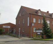
Landhotel Pagram
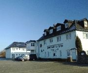
Goldener Hahn
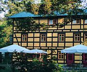
Kaisermühle
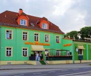
Am Schloß
Grünhof
Sportfördergruppe Bw Frankfurt/Oder Truppenunterkunft
Videos from this area
These are videos related to the place based on their proximity to this place.
Walking in Frankfurt # 6/6 - FF By Day
It's the next day and therefore the only part of this Frankfurt series taken in normal light. But does the sunshine illuminate only good things on the Frankfurt streets?
Erster Rohkost-Abend in Müllrose
Heute bleibt die Küche kalt. Für mehr Lebensenergie, Freude und Power. Mit allen Sinnen genießen.
Mehrzweckboot Feuerwehr Amt Schlaubetal - Müllrose
Das Mehrzweckboot der FF Amt Schlaubetal bei Gleitfahrt und Löschangriff über 2 B-Rohre.
Nerd Zone: Otakus Welt auf der Buchmesse
Unser Trip nach Frankfurt auf die Buchmesse, Viel Spaß Leuteund Danke an alle Cosplayer in den Interviews! Viele Videoclips konnte ich wegen Hintergrundgeräuschen nicht verwenden, aber ...
Hager and Berker are members of the German Sustainable Building Council (DGNB)
MAKING SUSTAINABILITY MEASURABLE Hager and Berker are members of the German Sustainable Building Council (DGNB) An official ceremony was held at this year's Light+Building exhibition on ...
Straßenbahn Frankfurt/O linia 5
Trasa linii tramwajowej nr 5 w Frankfurcie/O Messegelände - Neuberesinchen.
☆ FERRARI 458 SPIDER @ FRANKFURT MOTOR SHOW ☆
HOMEPAGE: http://www.rtcmanga.com TWITTER: https://twitter.com/rtcmanga FACEBOOK: https://www.facebook.com/rtcmanga MAILING LIST: http://www.rtcmanga.com/mailing_list Ferrari 458 Spider.
B5 + B112 + A12: Umfahrung Frankfurt (Oder) (2x)
Autostrada A12 i Drogi Krajowe nr 5 i 112: obwodnica Frankfurtu nad Odrą. Kierunek przeciwny do ruchu wskazówek zegara. Autobahn A12 and Bundesstrassen no. 5 and 112: Frankfurt (Oder) bypass.
Klinikum Frankfurt (Oder) im Bundesland Brandenburg
FRANKFURT (ODER) 28.08.2012 Video vom Gelände des Klinikum Frankfurt (Oder) im Bundesland Brandenburg. Das Krankenhaus an der Müllroser Chaussee im Ortsteil Markendorf wurde 2003 ...
MAN KAT1 mil glw im Schlamm
Der Ortsverband Frankfurt Oder veranstaltete im Sommer 2007 eine Feier zum 15,5 jährigen Bestehen. Dazu wurde allerhand Technik ausgestellt und auf dem Acker neben den ehemaligen ...
Videos provided by Youtube are under the copyright of their owners.
Attractions and noteworthy things
Distances are based on the centre of the city/town and sightseeing location. This list contains brief abstracts about monuments, holiday activities, national parcs, museums, organisations and more from the area as well as interesting facts about the region itself. Where available, you'll find the corresponding homepage. Otherwise the related wikipedia article.
Battle of Kunersdorf
The Battle of Kunersdorf, fought in the Seven Years' War, was Frederick the Great's most devastating defeat. On August 12, 1759, near Kunersdorf (Kunowice), east of Frankfurt (Oder), 50,900 Prussians were defeated by a combined allied army 59,500 strong consisting of 41,000 Russians and 18,500 Austrians under Pyotr Saltykov. Only 3,000 soldiers from original 50,900 Prussian army returned to Berlin after the battle, though many more had only scattered.
Viadrina European University
For other uses, see European University (disambiguation) Viadrina European University Europa-Universität Viadrina Seal of Viadrina University {{#invoke:InfoboxImage|InfoboxImage|image=|size=|sizedefault=frameless|alt=}}Motto Ex oriente lux (Light from the east)Established 1506, closed 1811, refounded 1991Type StatePresident Gunter PleugerAcademic staff 160Students 6,267Location Frankfurt (Oder), Brandenburg, GermanyCampus Urban, several locationsWebsite www. euv-frankfurt-o.
Świecko
Świecko (formerly German Schwetig) is a village in the administrative district of Gmina Słubice, within Słubice County, Lubusz Voivodeship, in western Poland, close to Frankfurt an der Oder on the German border. It lies approximately 6 kilometres south of Słubice, 66 km south-west of Gorzów Wielkopolski, and 74 km north-west of Zielona Góra. The village has a population of 180.
Oderturm
Der Oderturm is a 24-storey high-rise office building in Frankfurt (Oder), Germany, built between 1968 and 1976 when the city was part of East Germany. It is arguably the tallest office building in Brandenburg, with a mobile telephony mast reaching 95 m; however, its roof height of 89 m is 1 m less than that of the Stern-Plaza in Potsdam, built in 1998.
Seelow-Land
Seelow-Land is an Amt ("municipal federation") in the district of Märkisch-Oderland, in Brandenburg, Germany. Its seat is in Seelow, itself not part of the Amt. The Amt Seelow-Land consists of the following municipalities: Falkenhagen Fichtenhöhe Lietzen Lindendorf Vierlinden
Lebus (Amt)
Lebus is an Amt ("municipal federation") in the district of Märkisch-Oderland, in Brandenburg, Germany. Its seat is in Lebus. The Amt Lebus consists of the following municipalities: Lebus Podelzig Reitwein Treplin Zeschdorf
Brieskow-Finkenheerd (Amt)
Brieskow-Finkenheerd is an Amt ("municipal federation") in the district of Oder-Spree, in Brandenburg, Germany. Its seat is in Brieskow-Finkenheerd. The Amt Brieskow-Finkenheerd consists of the following municipalities: Brieskow-Finkenheerd Groß Lindow Vogelsang Wiesenau Ziltendorf
Odervorland
Odervorland is an Amt ("municipal federation") in the district of Oder-Spree, in Brandenburg, Germany. Its seat is in Briesen. The Amt Odervorland consists of the following municipalities: Berkenbrück Briesen Jacobsdorf Madlitz-Wilmersdorf
Schlaubetal (Amt)
Schlaubetal is an Amt ("municipal federation") in the district of Oder-Spree, in Brandenburg, Germany. Its seat is in Müllrose. The Amt Schlaubetal consists of the following municipalities: Grunow-Dammendorf Mixdorf Müllrose Ragow-Merz Schlaubetal Siehdichum
Hohenwalde
Hohenwalde is an Ortsteil of Frankfurt (Oder), Brandenburg, Germany, with a population of 425. The town of Müllrose is also close by.
Kliestow
Kliestow is an Ortsteil of Frankfurt (Oder), Germany, with a population of 1,194. Kliestow is approx. 80 km east of Berlin.
Carl-Philipp-Emanuel-Bach-Straße
Carl-Philipp-Emanuel-Bach-Straße is a street in Frankfurt (Oder), Germany. Named after the 18th century German musician and composer Carl Philipp Emanuel Bach, Carl-Philipp-Emanuel-Bach-Straße is indeed one of the longest street names in the world, certainly Germany. Apart from being very close to the Oder river and the border crossing to Słubice, Poland, Carl-Philipp-Emanuel-Bach-Straße is home to part of the Viadrina Museum in the Junker house and Museum for Junge Kunst.
Stadtarchiv Frankfurt (Oder)
The Stadtarchiv Frankfurt (Oder), German: Archives of the city Frankfurt an der Oder, contains the documents with information about history of the city Frankfurt (Oder) and its citizens from the 13th century to the present day. To the archives belongs: seeds, sources for history research, acts, maps, plans, manuscripts, newspapers, magazines, books, stamps and other materials.
Pławidło
Pławidło is a village in the administrative district of Gmina Słubice, within Słubice County, Lubusz Voivodeship, in western Poland, close to the German border. It lies approximately 8 kilometres north of Słubice, 57 km south-west of Gorzów Wielkopolski, and 82 km north-west of Zielona Góra. Before 1945 the area was part of Germany. The village has a population of 190.
Helenesee
Helenesee is a lake in Brandenburg, Germany. Its surface area is ca. 250 ha. With a depth of 56.63 m, the Helenseee is the second deepest lake in Brandenburg, only surpassed by the lake Großer Stechlinsee. It is situated approximately 8 kilometers in the south of Frankfurt (Oder). It was formed after the flooding of a former open-pit mining which started in 1958.
OSiR Stadium in Słubice
The OSiR Stadium (locally known as the Olympic Stadium) is a multi-purpose stadium in Słubice, Poland, home of the IV liga football club Polonia Słubice. It is located just east of the Oder river close to the German border. Building work on the 16-acre complex employing Russian prisoners of war commenced in spring of 1914, when present-day Słubice was still part of German Frankfurt (Oder), but due to the effects of World War I wasn't completed until 1927.
Stadion der Freundschaft (Frankfurt (Oder))
The Stadion der Freundschaft is a multi-purpose stadium in Frankfurt (Oder), Germany with a current capacity of 12,000.
Schlaube
The Schlaube is a river in the district Oder-Spree, Brandenburg, Germany. It is situated in the Schlaube Valley Nature Park and runs over a distance of 20 kilometers through the Schlaube-Valley, a tunnel valley of the last glacial period. Its source is east of Groß Muckrow in the Wirchenberge (hill). After passing some lakes, including the Großer Müllroser See, the Schlaube ends in Müllrose into the Kleiner Müllroser See, which is connected with the Oder-Spree Canal.
Trams in Frankfurt (Oder)
The Frankfurt (Oder) tramway network (German: Straßenbahnnetz Frankfurt) forms part of the public transport system in Frankfurt (Oder), a town in the federal state of Brandenburg, Germany, on the Oder River, at the German-Polish border. Opened in 1898, the network presently consists of five lines, operated by Stadtverkehrsgesellschaft mbH Frankfurt (Oder) (SVF).
Frankfurt (Oder) railway station
Frankfurt (Oder) is a railway station located in Frankfurt (Oder), Germany.
Falkenhagen Bunker
The Falkenhagen Bunker is an abandoned semi-submerged and bunker-level military industrial complex, just north of the town of Falkenhagen in the district Märkisch-Oderland, in Brandenburg, Germany. Designed originally by Nazi Germany for the production of N-stoff. Never reaching its potential before being over run by the Soviet Army in 1945, the site was eventually reconstructed by the Warsaw Pact to become its main command and control bunker outside the Soviet Union.
Großer Müllroser See
The Großer Müllroser See is a lake in Brandenburg, Germany. It is located in the district Oder-Spree between the town Müllrose in the north and the municipality Mixdorf in the south. The lake covers an area of 1,32 km². At an elevation of 41,6 m, its depth is maximal 8 m. The lake is the largest water in the Schlaube Valley Nature Park and flown through by the river Schlaube, which runs over a distance of 20 kilometers through the Schlaube-Valley, a tunnel valley of the last glacial period.


