Safety Score: 3,0 of 5.0 based on data from 9 authorites. Meaning we advice caution when travelling to Germany.
Travel warnings are updated daily. Source: Travel Warning Germany. Last Update: 2024-05-09 08:23:21
Explore Glapfenberg
Glapfenberg in Upper Palatinate (Bavaria) is a city in Germany about 238 mi (or 382 km) south of Berlin, the country's capital.
Local time in Glapfenberg is now 06:11 AM (Friday). The local timezone is named Europe / Berlin with an UTC offset of 2 hours. We know of 11 airports in the vicinity of Glapfenberg, of which 5 are larger airports. The closest airport in Germany is Straubing Airport in a distance of 23 mi (or 37 km), South-East. Besides the airports, there are other travel options available (check left side).
There are several Unesco world heritage sites nearby. The closest heritage site in Germany is Old town of Regensburg with Stadtamhof in a distance of 12 mi (or 19 km), South-West. If you need a place to sleep, we compiled a list of available hotels close to the map centre further down the page.
Depending on your travel schedule, you might want to pay a visit to some of the following locations: Bernhardswald, Wenzenbach, Altenthann, Steinberg and Reichenbach. To further explore this place, just scroll down and browse the available info.
Local weather forecast
Todays Local Weather Conditions & Forecast: 18°C / 65 °F
| Morning Temperature | 9°C / 49 °F |
| Evening Temperature | 18°C / 64 °F |
| Night Temperature | 11°C / 51 °F |
| Chance of rainfall | 0% |
| Air Humidity | 46% |
| Air Pressure | 1022 hPa |
| Wind Speed | Gentle Breeze with 6 km/h (4 mph) from West |
| Cloud Conditions | Overcast clouds, covering 100% of sky |
| General Conditions | Overcast clouds |
Saturday, 11th of May 2024
20°C (68 °F)
13°C (55 °F)
Overcast clouds, light breeze.
Sunday, 12th of May 2024
22°C (71 °F)
13°C (56 °F)
Few clouds, light breeze.
Monday, 13th of May 2024
23°C (73 °F)
14°C (58 °F)
Overcast clouds, light breeze.
Hotels and Places to Stay
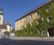
Jakob Brauereigasthof
Videos from this area
These are videos related to the place based on their proximity to this place.
ZMT Automotive GmbH & Co. KG aus Bruck i.d.OPf. Promotion video HD
Die ZMT Automotive GmbH & Co. KG wurde am 01.10.2003 unter dem Nahmen ZBG Motorentechnik GmbH & Co. KG gegründet. Am 01.01.2013 änderten wir unseren Namen von ZBG Motorentechnik ...
Gyrocopter / Tragschrauber Landung in Nittenau Bruck -- EDNM
Fly-Around GbR www.fly-around.com Landung mit dem Gyrocopter / Tragschrauber MTOsport am Flugplatz Nittenau-Bruck - EDNM - nach einem faszinierenden Rundflug.
Gyrocopter take off at Nittenau-Bruck airfield for a scenic flight over the Upper Palatinate
my 400th flight.
A³D´s Doom 3 Playthrough Part 23 - Journey through Delta (3/6)
PART 23 Doom 3 Playthrough by acantophis3rd Journey through Delta Part 3.
Vuvuzela used as plant irrigation system
Using the Vuvuzela as the new Plant irrigation system on the amazing balcony with sea view.
Fukushima UPDATE : CONTRACTORS comp. hacked - Webs Weaves 26102011
r3volt23 26.10.2011 Thanks go to :msmilkytheclown AGENDA 21 Written by the UN... "Sustainable Development"... they need to reduce the population according to...
Minikamera MDV 100 - Radweg Regensburg-Falkenstein (alte Bahnlinie)
Fahrt auf heftigem "Geläuf" auf der alten Bahnlinie hinauf nach Falkenstein. Die Schläge und Unebenheiten werden durch die Federung nicht ganz von der Kamera am Tretausleger weggenommen.
Motorrad Tour Rund ums Regental 003
Teil 3 von 3. Von Ramspau über Karlstein und Schneitweg nach Regenstauf. Leicht Kurvige flache Bergstrecke mit geiler Abfahrtr nach Regenstauf.
Videos provided by Youtube are under the copyright of their owners.


