Safety Score: 3,0 of 5.0 based on data from 9 authorites. Meaning we advice caution when travelling to Germany.
Travel warnings are updated daily. Source: Travel Warning Germany. Last Update: 2024-04-27 08:23:39
Explore Grambach
Grambach in Upper Bavaria (Bavaria) is located in Germany about 345 mi (or 555 km) south of Berlin, the country's capital.
Local time in Grambach is now 05:14 PM (Saturday). The local timezone is named Europe / Berlin with an UTC offset of 2 hours. We know of 12 airports in the wider vicinity of Grambach, of which 5 are larger airports. The closest airport in Germany is Oberpfaffenhofen Airport in a distance of 25 mi (or 39 km), North-East. Besides the airports, there are other travel options available (check left side).
There are several Unesco world heritage sites nearby. The closest heritage site in Germany is Pilgrimage Church of Wies in a distance of 9 mi (or 14 km), South-West. We found 1 points of interest in the vicinity of this place. If you need a place to sleep, we compiled a list of available hotels close to the map centre further down the page.
Depending on your travel schedule, you might want to pay a visit to some of the following locations: Boebing, Hohenpeissenberg, Oberhausen, Rottenbuch and Bad Kohlgrub. To further explore this place, just scroll down and browse the available info.
Local weather forecast
Todays Local Weather Conditions & Forecast: 18°C / 65 °F
| Morning Temperature | 3°C / 38 °F |
| Evening Temperature | 15°C / 59 °F |
| Night Temperature | 7°C / 45 °F |
| Chance of rainfall | 0% |
| Air Humidity | 33% |
| Air Pressure | 1008 hPa |
| Wind Speed | Gentle Breeze with 6 km/h (4 mph) from North-West |
| Cloud Conditions | Clear sky, covering 5% of sky |
| General Conditions | Sky is clear |
Sunday, 28th of April 2024
22°C (71 °F)
10°C (50 °F)
Scattered clouds, gentle breeze.
Monday, 29th of April 2024
20°C (68 °F)
12°C (53 °F)
Sky is clear, light breeze, clear sky.
Tuesday, 30th of April 2024
24°C (75 °F)
13°C (55 °F)
Few clouds, gentle breeze.
Hotels and Places to Stay
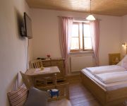
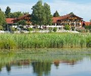
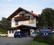
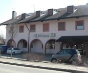
Gut Grasleiten
Parkhotel am Soier See
Gasthaus Sonne
Christophorus
Zum Metzgerwirt Landhotel
Landhaus am Soier See
Haslacher Landgasthof
Videos from this area
These are videos related to the place based on their proximity to this place.
Musikfest -Festzug -Blasmusik -Märsche Festwagen Trachtenfestzug
Festzug zum Musikfest 2012 Frieding Erling Andechs Musikbund in Rottenbuch Tei 2 -Oberland Trachtenfestzug Festwagen.
Aufzug einer Schauerlinie am 12. April 2011 nahe Rottenbuch
Aufzug einer Schauerlinie am 12. April 2011 nahe Rottenbuch.
Bierflaschen mit Zollstock öffnen
Bierflaschen mit Zollstock öffnen Rottenbuch Bier Zollstock Flaschen Zollstock.
Karlotta unterwegs: Mit Geocaching auf der Suche nach der gesunden Milch
Unter dem Motto Mehr Milch - mehr Spaß. Volle Kanne Leben! versucht eine Kampagne derzeit vor allem Kinder und Jugendliche über die wichtigen Nährstoffe in der Milch und ihre Wirkung aufzukläre ...
Kajak: Ammer Wehr mit Bootsrutsche bei Rottenburg (altes Klinikum)
Die Bootsrutsche beim alten Klinikum kurz vor dem Ausstieg an der Straßenbrücke Rottenburg. Die Rutsche ist von der Mitte aus etwas links im Fluss. Achtung bei Anfahrt am linken Ufer vor...
DJI Phantom GoPro - Nebel - Fog Hohenpeissenberg
Nebel am Hohenpeissenberg Fog at Hohenpeissenberg Hohenpeissenberg Bayern Bavaria Germany Relax Lean back Fog Phantom GoPro Zenmuse Quadrocopter.
DJI Phantom GoPro - Herbstfarben - Fall Colors Hohenpeissenberg
Hohenpeissenberg Bayern Bavaria Germany Fall Colors Relax Lean back Fog Phantom GoPro Zenmuse Quadrocopter.
Club Fred MTB - Tour 2014 rund um Hohenpeissenberg
Tagestour mit dem MTB von Weilheim über Paterzell nach Wessobrunn und weiter nach Kinsau. Von dort über den Nordanstieg zur Wallfahrtskirche mit seinen prächtigen für die 500-Jahrfeier...
FZ1 Fazer: Fast Country Tour / Schnelle Ortsrunde 263-
Short track highspeed ride (as usual) on a sunday evening. Nothing for fear hearted folks.
Videos provided by Youtube are under the copyright of their owners.
Attractions and noteworthy things
Distances are based on the centre of the city/town and sightseeing location. This list contains brief abstracts about monuments, holiday activities, national parcs, museums, organisations and more from the area as well as interesting facts about the region itself. Where available, you'll find the corresponding homepage. Otherwise the related wikipedia article.
Hoher Peißenberg
Hoher Peißenberg is a mountain of Bavaria, Germany.


