Safety Score: 3,0 of 5.0 based on data from 9 authorites. Meaning we advice caution when travelling to France.
Travel warnings are updated daily. Source: Travel Warning France. Last Update: 2024-05-04 08:22:41
Touring Leubringhen
Leubringhen in Pas-de-Calais (Hauts-de-France) with it's 261 residents is a town located in France about 141 mi (or 227 km) north of Paris, the country's capital place.
Time in Leubringhen is now 08:46 PM (Saturday). The local timezone is named Europe / Paris with an UTC offset of 2 hours. We know of 13 airports nearby Leubringhen, of which 5 are larger airports. The closest airport in France is Calais-Dunkerque Airport in a distance of 12 mi (or 20 km), North-East. Besides the airports, there are other travel options available (check left side).
There are several Unesco world heritage sites nearby. The closest heritage site is Canterbury Cathedral, St Augustine's Abbey, and St Martin's Church in United kingdom at a distance of 40 mi (or 65 km). The closest in France is Fortifications of Vauban in a distance of 60 mi (or 65 km), North-West. Need some hints on where to stay? We compiled a list of available hotels close to the map centre further down the page.
Being here already, you might want to pay a visit to some of the following locations: Calais, Boulogne-sur-Mer, Montreuil, Saint-Omer and Dunkerque. To further explore this place, just scroll down and browse the available info.
Local weather forecast
Todays Local Weather Conditions & Forecast: 13°C / 55 °F
| Morning Temperature | 8°C / 47 °F |
| Evening Temperature | 11°C / 53 °F |
| Night Temperature | 10°C / 51 °F |
| Chance of rainfall | 3% |
| Air Humidity | 74% |
| Air Pressure | 1012 hPa |
| Wind Speed | Gentle Breeze with 8 km/h (5 mph) from North-East |
| Cloud Conditions | Overcast clouds, covering 93% of sky |
| General Conditions | Light rain |
Sunday, 5th of May 2024
13°C (56 °F)
12°C (54 °F)
Scattered clouds, gentle breeze.
Monday, 6th of May 2024
13°C (55 °F)
12°C (53 °F)
Moderate rain, moderate breeze, overcast clouds.
Tuesday, 7th of May 2024
13°C (55 °F)
10°C (50 °F)
Light rain, moderate breeze, broken clouds.
Hotels and Places to Stay
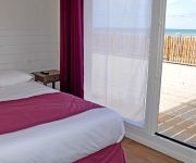
De la Baie Logis
Ferme du vert Logis
Holiday Inn CALAIS - COQUELLES
l'Haut'Aile INTER-HOTEL
Kyriad Calais Sud Coquelles
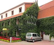
L' Escale Logis
Auberge du Colombier
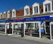
Hôtel Restaurant Le Vivier
Hôtel Le Vivier - vue mer
La Maison Blanche
Videos from this area
These are videos related to the place based on their proximity to this place.
La Fête du Flobart 2014 (Wissant), 26e édition
Fête du Flobart 2014, 26ème édition, le 31 août 2014, à Wissant (Pas de Calais, Pays du Boulonnais). Retrouvez-nous sur Les Plus Beaux Villages du Nord-Pas de Calais : www.facebook.com/lesplus.
Fête du Flobart 2014 (Wissant), chant de marins...
Fête du Flobart 2014, chant de marins..., à Wissant (Pas de Calais, Pays du Boulonnais), le 31 août 2014. Retrouvez-nous sur Les Plus Beaux Villages du Nord-Pas de Calais : www.facebook.com/lesp.
Kite Wissant août 2012
Session kite 26 août 2012 à Wissant 15-20 noeuds Matos: Naish Torch 2012 9m², Naish Thorn full carbon 2009 130*39 Rider: Nico.
5 JAN 2010 FRANCE PAS-DE-CALAIS WISSANT SOUS LA NEIGE PART 2/2
A partir de 16.00H la neige change Wissant dans un décor féérique....
Boulogne-Aéroglisseur à la fête du Flobart à WIssant
Découvrez de nouvelles sensations lors d'un vol sur terre et sur l'eau. Vous propose des baptêmes et diverses prestations avec ses deux aéroglisseurs, de type Vortex 4+ : BATISSE et ZABELLE....
WTC jabbeke : winterrit Wissant 2013.wmv
WTC Jabbeke : MTB winterrit @ Wissant 17/02/2013 (Bullet HD PRO)
Videos provided by Youtube are under the copyright of their owners.
Attractions and noteworthy things
Distances are based on the centre of the city/town and sightseeing location. This list contains brief abstracts about monuments, holiday activities, national parcs, museums, organisations and more from the area as well as interesting facts about the region itself. Where available, you'll find the corresponding homepage. Otherwise the related wikipedia article.
V-3 cannon
The V-3 was a German World War II supergun working on the multi-charge principle whereby secondary propellant charges are fired to add velocity to a projectile. The weapon was planned to be used to bombard London from two large bunkers in the Pas-de-Calais region of northern France, but they were rendered unusable by Allied bombing raids before completion. Two similar guns were used to bombard Luxembourg from December 1944 to February 1945.
Saint-Inglevert Airfield
Saint-Inglevert Airfield is a general aviation airfield at Saint-Inglevert, Pas-de-Calais, France. In the First World War an airfield was established near Saint-Inglevert by the Royal Flying Corps, later passing to the Royal Air Force on formation and thus becoming RAF Saint Inglevert. In 1920, a civil airfield was established on a different site which was a designated customs airfield. During the Second World War, Saint-Inglevert was occupied by the Royal Air Force and the Armée de l'Air.


