Safety Score: 3,0 of 5.0 based on data from 9 authorites. Meaning we advice caution when travelling to France.
Travel warnings are updated daily. Source: Travel Warning France. Last Update: 2024-05-19 08:11:23
Discover Dar
Dar in Allier (Auvergne-Rhône-Alpes) is a place in France about 169 mi (or 272 km) south of Paris, the country's capital city.
Current time in Dar is now 06:30 AM (Monday). The local timezone is named Europe / Paris with an UTC offset of 2 hours. We know of 12 airports near Dar, of which 4 are larger airports. The closest airport in France is Montluçon-Domérat Airport in a distance of 23 mi (or 37 km), West. Besides the airports, there are other travel options available (check left side).
There are several Unesco world heritage sites nearby. The closest heritage site in France is Bourges Cathedral in a distance of 53 mi (or 85 km), North-West. If you need a hotel, we compiled a list of available hotels close to the map centre further down the page.
While being here, you might want to pay a visit to some of the following locations: Moulins, Montlucon, Vichy, Nevers and Riom. To further explore this place, just scroll down and browse the available info.
Local weather forecast
Todays Local Weather Conditions & Forecast: 19°C / 65 °F
| Morning Temperature | 11°C / 52 °F |
| Evening Temperature | 16°C / 61 °F |
| Night Temperature | 11°C / 52 °F |
| Chance of rainfall | 4% |
| Air Humidity | 68% |
| Air Pressure | 1008 hPa |
| Wind Speed | Gentle Breeze with 6 km/h (4 mph) from North-East |
| Cloud Conditions | Overcast clouds, covering 86% of sky |
| General Conditions | Light rain |
Tuesday, 21st of May 2024
16°C (60 °F)
13°C (55 °F)
Light rain, gentle breeze, overcast clouds.
Wednesday, 22nd of May 2024
14°C (57 °F)
11°C (52 °F)
Light rain, gentle breeze, overcast clouds.
Thursday, 23rd of May 2024
18°C (64 °F)
11°C (52 °F)
Light rain, light breeze, overcast clouds.
Hotels and Places to Stay
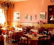
hôtel du Commerce
Videos from this area
These are videos related to the place based on their proximity to this place.
The Robert Louis Stevenson Trail Begins, France
http://www.TravelsWithSheila.com Robert Louis Stevenson of "Dr. Jekyll & Mr. Hyde" and "Treasure Island" fame was mentally in a bad place and decided a possible cure would be to walk across...
BANDE Annonce EXTREME OPS (PART 2 )
la bande annonce du petit film EXTREME OPS ( PART 2) réalisé par CRAZY RIDERS & P 13.
Test vidéo Nikon D750
Vidéo de test réalisé avec un Nikon D750 et 3 objectifs, Nikkor 16-35mm, Tamron 24-70mm f2.8 et Tamron 70-200mm f2.8. L'appareil à été utilisé avec les réglages de base en 1080i et...
Noyant d'Allier Année Vietnam 2014
2014 a été décrétée « année du Vietnam en France »." Dans ce cadre, deux ensembles vietnamiens étaient présents à Noyant : les « Gong » le 15 juillet et les « Len dong » le...
Château de Fontariol O3240 LE THEIL
La visite intérieure de ce petit château, inhabituel par la modestie de son architecture et de son intérieur, propose de faire revivre les us et coutumes de jadis. Membre de la Route Historique...
Videos provided by Youtube are under the copyright of their owners.
Attractions and noteworthy things
Distances are based on the centre of the city/town and sightseeing location. This list contains brief abstracts about monuments, holiday activities, national parcs, museums, organisations and more from the area as well as interesting facts about the region itself. Where available, you'll find the corresponding homepage. Otherwise the related wikipedia article.
Château de Montbillon
The Château de Montbillon is a château in Saint-Sornin in the Allier départment in the Auvergne region of France.
Château de Laly
The Château de Laly is a château or manor-house in Le Montet in the Allier départment in the Auvergne Region of France.
Château de la Lande
The Château de la Lande is a castle in Rocles in the Allier départment in the Auvergne Region of France.
Canton of Le Montet
The canton of Le Montet is an administrative division in central France. It includes the following communes: Commune Inhabitants Postal code INSEE code Châtel-de-Neuvre 515 03500 03065 Châtillon 277 03210 03069 Cressanges 670 03240 03092 Deux-Chaises 414 03240 03099 Meillard 280 03500 03169 Le Montet 502 03240 03183 Rocles 373 03240 03214 Saint-Sornin 225 03240 03260 Le Theil 413 03240 03281 Treban 369 03240 03287 Tronget 928 03240 03292


