Explore Bells Beach
The district Bells Beach of Bellbrae in Surf Coast (Victoria) is located in Australia about 344 mi south-west of Canberra, the country's capital.
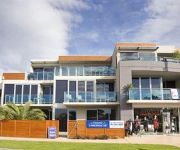
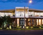
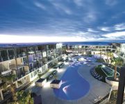
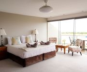
If you need a place to sleep, we compiled a list of available hotels close to the map centre further down the page.
Depending on your travel schedule, you might want to pay a visit to some of the following locations: Melbourne, Currie, Hay, Loxton and . To further explore this place, just scroll down and browse the available info.
Local weather forecast
Todays Local Weather Conditions & Forecast: 19°C / 66 °F
| Morning Temperature | 10°C / 49 °F |
| Evening Temperature | 14°C / 58 °F |
| Night Temperature | 15°C / 58 °F |
| Chance of rainfall | 0% |
| Air Humidity | 31% |
| Air Pressure | 1022 hPa |
| Wind Speed | Gentle Breeze with 9 km/h (5 mph) from South-East |
| Cloud Conditions | Broken clouds, covering 75% of sky |
| General Conditions | Broken clouds |
Monday, 29th of April 2024
14°C (57 °F)
12°C (53 °F)
Light rain, gentle breeze, overcast clouds.
Tuesday, 30th of April 2024
13°C (56 °F)
13°C (55 °F)
Overcast clouds, moderate breeze.
Wednesday, 1st of May 2024
16°C (60 °F)
12°C (54 °F)
Sky is clear, moderate breeze, clear sky.
Hotels and Places to Stay
RACV Torquay Resort
Bell Street Apartments Torquay
Great Ocean Road Resort
Anglesea River Apartments
Whitewater Apartments
Four Kings Apartments
WYNDHAM RESORT TORQUAY
Whitesbeach Guesthouse
Torquay Foreshore Caravan Park
Surf City Motel
Videos from this area
These are videos related to the place based on their proximity to this place.
Steep hill at Anglesea: trail riding and FJ60 landruisers
The boys and I headed down to anglesea heath to do some trail riding. Came across a extremely steap hill and thought i would have a go. Didn't make it, it had been a long day and wasn't concentrati...
ANGLESEA BIKE PARK NEW GENERATION
TWO UP AND COMING YOUNG BIKE RIDERS FROM THE ANGLESEA AREA RIDING AT THE 4CROSS TRACK SURFCOAST DOINIT PRODUCTIONS.
ANGLESEA BIKE PARK RIDE DAY 2008
four cross and dirt jumping competition at the anglesea bike park ride day.
Jason and Sams Stack at Anglesea - a YZ250F vs KTM 450EXC
This is a stack that Jason and Sam had a few weeks ago at Anglesea. Jason was following Dave who threw a lot of dust up avoiding some downed logs. Jason missed the turn due to the dust and...
ANGLESEA BIKE PARK LOG RIDE
a look at the first stage of the log track at the Anglesea bike park Australia.
Longest log feature in Australia?
Long log feature at the Anglesea Bike Park in Victoria. Australia isn't big on mountain biking wood work, so this might be the longest skinny in the country??
Gopro: Small Surf Point Roadknight
14.1.15 Small day at Point Roadknight, Anglesea on my 9' 1" Island Surfboard. My first attempt at using a Gopro. Also my first video Point Roadknight Surf Report: http://magicseaweed.com/Point-Roa...
Videos provided by Youtube are under the copyright of their owners.
Attractions and noteworthy things
Distances are based on the centre of the city/town and sightseeing location. This list contains brief abstracts about monuments, holiday activities, national parcs, museums, organisations and more from the area as well as interesting facts about the region itself. Where available, you'll find the corresponding homepage. Otherwise the related wikipedia article.
Aireys Inlet
Aireys Inlet is a small coastal inlet and town located on the Great Ocean Road, southwest of Melbourne, Victoria, Australia. Aireys Inlet is located between Anglesea and Lorne, and joined with Fairhaven to the west. At the 2006 census, Aireys Inlet had a population of 1,148. Many surfers holiday in Aireys Inlet to take advantage of the popular Fairhaven beach. As the inclination of the beach can change dramatically between years, the surf is regarded as unpredictable.
Bells Beach, Victoria
Bells Beach is a coastal locality of Victoria, Australia in Surf Coast Shire and a renowned surf beach, located 100 km south-west of Melbourne, on the Great Ocean Road near the towns of Torquay and Jan Juc. It is named after John Cavert Bell of the family that first took up a pastoral run there in the 1840s.
Torquay, Victoria
Torquay is a township in Victoria, Australia, which faces Bass Strait, 21 km. south of Geelong and is the gateway to the Great Ocean Road. It is bordered on the west by Spring Creek and its coastal features include Point Danger and Zeally Bay. At the 2006 census, Torquay had a population of 6,695.
Offshore Festival
The Offshore Festival was a camp-out rock and alternative music festival held during Easter at a farm near Torquay, Victoria, Australia in the late 1990s, 2000 and 2001. It was run by the same organisers as the Falls Festival, held at nearby Lorne on New Year's Eve. It interlinked with the major Rip Curl Pro surfing event, held at nearby Bells Beach. The policy reason behind starting the festival was to keep the youth entertained and off the streets of Torquay while the contest was on.
Waurn Ponds, Victoria
Waurn Ponds is a mainly residential southern suburb of Geelong, Victoria, Australia. The suburb is bounded by Rossack Drive, Princes Highway, the Geelong to Warnambool railway, Reservoir Road, Draytons Road, Pigdons Road, Deakin University and Honeys Road.
Jan Juc, Victoria
Jan Juc is a coastal town of Victoria, Australia, adjacent to Torquay, Victoria. At the 2006 census, Jan Juc had a population of 3,158.
Anglesea, Victoria
Anglesea is a town in Victoria, Australia. It is located on the Great Ocean Road in the Surf Coast Shire local government area. At the 2006 census, Anglesea had a population of 2,290. Originally known as Swampy Creek, the area's name was changed to Anglesea River in 1884 when the township was established. A Post Office under that name opened on 16 April 1886 and was renamed Anglesea in 1950. Alcoa of Australia operate a power station and open-cut coalmine in the town.
Mount Duneed, Victoria
Mount Duneed is a suburb of Geelong, Victoria, Australia. The Geelong Airport is located in Mount Duneed. Though the airport continues to operate, the site is for sale as of July 2005, and it appears likely that it will be demolished to make way for housing. Much of the locality north of Lower Duneed Road is part of the large Armstrong Creek Growth Area with urban development beginning in 2010.
Moriac, Victoria
Moriac is a rural town in Victoria, Australia, located approximately 25 kilometres west of Geelong. It forms part of the Surf Coast Shire. At the 2006 census, Moriac had a population of 594. The town was surveyed in the 1920s as a village based around the Moriac railway station on the Port Fairy line. The station had been provided to serve the adjacent community of Mount Moriac.
Moriac railway station
Moriac is a closed station located in the town of Moriac, on the Warrnambool railway line in Victoria, Australia. Remaining facilities include a bluestone platform, with a timber goods platform opposite. Moriac was the junction of the short branch line south to Wensleydale which opened in 1889, and was closed in 1948. The station was one of 35 closed to passenger traffic on 4 October 1981, as part of the New Deal timetable for country passengers.
Connewarre, Victoria
Connewarre, Victoria, Australia, is located in southern Australia in an area that is sparsely populated. At the 2006 census, Connewarre and the surrounding area had a population of 78. Part of Eastern Precinct of the large Armstrong Creek Growth Area was within Connewarre when urban development began in 2010.
Breamlea, Victoria
Breamlea, Victoria, Australia, is a secluded seaside hamlet located 18 km south of Geelong on the south coast of Australia halfway between Barwon Heads and Torquay on the Bellarine Peninsula. At the 2006 census, Breamlea and the surrounding area had a population of 244.
Grovedale College
Grovedale College (formerly known as Grovedale Secondary College) is an Australian public high school located in Grovedale, Victoria, a suburb in the city of Geelong. It was established in 1979 and as Grovedale Technical High School. Under the guidance of the founding principal Mr R "Roly" Arnup the new school prospered and developed a unique status at the time as a model of progressive education.
Point Impossible Beach
Point Impossible Beach is a clothes-optional beach located at Torquay, west coast, in the State of Victoria, Australia. It is designated as a legal nudist beach under the Nudity (Prescribed Areas) Act 1983.
Southside Beach
Southside Beach is a clothes-optional beach located near Torquay, in the State of Victoria, Australia. It is designated as a legal nudist beach under Nudity (Prescribed Areas) Act 1983.
Shire of Barrabool
The Shire of Barrabool was a local government area about 100 kilometres southwest of Melbourne, the state capital of Victoria, Australia. The shire covered an area of 575.18 square kilometres, and existed from 1853 until 1994.
Joseph H. Scammell (ship)
The Joseph H Scammell was a Canadian sailing ship that was built at Eatonville, Nova Scotia in 1884 and shipwrecked at Point Danger, Torquay, Victoria, Australia in 1891. Her wreck triggered a large scale episode of shipwreck pilfering and smuggling.
Anglesea Heath
Anglesea Heath is a 72 km area of natural heath, woodland and forest in Victoria, south-eastern Australia. It is about 100 km south-west of Melbourne, just north of the coastal town of Anglesea and accessible from the Great Ocean Road. It comprises 67 km of land managed for conservation and 5 km of land used for coal mining and power generation at the Anglesea Power Station by Alcoa Australia.
Bellbrae, Victoria
Bellbrae is a bounded rural locality in Victoria, Australia located on the Great Ocean Road between Torquay and Anglesea. At the 2006 census, Bellbrae had a population of 1,388.
Reedy Lake
Reedy Lake, historically also known as Lake Reedy, is a shallow 5.5 km freshwater lake or swamp on the lower reaches of the Barwon River, on the Bellarine Peninsula near the city Geelong, Victoria, Australia. It is included in the Lake Connewarre State Game Reserve, which is managed by Parks Victoria. It is the largest freshwater swamp in central Victoria, and is part of a wetland complex which includes Hospital Swamp, Lake Connewarre, Salt Swamp and the Barwon estuary.
Armstrong Creek Growth Area
The Armstrong Creek Growth Area is a southern extension to the urban growth boundary of the metropolitan area of Geelong, Victoria, Australia. It comprises parts of the localities of Grovedale and Marshall south of the Warrnambool railway line, and parts of the localities of Mount Duneed and Connewarre from some distance to the north of Lower Duneed Road and generally to the west of Barwon Heads Road.
Anglesea River
The Anglesea River is a river in southwestern Victoria, Australia. It arises in the Otway Ranges and enters Bass Strait through the town of the same name. The river was named named after Anglesey, an island in Wales .
Point Addis Marine National Park
Point Addis Marine National Park is a 4,600-hectare marine park near Anglesea, Victoria, Australia. It extends along 10 kilometres of coastline east of Anglesea, around Point Addis to the eastern end of Bells Beach and offshore three nautical miles to the limit of Victorian waters.
Point Danger (Torquay)
Point Danger is a limestone headland on the coast of south-western Victoria, Australia on the northern side of Bass Strait. It is adjacent to the coastal town of Torquay, separating the town’s front and back surfing beaches. It is the site of Torquay’s war memorial and a venue for ANZAC Day services.


