Discover Jan Juc
The district Jan Juc of Bellbrae in Surf Coast (Victoria) is a district in Australia about 341 mi south-west of Canberra, the country's capital city.
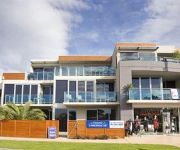
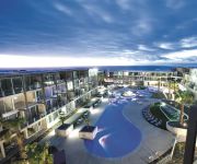
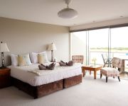
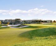
Looking for a place to stay? we compiled a list of available hotels close to the map centre further down the page.
When in this area, you might want to pay a visit to some of the following locations: Melbourne, Currie, Hay, Loxton and . To further explore this place, just scroll down and browse the available info.
Local weather forecast
Todays Local Weather Conditions & Forecast: 17°C / 62 °F
| Morning Temperature | 7°C / 44 °F |
| Evening Temperature | 11°C / 53 °F |
| Night Temperature | 10°C / 51 °F |
| Chance of rainfall | 0% |
| Air Humidity | 49% |
| Air Pressure | 1026 hPa |
| Wind Speed | Light breeze with 4 km/h (2 mph) from East |
| Cloud Conditions | Clear sky, covering 0% of sky |
| General Conditions | Sky is clear |
Sunday, 28th of April 2024
19°C (66 °F)
15°C (58 °F)
Broken clouds, gentle breeze.
Monday, 29th of April 2024
14°C (57 °F)
12°C (53 °F)
Light rain, gentle breeze, overcast clouds.
Tuesday, 30th of April 2024
13°C (56 °F)
13°C (55 °F)
Overcast clouds, moderate breeze.
Hotels and Places to Stay
RACV Torquay Resort
Bell Street Apartments Torquay
Whitewater Apartments
WYNDHAM RESORT TORQUAY
Whitesbeach Guesthouse
Two Bays Apartments
Beach & Golf Stays Torquay
Peppers The Sands Resort
Torquay Foreshore Caravan Park
Torquay Tropicana Motel
Videos from this area
These are videos related to the place based on their proximity to this place.
Spring Valley Bike Park - Torquay, Victoria
Still on the hunt for new riding locations we hit up the Torquay (Spring Valley) Bike Park. It's got something for just about everyone, although the step from the intermediate to expert run...
Torquay / Phillip island surf trip
The weather and the surf report wasn't looking too great but we still decided to venture out and catch a few waves at Smiths beach in Phillip Island and the Torquay surf beach.
Saltair Spa Retreat, Torquay, Victoria
Treat yourself to the ultimate day spa experience at Saltair Spa Retreat's luxurious spa resort, set in the idylic surrounds of Torquay, Victoria. This is the perfect setting to relax, unwind...
FISHEYE
Torquay hammer fisheye sesh with my new trv-900 with baby death MK2 STARRING. *DANIEL CHICK *ANTHONY DAVIE *KRISTIAN WILD *DEAN BROOKES *JAMIE HARMER WASHED UP HYPE.
JOCO cups and Otis & Otto DIY Collaboration 2014
Part 1 : JOCO glass reusable cups and Otis & Otto (www.otisandotto.com) collaborated to create a drawstring carry bag for your daily essentials and JOCO cup. Visit the JOCO blog to download...
Searching for Australia's Deadly Tiger Snake
This is our pilot movie of a potential film series my sister and I want to create, called "The Adventures of the Huber Sisters". Depending on viewer ratings, there will be more. Please let...
Videos provided by Youtube are under the copyright of their owners.
Attractions and noteworthy things
Distances are based on the centre of the city/town and sightseeing location. This list contains brief abstracts about monuments, holiday activities, national parcs, museums, organisations and more from the area as well as interesting facts about the region itself. Where available, you'll find the corresponding homepage. Otherwise the related wikipedia article.
Bells Beach, Victoria
Bells Beach is a coastal locality of Victoria, Australia in Surf Coast Shire and a renowned surf beach, located 100 km south-west of Melbourne, on the Great Ocean Road near the towns of Torquay and Jan Juc. It is named after John Cavert Bell of the family that first took up a pastoral run there in the 1840s.
Torquay, Victoria
Torquay is a township in Victoria, Australia, which faces Bass Strait, 21 km. south of Geelong and is the gateway to the Great Ocean Road. It is bordered on the west by Spring Creek and its coastal features include Point Danger and Zeally Bay. At the 2006 census, Torquay had a population of 6,695.
Offshore Festival
The Offshore Festival was a camp-out rock and alternative music festival held during Easter at a farm near Torquay, Victoria, Australia in the late 1990s, 2000 and 2001. It was run by the same organisers as the Falls Festival, held at nearby Lorne on New Year's Eve. It interlinked with the major Rip Curl Pro surfing event, held at nearby Bells Beach. The policy reason behind starting the festival was to keep the youth entertained and off the streets of Torquay while the contest was on.
Deakin University School of Law
The Deakin University School of Law operates at Geelong, Melbourne and Warrnambool campuses. It is part of Deakin University. Deakin’s LLB degree has a strong commercial focus, with an international orientation, enabling Deakin law graduates to undertake legal work in a wide range of settings whether in Australia or abroad.
Grovedale, Victoria
Grovedale is a mainly residential southern suburb of Geelong, Victoria, Australia. The suburb is bounded by the Waurn Ponds Creek, Rossack Drive, Boundary Road and Barwarre Road.
Waurn Ponds, Victoria
Waurn Ponds is a mainly residential southern suburb of Geelong, Victoria, Australia. The suburb is bounded by Rossack Drive, Princes Highway, the Geelong to Warnambool railway, Reservoir Road, Draytons Road, Pigdons Road, Deakin University and Honeys Road.
Jan Juc, Victoria
Jan Juc is a coastal town of Victoria, Australia, adjacent to Torquay, Victoria. At the 2006 census, Jan Juc had a population of 3,158.
Anglesea, Victoria
Anglesea is a town in Victoria, Australia. It is located on the Great Ocean Road in the Surf Coast Shire local government area. At the 2006 census, Anglesea had a population of 2,290. Originally known as Swampy Creek, the area's name was changed to Anglesea River in 1884 when the township was established. A Post Office under that name opened on 16 April 1886 and was renamed Anglesea in 1950. Alcoa of Australia operate a power station and open-cut coalmine in the town.
Mount Duneed, Victoria
Mount Duneed is a suburb of Geelong, Victoria, Australia. The Geelong Airport is located in Mount Duneed. Though the airport continues to operate, the site is for sale as of July 2005, and it appears likely that it will be demolished to make way for housing. Much of the locality north of Lower Duneed Road is part of the large Armstrong Creek Growth Area with urban development beginning in 2010.
Deakin University School of Medicine
Deakin University School of Medicine is a medical school of Deakin University based in at the Waurn Ponds campus in Geelong, Victoria, Australia. It offers a four year, graduate-entry, Bachelor of Medicine / Bachelor of Surgery (BMBS) degree. On 8 April 2006, the Prime Minister of Australia, John Howard announced that Deakin University would host Victoria's third medical school.
Reformed Theological College
The Reformed Theological College (RTC) is the theological college supported by the Christian Reformed Churches of Australia, the Reformed Churches of New Zealand and the Reformed Presbyterian Church of Australia. It is located in at Waurn Ponds, Geelong, Victoria, next to Deakin University. RTC accredited through the Australian College of Theology and is a member of the South Pacific Association of Bible Colleges. RTC has published the Vox Reformata annual journal since 1962.
Connewarre, Victoria
Connewarre, Victoria, Australia, is located in southern Australia in an area that is sparsely populated. At the 2006 census, Connewarre and the surrounding area had a population of 78. Part of Eastern Precinct of the large Armstrong Creek Growth Area was within Connewarre when urban development began in 2010.
Breamlea, Victoria
Breamlea, Victoria, Australia, is a secluded seaside hamlet located 18 km south of Geelong on the south coast of Australia halfway between Barwon Heads and Torquay on the Bellarine Peninsula. At the 2006 census, Breamlea and the surrounding area had a population of 244.
Grovedale College
Grovedale College (formerly known as Grovedale Secondary College) is an Australian public high school located in Grovedale, Victoria, a suburb in the city of Geelong. It was established in 1979 and as Grovedale Technical High School. Under the guidance of the founding principal Mr R "Roly" Arnup the new school prospered and developed a unique status at the time as a model of progressive education.
Marcus Oldham College
Marcus Oldham College is an agricultural and farm management institution located in Geelong, Victoria and is the only private agricultural college operating in Australia. Founded in 1962, the institution attracts enrolments from domestic and international students.
Point Impossible Beach
Point Impossible Beach is a clothes-optional beach located at Torquay, west coast, in the State of Victoria, Australia. It is designated as a legal nudist beach under the Nudity (Prescribed Areas) Act 1983.
Southside Beach
Southside Beach is a clothes-optional beach located near Torquay, in the State of Victoria, Australia. It is designated as a legal nudist beach under Nudity (Prescribed Areas) Act 1983.
Christian College, Geelong
Christian College is an P-12 independent school located over four campuses in Geelong, Victoria, Australia. Three campuses are located in suburban Geelong: the Senior Campus at Waurn Ponds (Year 10-12), the Middle School in Highton (Year 5-9), and the Junior School in Belmont (Prep - Year 4), while the Bellarine Campus in located in Drysdale (Prep- Year 9).
Shire of Barrabool
The Shire of Barrabool was a local government area about 100 kilometres southwest of Melbourne, the state capital of Victoria, Australia. The shire covered an area of 575.18 square kilometres, and existed from 1853 until 1994.
Joseph H. Scammell (ship)
The Joseph H Scammell was a Canadian sailing ship that was built at Eatonville, Nova Scotia in 1884 and shipwrecked at Point Danger, Torquay, Victoria, Australia in 1891. Her wreck triggered a large scale episode of shipwreck pilfering and smuggling.
Geelong Baseball Park
The Geelong Baseball Centre or Geelong Baseball Park is home to Geelong Baseball Club in Geelong, Victoria during summer and the Guild Allstars Baseball Club during the winter season. In total the Geelong Baseball Centre has four playing fields, with the main diamond being one of the only international standard baseball ballparks in Australia.
Bellbrae, Victoria
Bellbrae is a bounded rural locality in Victoria, Australia located on the Great Ocean Road between Torquay and Anglesea. At the 2006 census, Bellbrae had a population of 1,388.
Armstrong Creek Growth Area
The Armstrong Creek Growth Area is a southern extension to the urban growth boundary of the metropolitan area of Geelong, Victoria, Australia. It comprises parts of the localities of Grovedale and Marshall south of the Warrnambool railway line, and parts of the localities of Mount Duneed and Connewarre from some distance to the north of Lower Duneed Road and generally to the west of Barwon Heads Road.
Point Addis Marine National Park
Point Addis Marine National Park is a 4,600-hectare marine park near Anglesea, Victoria, Australia. It extends along 10 kilometres of coastline east of Anglesea, around Point Addis to the eastern end of Bells Beach and offshore three nautical miles to the limit of Victorian waters.
Point Danger (Torquay)
Point Danger is a limestone headland on the coast of south-western Victoria, Australia on the northern side of Bass Strait. It is adjacent to the coastal town of Torquay, separating the town’s front and back surfing beaches. It is the site of Torquay’s war memorial and a venue for ANZAC Day services.


