Touring South Geelong
The district South Geelong of in Greater Geelong (Victoria) is a subburb located in Australia about 331 mi south-west of Canberra, the country's capital place.
Need some hints on where to stay? We compiled a list of available hotels close to the map centre further down the page.
Being here already, you might want to pay a visit to some of the following locations: Melbourne, Currie, Hay, Loxton and . To further explore this place, just scroll down and browse the available info.
Local weather forecast
Todays Local Weather Conditions & Forecast: 17°C / 62 °F
| Morning Temperature | 7°C / 44 °F |
| Evening Temperature | 11°C / 53 °F |
| Night Temperature | 10°C / 51 °F |
| Chance of rainfall | 0% |
| Air Humidity | 49% |
| Air Pressure | 1026 hPa |
| Wind Speed | Light breeze with 4 km/h (2 mph) from East |
| Cloud Conditions | Clear sky, covering 0% of sky |
| General Conditions | Sky is clear |
Sunday, 28th of April 2024
19°C (66 °F)
15°C (58 °F)
Broken clouds, gentle breeze.
Monday, 29th of April 2024
14°C (57 °F)
12°C (53 °F)
Light rain, gentle breeze, overcast clouds.
Tuesday, 30th of April 2024
13°C (56 °F)
13°C (55 °F)
Overcast clouds, moderate breeze.
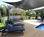
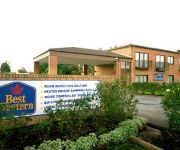
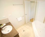
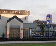
Hotels and Places to Stay
VUE APARTMENTS
Barwon Valley Lodge
Rose Garden Motel
BEST WESTERN GEELONG MOTOR
QUEST GEELONG
Discovery Parks – Geelong
BW ADMIRALTY MOTOR
Gateway Hotel
Golden Palms Motel
Parkwood Motel and Apartments
Videos from this area
These are videos related to the place based on their proximity to this place.
Geelong City Fire Station Tour
CFA Fire Officer Mark Sinkinson takes us on a tour of the new Geelong City Fire Station.
V/line trains through the South Geelong Tunnel 2/6/13
The South Geelong Tunnel opened to traffic in 1876. The tunnel carries trains on a 1 in 50 grade under a built-up area immediately out of Geelong station, and these days sees quite a lot of...
Ghost Research International - Old Geelong Gaol Dec 2007
A walk around the Old Geelong Gaol with a Thermal Imaging Camera during the December 2007 investigation at the Old Geelong Gaol in Geelong Victoria by Ghost Research International. For more...
Dietitian Geelong | Nutritionist Geelong | Rachel Jeffery
Dietitian Geelong, Rachel Jeffery an Accredited Practising Dietitian and Nutritionist http://www.racheljeffery.com now consulting in the Geelong CBD. My business details are: Latrobe Health...
Geelong Hair Salon - Looking for a Geelong Hair Salon or Hairdresser?
Geelong Hair Salon - http://www.VideoMarketingPartners.com - Looking for a Geelong Hair Salon or a Geelong Hairdresser? When it comes to Geelong Hair Salons there are plenty to chose from....
Geelong All Ford Day Time Lapse 2015
Filmed this at the All Ford Day Geelong with a Gopro Hero 3 mounted to a 6metre Skypod. Filmed over a period of 4 hours. Video sped up 21x www.ozstang.com.
Quintana - Geelong Cover Band
Quintana Here is the Demo for Geelong/Melbourne based cover band Quintana. We play at weddings, parties, wineries, venues, or wherever. Contact us if you would like to make a booking! We...
Deakin Uni, waurn ponds campus, Geelong, Australia
Deakin Uni waurn ponds campus (video and pictures) captured by iPhone 4s. Geelong Waurn Ponds Campus is located on the western edge of Geelong. The campus features expansive landscaped ...
Videos provided by Youtube are under the copyright of their owners.
Attractions and noteworthy things
Distances are based on the centre of the city/town and sightseeing location. This list contains brief abstracts about monuments, holiday activities, national parcs, museums, organisations and more from the area as well as interesting facts about the region itself. Where available, you'll find the corresponding homepage. Otherwise the related wikipedia article.
Geelong
Geelong is a port city located on Corio Bay and the Barwon River, in the state of Victoria, Australia, 75 kilometres south-west of the state capital, Melbourne. It is the second most populated city in Victoria and the fifth most populated non-capital city in Australia. The urban area runs from the plains of Lara in the north to the rolling hills of Waurn Ponds to the south, with the bay to the east and hills to the west, an area with an estimated population of 160,891 people.
City of Greater Geelong
The City of Greater Geelong is a local government area in Victoria, Australia. It is located in the western part of the state, south-west of Melbourne. It has an area of 1,240 square kilometres. In 2011 it had a population of 210,000. The council chambers are located at the Civic Conference and Reception Centre, a part of the Geelong Town Hall in central Geelong.
Kardinia Park (stadium)
Kardinia Park (currently known as Simonds Stadium due to naming rights) is an Australian rules football stadium located in South Geelong, Victoria. The stadium is the home ground of the Geelong Football Club. It is nicknamed "The Cattery" by the club's supporters. Due to redevelopments, the current capacity is 21,973, making it the smallest regularly used home ground in the Australian Football League. At the completion of the redevelopments, the capacity of the stadium will be 33,500.
HM Prison Geelong
HM Prison Geelong was a maximum security Australia prison located on the corner of Myers Street and Swanston Street in Geelong, Victoria, Australia. The prison was built in stages from 1849 to 1864. Its panopticon design is based on Pentonville Prison in England. The prison was officially closed in 1991 and prisoners were moved to the newly built HM Prison Barwon in Lara.
St Albans Park, Victoria
St. Albans Park is a residential eastern suburb of Geelong, Victoria. It is bounded by Boundary Road (West) Coppards Road (East) Townsend Road (North) and the Barwon River (South). The suburbs that surround it are Whittington, Breakwater, Moolap and Marshall. The suburb extends around the St. Albans Homestead and stud, a historic house and accompanying stables.
South Geelong, Victoria
South Geelong, also referred to as Geelong South, is a residential and industrial southern suburb of Geelong, Victoria, Australia. The suburb is adjacent to the Geelong central business district, with the Barwon River forming the suburb's southern border. South Geelong is also the western end-point for the Bellarine Rail Trail, a 32 km walking and cycling track to Queenscliff.
South Geelong railway station
South Geelong is a railway station on the Geelong railway line in South Geelong, Victoria, Australia. It is 76 km from Southern Cross station. South Geelong is the terminus for some V/Line services, and includes a run-around loop for locomotive-hauled services which terminate there. The station was once the junction for the branch line to Queenscliff, the route of which is now occupied by the Bellarine Rail Trail and the Bellarine Peninsula Railway.
Gordon Institute of TAFE
The Gordon Institute of TAFE is the TAFE institute servicing Geelong since 1888. It has 26,000 students studying on-campus, off-campus and in business or industry (2007). The Gordon has campuses in Geelong, Warrnambool, Victoria, Colac, Victoria, East Geelong, Victoria, Waurn Ponds, Victoria and Werribee, Victoria. It was named after General Charles George Gordon after his death at the Siege of Khartoum.
St Mary of the Angels Basilica
St. Mary of the Angels Basilica, formerly St. Mary's Church, is a basilica located in Yarra Street, Geelong, Victoria, Australia. Since the completion of the current he Gothic revival bluestone building in 1937 St Mary of the Angels has the tallest bluestone spire in Australia, at 150 feet and is the 4th tallest church (non-cathedral) in Australia. In 2004 it became Australia's fifth basilica upon gaining Vatican approval.
93.9 Bay FM
93.9 Bay FM is a commercial FM radio station based in Geelong, Victoria, Australia. It commenced broadcasting from an old industrial estate in Corio, Geelong in 1989. The Official starting date provided by broadcasting authorities was 10 December 1989, however former listeners have suggested that Bay FM broadcasting began on the afternoon of Friday 8 December 1989.
View of Geelong
Throughout this article, the $ symbol refers to the Australian dollar. View Of Geelong is an 1856 oil painting on canvas by Eugene von Guerard. The painting is currently owned by the City of Greater Geelong after being purchased from English composer Andrew Lloyd Webber for $3.8M. The purchase is the second highest ever for an Australian work of art, with the top being $5.3M paid by the National Gallery of Australia for a portrait of Captain James Cook by John Webber. http://www. heraldsun.
Market Square, Geelong
Market Square was a town square located in the centre of Geelong, Victoria, Australia. Consisting of eight acres (2.9 hectares) of land, the area was reserved by Governor Sir George Gipps as a town square during the initial surveying of Geelong. The area later became a produce market, before being progressively built upon. Today the Market Square Shopping Centre occupies the site, having been opened in 1985 by the City of Geelong.
City of Geelong
The City of Geelong was a local government area about 75 kilometres southwest of Melbourne, the state capital of Victoria, Australia. The city covered an area of 13.4 square kilometres, and existed from 1849 until 1994.
Geelong Hospital
The Geelong Hospital is an Australian public hospital located in Ryrie Street, Geelong, Victoria. The hospital is part of Barwon Health, Victoria's largest regional health care provider, which has 21 sites. It is the largest hospital in regional Victoria and the only tertiary hospital outside of the Melbourne Metropolitan area. The site is bounded by Ryrie, Bellarine, Myers, and Swanston Streets.
Matthew Flinders Girls Secondary College
Matthew Flinders Girls' Secondary College is an all-girls State secondary school located in Geelong, Victoria, Australia. It provides education for students years 7-12.
Geelong Town Hall
Geelong Town Hall is a civic building located on Gheringhap Street in central Geelong, Victoria. It was originally built for the City of Geelong, which became the City of Greater Geelong in 1993.
Market Square Shopping Centre
Market Square Shopping Centre is located in Geelong, Victoria, Australia. The shopping centre was named after the original town square of Geelong on which the shopping centre is constructed. The centre is surrounded by Little Malop, Moorabool, Malop, and Yarra Streets. Market Square is located on the southern side of Malop Street opposite the Westfield Geelong shopping complex.
T & G Building, Geelong
The T & G Building is a distinctive building in Geelong, Victoria, Australia. It is located on the corner of Moorabool and Ryrie Streets. Construction was announced by the T & G Mutual Life Assurance Society in June 1933, while Geelong was still suffering the effects of the Great Depression. It costed 37,000 pounds ($74,000) and was completed by 1934. The 'Father and Son' clock was installed near the top of the tower.
Geelong Art Gallery
The Geelong Art Gallery is a major regional gallery in the city of Geelong in Victoria, Australia. The gallery has approximately 4,000 works of art in its collection. The gallery forms Geelong's Arts Precinct with the adjacent Geelong Performing Arts Centre, Geelong Heritage Centre, Geelong Courthouse centre, and the Geelong Library.
Geelong Post Office building
The current Geelong Post Office opened in 1994 and is located on the corner of Gheringhap and Little Myers Streets. The original post office was located on the corner of Ryrie and Gheringhap Streets. The Geelong Telegraph Station was located next door.
Johnstone Park
Johnstone Park is a landscaped garden in Geelong, Victoria, Australia. It is bounded by Railway Terrace, Gheringhap Street, Little Malop Street, Fenwick Street, and Mercer Street. The park is surrounded by civic buildings including the Geelong Town Hall, Geelong Art Gallery, Geelong Library, Geelong Law Courts, and the Geelong Railway Station. A war memorial and bandstand feature in the centre of the park.
Geelong Performing Arts Centre
The Geelong Performing Arts Centre is a performing arts, functions, and events venue located in Geelong, Victoria, Australia. The centre has two major theatres, a number of smaller performance spaces, and a bar, restaurant and cafe. It is located between Little Malop and Ryrie Streets in central Geelong.
Geelong city centre, Victoria
The Geelong city centre (also referred to as the Central Activities Area by the City of Greater Geelong) is a locality surrounded by suburban Geelong. It is the oldest part of Geelong and includes many of the city's important landmarks such as the Geelong Town Hall, St. Mary of the Angels Basilica, the T & G Building, Johnstone Park and the Geelong Botanic Gardens, and the old Geelong Post Office.
Christ Church, Geelong
Christ Church is the oldest Anglican Church in Victoria, Australia, in continuous use on its original site.
3GPH
3GPH is a radio station based in Geelong, Victoria. It is part of the Vision Australia Radio network, a reading and information service for those persons unable to read or easily access information in print. The station is run and operated by volunteers. When not broadcasting local programs, the station is a relay of 3RPH in Melbourne.


