Safety Score: 2,7 of 5.0 based on data from 9 authorites. Meaning we advice caution when travelling to United States.
Travel warnings are updated daily. Source: Travel Warning United States. Last Update: 2024-04-28 08:22:10
Delve into Country Club
Country Club in Bronx County (New York) is a town located in United States about 217 mi (or 349 km) north-east of Washington DC, the country's capital town.
Time in Country Club is now 05:10 AM (Sunday). The local timezone is named America / New York with an UTC offset of -4 hours. We know of 9 airports closer to Country Club, of which 4 are larger airports. The closest airport in United States is La Guardia Airport in a distance of 5 mi (or 8 km), South-West. Besides the airports, there are other travel options available (check left side).
There are two Unesco world heritage sites nearby. The closest heritage site in United States is Statue of Liberty in a distance of 13 mi (or 20 km), South-West. Also, if you like the game of golf, there are some options within driving distance. We saw 10 points of interest near this location. In need of a room? We compiled a list of available hotels close to the map centre further down the page.
Since you are here already, you might want to pay a visit to some of the following locations: The Bronx, Manhattan, Queens, Mineola and White Plains. To further explore this place, just scroll down and browse the available info.
Local weather forecast
Todays Local Weather Conditions & Forecast: 18°C / 64 °F
| Morning Temperature | 10°C / 49 °F |
| Evening Temperature | 22°C / 71 °F |
| Night Temperature | 18°C / 65 °F |
| Chance of rainfall | 2% |
| Air Humidity | 60% |
| Air Pressure | 1022 hPa |
| Wind Speed | Gentle Breeze with 7 km/h (4 mph) from North-East |
| Cloud Conditions | Overcast clouds, covering 86% of sky |
| General Conditions | Moderate rain |
Sunday, 28th of April 2024
28°C (82 °F)
19°C (67 °F)
Light rain, moderate breeze, few clouds.
Monday, 29th of April 2024
16°C (60 °F)
10°C (51 °F)
Moderate rain, gentle breeze, overcast clouds.
Tuesday, 30th of April 2024
13°C (55 °F)
12°C (54 °F)
Light rain, gentle breeze, overcast clouds.
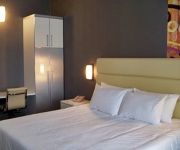
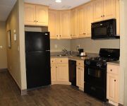
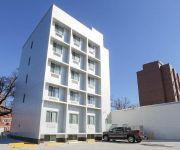
Hotels and Places to Stay
Sheraton LaGuardia East Hotel
an Ascend Hotel Collection Member Hotel de Point
Residence Inn New York The Bronx at Metro Center Atrium
Fairfield Inn New York LaGuardia Airport/Flushing
BW QUEENS COURT HOTEL
Marco LaGuardia Hotel by Lexington
Residence Inn New Rochelle
GRANDVIEW HOTEL NEW YORK
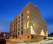
Super 8 Bronx
Explore NYC
Videos from this area
These are videos related to the place based on their proximity to this place.
Motorcycle Crash BRONX
So this one happened just hours ago... Middletown and Crosby Ave. Same intersection as the Bicycle Accident just a month ago? Action starts at the 3min 40sec mark. Seems the car was in the...
Community Chiropractic of Country Club - Short | Bronx, NY
http://bronxchiro.com/ - Call us today at (718) 829-9666. At Community Chiropractic of Country Club, we are committed to providing the best quality patient care available. We specialize in...
Super 8mm - Harpers at Pelham Bay Park in the Bronx - 1964
One day Mom got lost driving and we ended up at this undeveloped corner of Pelham Bay Park in the Bronx. It turned out to be a good place to let the boys and dogs blow off steam so we went...
MTA Bus Orion V#6023 Bx23 Bus/#6014 Q50 Limited Bus@Pelham Bay Park Station
Here's a pair of Orion V in action at Pelham Bay Park Station.#6023 on the Bx23 bus and #6014 Q50 Limited bus Train Transfers: 6 Train Bus Transfers:Bx5 Bus to West Farms Road Sothern Boulevard.
Orion VII NG #4408 Bx29 Bus@Pelham Bay Park Station
Here's an Orion VII NG #4408 on the Bx29 bus route in action at the Pelham Bay Park Station on its way to Co-Op City/Bay Plaza Shopping Center Train Transfers: 6 Train Bus Transfers:Bx5 Bus...
MTA Bus Bee-Line Orion V #180 Bx23 Bus@Pelham Bay Park Station
Here's a Bus Bee-Line Orion V#180 on the Bx23 bus in action at Pelham Bay Park Station Train Transfers: 6 Train Bus Transfers:Bx5 Bus to West Farms Road Sothern Boulevard via Bruckner ...
Stephen B. Kaufman PC
Stephen B. Kaufman and his team know everything there is to know about personal injury law and are committed to helping you. Our firm is dedicated to client service and communication with all...
IRT Pelham Line: R142A 6 Train at Pelham Bay Park (Downtown Bound)
Manhattan bound R142A 6 Train at its first station stop Pelham Bay Park leaving towards Manhattan heading towards Buhre Ave as its next station stop. Bus Transfer: Bx5, Bx12, Bx12SBS, Bx23,...
IRT Pelham Line: R62A 6 Train at Pelham Bay Park (PM Rush Hour)
Manhattan (Brooklyn Bridge) bound R62A 6 Train coming from Pelham Yard and entering at Pelham Bay Park last station stop to start it's local service to Brooklyn Bridge-City Hall and express...
Videos provided by Youtube are under the copyright of their owners.
Attractions and noteworthy things
Distances are based on the centre of the city/town and sightseeing location. This list contains brief abstracts about monuments, holiday activities, national parcs, museums, organisations and more from the area as well as interesting facts about the region itself. Where available, you'll find the corresponding homepage. Otherwise the related wikipedia article.
Middletown Road (IRT Pelham Line)
Middletown Road is a local station of the IRT Pelham Line of the New York City Subway. Located at Middletown Road and Westchester Avenue in the Bronx, it is served by the 6 train at all times except weekdays in the peak direction. During those times, the <6> train replaces the 6. This elevated station, opened on December 20, 1920, has two side platforms and three tracks. The center express track is not normally used.
Buhre Avenue (IRT Pelham Line)
Buhre Avenue is a local station on the IRT Pelham Line of the New York City Subway. Located at the intersection of Buhre and Westchester Avenues in the Bronx, it is served by the 6 train at all times except weekdays in the peak direction. During those times, the <6> train replaces the 6; Manhattan-bound in the morning and Pelham Bay Park-bound in the afternoon and early evening. There are three tracks and two side platforms.
Pelham Bay Park (IRT Pelham Line)
Pelham Bay Park is the northern terminal station of the IRT Pelham Line of the New York City Subway. Located by Pelham Bay Park, at the intersection of the Bruckner Expressway and Westchester Avenue in the Bronx, it is served by the 6 train at all times except weekdays in the peak direction and <6> train on weekdays in the peak direction.
Pelham Bay, Bronx
Pelham Bay is a neighborhood in the borough of the Bronx, in New York City. It is named for Pelham Bay Park, New York City's largest park which lies on the neighborhood's northeastern border.
Cuban Ledge (New York)
Cuban Ledge is a reef or islet composed chiefly of sand and small rocks in Eastchester Bay, The Bronx, in Long Island Sound. It is located between Rodman's Neck and Country Club in Eastchester Bay and is visible only during periods of low tide.
The Bronx Victory Column & Memorial Grove
The Bronx Victory Column & Memorial Grove, built in 1933, is a 75-foot-tall limestone column that supports a bronze statue of Winged Victory on Crimi Road in Pelham Bay Park. While officially a memorial to servicemen from The Bronx, it is also a favorite location for wedding photography. The grove of trees that surround the statue were transplanted from the Grand Concourse when construction began on the IND Subway Line.
Country Club, Bronx
Country Club is a neighborhood located in the East Bronx in New York City. It shares the 10465 ZIP code with Throggs Neck, although it is part of Pelham Bay. The neighborhood's boundaries are Pelham Bay Park to the north, Eastchester Bay to the east, Randall Avenue to the south, and the New England Thruway to the west. This area is policed by the 45th Precinct.
Saint Raymond's Cemetery, Bronx
Saint Raymond's Cemetery is a Roman Catholic cemetery at 2600 Lafayette Avenue in the Throggs Neck section of the Bronx, New York City. The cemetery is composed of two separate locations: the older section (main entrance is located at 1201 Balcom Avenue), and the newer section (where most present-day burials now take place), both east of the Hutchinson River Parkway.
East Bronx
The East Bronx is that part of the New York City borough of the Bronx which lies east of the Bronx River; this roughly corresponds to the eastern half of the borough. Neighborhoods include: Harding Park, Soundview, Castle Hill, Parkchester, Westchester Square, Van Nest, Pelham Parkway, Morris Park, Throggs Neck, Country Club, City Island, Pelham Bay, Williamsbridge, Eastchester, Baychester, Edenwald, Wakefield, Bronx, and Co-op City.
St. Theresa of the Infant Jesus Church (Bronx, New York)
The Church of St. Theresa of the Infant Jesus is a Roman Catholic parish church under the authority of the Roman Catholic Archdiocese of New York, located at 2855 St. Theresa Avenue, Bronx, New York City. It was established in 1927. The plans for the first church for this congregation was drawn up and built 1930 by architect Anthony J. DePace, a Bronx resident who designed many buildings for Catholic clients throughout the Northeastern United States.
Schuylerville, Bronx
. Schuylerville (nicknamed "Skyville") is a middle-class neighborhood located in the East Bronx part of New York City. Housing is mostly single-family and two-family houses. It is located next to other middle-to-upper class residential neighborhoods of Country Club and Pelham Bay. Schuylerville is a small enclave situated between Bruckner Expressway and Hutchinson River Parkway, with suburban style and it is a predominantly Italian neighborhood with small Hispanic and black population.
Interboro Theatre
Interboro Theatre was built in the 1920s and originally called the Interborough for a rapid transit route expansion that never came to pass. It was at 3462 East Tremont Avenue between Barkley Boulevard and Eastern Boulevard, now Bruckner, in the Throggs Neck section of The Bronx, New York. The first movie shown was Seventh Heaven in 1927. It hosted a variety of silent films and shows. A lice problem led to it becoming known as "The Itch".


