Safety Score: 2,7 of 5.0 based on data from 9 authorites. Meaning we advice caution when travelling to United States.
Travel warnings are updated daily. Source: Travel Warning United States. Last Update: 2024-04-19 08:03:45
Delve into Baychester
Baychester in Bronx County (New York) with it's 16,274 habitants is located in United States about 218 mi (or 350 km) north-east of Washington DC, the country's capital town.
Current time in Baychester is now 11:44 AM (Friday). The local timezone is named America / New York with an UTC offset of -4 hours. We know of 9 airports close to Baychester, of which 4 are larger airports. The closest airport in United States is La Guardia Airport in a distance of 7 mi (or 11 km), South. Besides the airports, there are other travel options available (check left side).
There are two Unesco world heritage sites nearby. The closest heritage site in United States is Statue of Liberty in a distance of 14 mi (or 22 km), South-West. Also, if you like playing golf, there are some options within driving distance. We encountered 10 points of interest near this location. If you need a hotel, we compiled a list of available hotels close to the map centre further down the page.
While being here, you might want to pay a visit to some of the following locations: The Bronx, Manhattan, White Plains, Queens and Hackensack. To further explore this place, just scroll down and browse the available info.
Local weather forecast
Todays Local Weather Conditions & Forecast: 14°C / 57 °F
| Morning Temperature | 7°C / 45 °F |
| Evening Temperature | 12°C / 54 °F |
| Night Temperature | 10°C / 50 °F |
| Chance of rainfall | 0% |
| Air Humidity | 40% |
| Air Pressure | 1020 hPa |
| Wind Speed | Gentle Breeze with 8 km/h (5 mph) from North-West |
| Cloud Conditions | Broken clouds, covering 61% of sky |
| General Conditions | Broken clouds |
Friday, 19th of April 2024
14°C (58 °F)
9°C (48 °F)
Light rain, fresh breeze, overcast clouds.
Saturday, 20th of April 2024
13°C (55 °F)
12°C (54 °F)
Broken clouds, gentle breeze.
Sunday, 21st of April 2024
13°C (55 °F)
13°C (55 °F)
Sky is clear, gentle breeze, clear sky.
Hotels and Places to Stay
Radisson Hotel New Rochelle
Opera House Hotel
Residence Inn New Rochelle
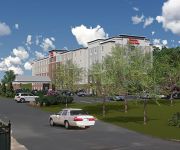
Hampton Inn - Suites Yonkers - Westchester
Residence Inn New York The Bronx at Metro Center Atrium
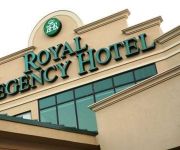
ROYAL REGENCY HOTEL
Bai Lancaster Hotel Apartments
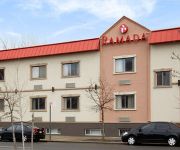
RAMADA INN BRONX
Morris Guest House
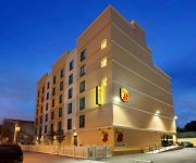
Super 8 Bronx
Videos from this area
These are videos related to the place based on their proximity to this place.
GRAND OPENING DAY the Mall at BAY PLAZA COOP CITY BRONX, NY
GRAND OPENING DAY the Mall at BAY PLAZA COOP CITY BRONX, NY GRAND OPENING DAY the Mall at BAY PLAZA COOP CITY BRONX, NY.
Brian Returns to Co-op City
Under Bldg. 11 in Co-Op city where I played "punch Ball" from 1970-1979.
Freedomland Defunct New York City Amusement Park
From time to time at ChiTownView we cast our eye towards New York City. Today we present this film about a now departed amusement park in the Bronx called Freedomland. Even though it's in NYC...
Cute cats together on the grass in Co-op City, Bronx, NY
Checking out two cats together. One licking herself clean while the other keeps an eye around the neighborhood. Taken 7/1/2014 in Co-op City, Bronx, NY.
3101 Eastchester Rd, Bronx, NY 10469
3101 Eastchester Rd Bronx, NY Besmatch Real Estate http://www.realestatebook.com/homes/listing/101-3002374343/refer=FP42A Currently a daycare. Entire property is vacant. Basement is ...
3101 Eastchester Rd, Bronx, NY 10469
3101 Eastchester Rd Bronx, NY Besmatch Real Estate http://www.realestatebook.com/homes/listing/101-3002374343/refer=FP42A Currently a daycare. Entire property is vacant. Basement is ...
I Travel All The Way from Florida to see Dr. Victor Oelbaum
http://www.sensationalteeth.com/about/new-patients/ A longtime patient of Bronx cosmetic dentist, Dr. Victor Oelbaum, talks about traveling from his home in ...
MTA Bus Company 1996 Orion V 174 (ex Bee Line Bus 474) [Audio Clip]
Engine: Detroit Diesel Series 50 Transmission: Allison World B400R-5 Depot: Eastchester Route: Bx23 Destination: Pelham Bay Park (Co-Op City Loop via 5-4-3-2-1)
Amtrak Train 194 Co-Op City view, Bronx, New York
Riding the Northeast Corridor on Amtrak is one of my favorite pastimes. Train 194 left NYC Penn Station a few minutes after five (it was late) and we chugged past Co-Op City just before the...
Westchester & Bronx Real Estate Market Report: Summer 2013
http://www.bronxandwestchesterhomes.com or (718) 697-6810 Lower Westchester & Bronx Real Estate Market Report for the Summer of 2013. Home values analysis for home buyers and sellers. -Low.
Videos provided by Youtube are under the copyright of their owners.
Attractions and noteworthy things
Distances are based on the centre of the city/town and sightseeing location. This list contains brief abstracts about monuments, holiday activities, national parcs, museums, organisations and more from the area as well as interesting facts about the region itself. Where available, you'll find the corresponding homepage. Otherwise the related wikipedia article.
Freedomland U.S.A
For other uses of Freedomland see: Freedomland Freedomland U.S.A. (usually just called Freedomland) was a short-lived, U.S. history-themed amusement park in the Baychester area in the northeastern part of the borough of The Bronx, New York City. Its slogan was "The World's Largest Entertainment Center" (later, "The World's Largest Outdoor Family Entertainment Center"). Freedomland opened on June 19, 1960. It closed at the end of the 1964 season when it failed to make a profit.
Pelham Bay Park (IRT Pelham Line)
Pelham Bay Park is the northern terminal station of the IRT Pelham Line of the New York City Subway. Located by Pelham Bay Park, at the intersection of the Bruckner Expressway and Westchester Avenue in the Bronx, it is served by the 6 train at all times except weekdays in the peak direction and <6> train on weekdays in the peak direction.
Co-op City, Bronx
Co-op City (or Cooperative City) is located in the Baychester section of the borough of the Bronx in northeast New York City, and is the largest cooperative housing development in the world. Situated at the intersection of Interstate 95 and the Hutchinson River Parkway, the community is part of Bronx Community Board 10. If it were a distinct municipality, it would be the 10th largest "city" in New York State. Nearby attractions include Pelham Bay Park, Orchard Beach and City Island.
Baychester, Bronx
Baychester is a working-class neighborhood geographically located in the northeast Bronx borough of New York City in the United States. The neighborhood is part of Bronx Community Board 12. Its boundaries, starting from the north and moving clockwise are: East 222nd Street to the north, the New England Thruway to the east, Pelham Parkway to the south, and Boston Road to the west. Eastchester Road is the primary thoroughfare through Baychester. The local subway is the 5 line.
Pelham Gardens, Bronx
Pelham Gardens is a working-class neighborhood geographically located in the Northeast section of Bronx, a borough of New York City in the United States. The neighborhood is part of Bronx Community Board 11. Its boundaries, starting from the north and moving clockwise are: East Gun Hill Road to the north and east, Pelham Parkway to the south, and Laconia Avenue to the west. Eastchester Road is the primary thoroughfare through Pelham Gardens.
Eastchester, Bronx
Eastchester is a working-class neighborhood in the northeast Bronx borough of New York City in the United States. The neighborhood is part of Bronx Community Board 12. Its boundaries, starting from the north and moving clockwise are: the Bronx-Westchester County border to the north, the New England Thruway to the east, Baychester Avenue to the south, and the intersection of 233 St and Baychester Avenue to the west.
Bay Plaza Shopping Center
Bay Plaza Shopping Center is a shopping center adjacent to Co-op City, in the Bronx, New York. In addition to various department stores and shops, such as JCPenney, Staples Inc. , Kmart and Old Navy, it has a multiplex movie theater, several restaurants, a fitness club, and some office space. The mall was constructed in the late 1980s, just outside of sections 4 and 5 of Co-op City, on an open lot that was previously unused (before which it was the site of Freedomland USA).
Baychester Avenue (IRT Dyre Avenue Line)
Baychester Avenue is a station on the IRT Dyre Avenue Line of the New York City Subway, located at the intersection of Baychester and Tillotson Avenues in the Bronx. It is served by the 5 train at all times. Originally opened on May 29, 1912 as a local station of the New York, Westchester and Boston Railway, it was closed on December 12, 1937 when the NYW&B went bankrupt. In 1940, the City of New York purchased the right of way from the Bronx line southward.
Gun Hill Road (IRT Dyre Avenue Line)
Gun Hill Road is a station on the IRT Dyre Avenue Line of the New York City Subway, located at the intersection of Gun Hill Road and Seymour Avenue in the Baychester and Allerton sections of The Bronx. It is served by the 5 train at all times. Originally opened on May 29, 1912 as a local station of the New York, Westchester and Boston Railway, the station was closed on December 12, 1937 when the NYW&B went bankrupt.
Cardinal Spellman High School (New York City)
Cardinal Spellman High School is a Catholic diocesan high school located in the New York City borough of the Bronx. It is named after Cardinal Francis Spellman, the sixth archbishop of the Roman Catholic Archdiocese of New York. In September 1959, the newly created Cardinal Spellman High School opened in temporary quarters on Marmion Avenue in the Edenwald section of the Bronx.
Edenwald, Bronx
Edenwald located in the northeast section of The Bronx, a borough of New York City, is the area north of Baychester, south of Wakefield, east of Bronxwood, and west of Boston Post Road and "the valley", a sub-neighborhood of Eastchester. Edenwald includes the Edenwald Projects, the largest housing development in the Bronx as well as the Baychester Projects, and the area north to Edenwald Avenue.
John Philip Sousa Junior High School (Bronx)
John Philip Sousa Junior High School (also known as JHS 142, MS 142 and John Philip Sousa Middle School) is a middle school located on Baychester Avenue, across the street from Cardinal Spellman High School, in the Edenwald section of the borough of the Bronx in New York City, New York. The school was named after John Philip Sousa and opened its doors in 1958. The school celebrated its golden jubilee in December 2008.


!['MTA Bus Company 1996 Orion V 174 (ex Bee Line Bus 474) [Audio Clip]' preview picture of video 'MTA Bus Company 1996 Orion V 174 (ex Bee Line Bus 474) [Audio Clip]'](https://img.youtube.com/vi/ZoOi5bLeqio/mqdefault.jpg)


