Safety Score: 2,7 of 5.0 based on data from 9 authorites. Meaning we advice caution when travelling to United States.
Travel warnings are updated daily. Source: Travel Warning United States. Last Update: 2024-05-15 08:00:47
Delve into Thomas J Dohany Homes
The district Thomas J Dohany Homes of South Amboy in Middlesex County (New Jersey) is a subburb in United States about 183 mi north-east of Washington DC, the country's capital town.
If you need a hotel, we compiled a list of available hotels close to the map centre further down the page.
While being here, you might want to pay a visit to some of the following locations: Staten Island, New Brunswick, Elizabeth, Freehold and Newark. To further explore this place, just scroll down and browse the available info.
Local weather forecast
Todays Local Weather Conditions & Forecast: 14°C / 58 °F
| Morning Temperature | 15°C / 59 °F |
| Evening Temperature | 14°C / 57 °F |
| Night Temperature | 14°C / 58 °F |
| Chance of rainfall | 30% |
| Air Humidity | 97% |
| Air Pressure | 1011 hPa |
| Wind Speed | Fresh Breeze with 13 km/h (8 mph) from West |
| Cloud Conditions | Overcast clouds, covering 100% of sky |
| General Conditions | Heavy intensity rain |
Thursday, 16th of May 2024
15°C (59 °F)
14°C (58 °F)
Moderate rain, fresh breeze, overcast clouds.
Friday, 17th of May 2024
19°C (67 °F)
15°C (58 °F)
Few clouds, gentle breeze.
Saturday, 18th of May 2024
14°C (57 °F)
12°C (54 °F)
Light rain, light breeze, overcast clouds.
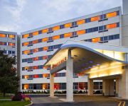
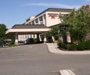
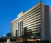
Hotels and Places to Stay
Renaissance Woodbridge Hotel
Hampton Inn Woodbridge
Residence Inn Woodbridge Edison/Raritan Center
E Hotel Banquet & Conference Center
Sheraton Edison Hotel Raritan Center
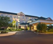
Hilton Garden Inn Edison-Raritan Center
Courtyard Edison Woodbridge
DAYS INN ISELIN - WOODBRIDGE
APA HOTEL WOODBRIDGE
Lee's Motel
Videos from this area
These are videos related to the place based on their proximity to this place.
Crossing the Raritan River in a Train - New Jersey - Perth Amboy / South Amboy
Going south, almost on the other side of the river. I seemed to have either misplaced the recording of the long ride across or I simply took a picture at that point and NOT a movie. Sorry.
NJCL - South Amboy Railfanning 1/10/14
I did some filming before and after school at the South Amboy Train Station on NJ Transit's North Jersey Coastline since I had a half day and had to kill time.
South Amboy Railfanning 6/5/14!
I decided to get rush hour in South Amboy since it was the last two days of school. Seen here are two locations at both grade crossings in town. In this video we see the local SA31 to Woodhaven...
NJCL - NJT #4634 in South Amboy, NJ
ALP-46A #4634 pushes Train #3243 into the South Amboy Train Station.
COMPUTER REPAIR south amboy computer upgrade
We provide computer repair service that is prompt, professional and affordable, technical services for your home and business. http://broadwaycomputerrepair.net/ 732-952-2626 New Systems ...
Grupo Haragan en Concierto, Sabado 22 Rumor 35 South Amboy NJ. 732-659-0952 Jose Andrea Con Grupo Ha
Concierto de Rock Mexicano, Grupo Haragan con Jose Andrea, Interpuesto Y Heavy Nopal. Sabado 22 de Marzo Rumor35. Para Boletas http://rumor35boletas.blogspot.com/ 732-659-0952 Grupo...
NJCL - South Amboy Railfanning 2/1/14
I decided to go out before Super Bowl to get some trains. Seen in this video was X232 and a couple NJT locals to Long Branch and also to South Amboy itself. Since it was the day before Super...
NJCL - NJT #4213 in South Amboy, NJ
NJT GP40PH-2B #4213 pulls NJRail #2303 into South Amboy bound for Bay Head. I had to zoom in to cut out most of the fencing that was in the way and since I didn't have my regular tripod with...
2000 Ford Ranger Used Cars South Amboy NJ
http://www.zumbachmtrs.com This 2000 Ford Ranger is available from Zumbach Sports Cars LTD. For details, call us at 732-525-1040.
1989 Plymouth Acclaim Used Cars South Amboy NJ
http://www.zumbachmtrs.com This 1989 Plymouth Acclaim is available from Zumbach Sports Cars LTD. For details, call us at 732-525-1040.
Videos provided by Youtube are under the copyright of their owners.
Attractions and noteworthy things
Distances are based on the centre of the city/town and sightseeing location. This list contains brief abstracts about monuments, holiday activities, national parcs, museums, organisations and more from the area as well as interesting facts about the region itself. Where available, you'll find the corresponding homepage. Otherwise the related wikipedia article.
Perth Amboy, New Jersey
Perth Amboy is a city in Middlesex County, New Jersey, United States. The City of Perth Amboy is part of the New York metropolitan area. As of the 2010 United States Census, the city's population was 50,814, reflecting an increase of 3,511 (+7.4%) from the 47,303 counted in the 2000 Census, which had in turn increased by 5,336 (+12.7%) from the 41,967 counted in the 1990 Census. Perth Amboy is known as the "City by the Bay," referring to Raritan Bay.
South Amboy, New Jersey
South Amboy is a city in Middlesex County, New Jersey, on the Raritan Bay. As of the 2010 United States Census, the city's population was 8,631, reflecting an increase of 718 (+9.1%) from the 7,913 counted in the 2000 Census, which had in turn increased by 50 (+0.6%) from the 7,863 counted in the 1990 Census. South Amboy, and Perth Amboy across the Raritan River, are collectively referred to as The Amboys. Signage for Exit 11 on the New Jersey Turnpike refers to "The Amboys" as a destination.
Driscoll Bridge
The Driscoll Bridge is a toll bridge (a series of three spans) on the Garden State Parkway in the U.S. state of New Jersey spanning the Raritan River near its mouth in Raritan Bay. The bridge connects the Middlesex County communities of Woodbridge Township on the north with Sayreville on the south. With a total of 15 travel lanes and 6 shoulder lanes, it is the widest motor vehicle bridge in the world by number of lanes and one of the world's busiest.
Ward's Point
Ward's Point is the southernmost point of New York State in Tottenville, Staten Island, across Arthur Kill from Perth Amboy, New Jersey at the head of Raritan Bay.
Edison Bridge (New Jersey)
The Edison Bridge (officially the Thomas Alva Edison Memorial Bridge) is a bridge on US 9 in the U.S. state of New Jersey spanning the Raritan River near its mouth in Raritan Bay. The bridge, which connects Woodbridge Township on the north with Sayreville on the south, was opened to weekend traffic starting on October 11, 1940, and was opened permanently on November 15, 1940.
Elizabethtown Tract
The Elizabethtown Tract was a property that was purchased on October 28, 1664, by John Baily, Daniel Denton and Luke Watson from the Native Americans that is in the area of (and surrounding) present-day Elizabeth, New Jersey.
Eagleswood Military Academy
The Eagleswood Military Academy was a private military academy in Perth Amboy, New Jersey which served antebellum educational needs. The Eagleswood Military Academy was started by Rebecca Spring (1812–1911) and Marcus Spring (1810–1874) in 1861 in the vicinity of the Route 35/Smith Street intersection. The Springs initially started the Raritan Bay Union, as a utopian community in 1853, but the Union closed in 1860. Rebecca had the bodies of A.D. Stevens and A.E.
Victory Bridge (New Jersey)
The Victory Bridge is a highway bridge in the U.S. state of New Jersey that carries Route 35 over the Raritan River, connecting the Middlesex County communities of Perth Amboy on the north and Sayreville to the south. The bridge is operated and maintained by the New Jersey Department of Transportation (NJDOT). The new bridge replaced the old Victory Bridge, dedicated to the U.S. troops who served in World War I and opened in 1926.
Cardinal McCarrick High School
Cardinal McCarrick High School is a Catholic secondary school located in South Amboy, New Jersey, that operates under the supervision of the Roman Catholic Diocese of Metuchen. As of the 2009-10 school year, the school had an enrollment of 328 students and 25.6 classroom teachers (on an FTE basis), for a student–teacher ratio of 12.8:1.
Great Beds Light
Great Beds Light is a sparkplug lighthouse in Raritan Bay in South Amboy, New Jersey. Over the years the lighthouse has become the symbol for the city of South Amboy. It was added to the New Jersey Register of Historic Places and National Register of Historic Places in 2008.
South Amboy Public Schools
The South Amboy Public Schools are a comprehensive community public school district that serve students in prekindergarten through twelfth grade from South Amboy, in Middlesex County, New Jersey, United States. As of the 2009-10 school year, the district's two schools had an enrollment of 1,172 students and 88 classroom teachers (on an FTE basis), for a student–teacher ratio of 13.32.
Perth Amboy Public Schools
Perth Amboy Public Schools is a community public school district serving students in prekindergarten through twelfth grade, located in the city of Perth Amboy, in Middlesex County, New Jersey, United States. The district is one of 31 Abbott districts statewide, which are now referred to as "SDA Districts" based on the requirement for the state to cover all costs for school building and renovation projects in these districts under the supervision of the New Jersey Schools Development Authority.
William C. McGinnis Middle School
William C. McGinnis Middle School is a four-year public middle school in Perth Amboy, New Jersey, United States, as part of the Perth Amboy Public Schools. It serves grades 5,6,7, and 8 and is part of Perth Amboy Public Schools. William C. McGinnis School was built in 1899 but was later refurbished in the mid-1990s. The student to computer ratio is 4 to 1. The average class size is 19. The school day is longer than the state average.
Raritan Bay Drawbridge
The Raritan Bay Drawbridge, also known as the Raritan Bay Swing Bridge or Raritan River Railroad Bridge, is a railroad swing bridge crossing the Raritan River a half mile from where in empties into the Raritan Bay in New Jersey. It connects Perth Amboy to the north and South Amboy to the south.
South Amboy Middle High School
South Amboy Middle High School is a six-year comprehensive public high school that serves students in seventh through twelfth grades from South Amboy in Middlesex County, New Jersey, United States, as part of the South Amboy Public Schools. As of the 2010-11 school year, the school had an enrollment of 508 students and 37.0 classroom teachers (on an FTE basis), for a student–teacher ratio of 13.73:1.
Christ Church Cemetery, South Amboy, New Jersey
Christ Church Cemetery is located in South Amboy, New Jersey. The cemetery is owned and operated by the Christ Episcopal Church in South Amboy. The cemetery opemed in 1856 and is still accepting new burials.
South Amboy (NJT station)
South Amboy is a station on New Jersey Transit's North Jersey Coast Line located in South Amboy, New Jersey, United States. The station is 2½ miles east of Perth Amboy station and 5 miles west of Aberdeen-Matawan station. Electric trains from the north started terminating here in 1938, and many still do. This station is located at grade level on Mason Street, and has a high-level island platform serving two tracks.
Five Corners, Perth Amboy
Five Corners is the intersection of New Brunswick Ave, State St, and Smith St in Perth Amboy, New Jersey. It is near the eastern end of the downtown area and is marked by the ten-story triangular Five Corners Building (also called the Amboy Towers). This building is the tallest building in the city.
T. A. Gillespie Company Shell Loading Plant explosion
The T. A. Gillespie Company Shell Loading Plant explosion, sometimes called the Morgan Depot Explosion, occurred at 7:30 p.m. on October 4, 1918 at an ammunition plant operated by the T. A. Gillespie Company and located in the Morgan area of Sayreville in Middlesex County, New Jersey. The initial explosion triggered a fire and subsequent series of explosions which continued for three days.
Tottenville (Staten Island Railway station)
Tottenville is a Staten Island Railway station in the neighborhood of Tottenville, Staten Island, New York. Located near Main Street and Arthur Kill Road, it is the southern terminus on the main line and the southernmost railway station in New York State. This is a grade-level station with two tracks and an island platform. There are three tracks to the east of the platform for storing trains. All five tracks end at bumper blocks at their south ends.
Conference House Park
Conference House Park is a park in the Tottenville section of Staten Island, New York, one of the boroughs of New York City. The park is named after the historic Conference House a c.1680 stone manor house in which a peace conference was initiated on September 11, 1776 by Lord Howe representing the British Crown with representatives of the Continental Congress including Benjamin Franklin, in an effort to halt the American Revolution.
Staten Island Peace Conference
The Staten Island Peace Conference was a brief meeting held in the hope of bringing an end to the American Revolutionary War. The conference took place on September 11, 1776, at Billop Manor, the residence of Colonel Christopher Billop, on Staten Island, New York. The participants were the British Admiral Lord Richard Howe, and members of the Second Continental Congress John Adams, Benjamin Franklin, and Edward Rutledge.
Essay Tower
Essay Tower or SA Tower is a closed Pennsylvania Railroad interlocking tower in South Amboy, New Jersey.
Faith Fellowship Ministries World Outreach Center
Faith Fellowship Ministries World Outreach Center is an independent non-Denominational "megachurch" in Sayreville, New Jersey, USA. The pastor is David T. Demola. As of 2008 Outreach Magazine ranked the church 53rd in size in the USA with attendance of 9,200. Demola founded Faith Fellowship Ministries in January 1980, and by the end of that year was able to move to St. Mark’s United Methodist Church in Staten Island.
Perth Amboy Public Library
The Perth Amboy Public Library is the free public library in the city of Perth Amboy, New Jersey located at 196 Jefferson Street.


